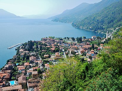
See Cannero Riviera on the map
Directions to Cannero Riviera with public transportation
The following transit lines have routes that pass near Cannero Riviera
 Bus:
Bus:
How to get to Cannero Riviera by bus?
Click on the bus route to see step by step directions with maps, line arrival times and updated time schedules.
Bus stations near Cannero Riviera
- Cannero Riviera - Incrocio SS 34 - SP 64,11 min walk,
Bus lines to Cannero Riviera
- 3,Cimitero Di Suna,
- 15,Trarego Viggiona,
What are the closest stations to Cannero Riviera?
The closest stations to Cannero Riviera are:
- Cannero Riviera - Incrocio SS 34 - SP 64 is 526 meters away, 11 min walk.
Which bus line stops near Cannero Riviera?
3
What’s the nearest bus stop to Cannero Riviera?
The nearest bus stop to Cannero Riviera is Cannero Riviera - Incrocio SS 34 - SP 64. It’s a 11 min walk away.
What time is the first bus to Cannero Riviera?
The 3 is the first bus that goes to Cannero Riviera. It stops nearby at 6:52 AM.
What time is the last bus to Cannero Riviera?
The 3 is the last bus that goes to Cannero Riviera. It stops nearby at 8:13 PM.
See Cannero Riviera on the map
Public Transportation to Cannero Riviera
Wondering how to get to Cannero Riviera, Italy? Moovit helps you find the best way to get to Cannero Riviera with step-by-step directions from the nearest public transit station.
Moovit provides free maps and live directions to help you navigate through your city. View schedules, routes, timetables, and find out how long does it take to get to Cannero Riviera in real time.
Looking for the nearest stop or station to Cannero Riviera? Check out this list of stops closest to your destination: Cannero Riviera - Incrocio SS 34 - SP 64.
Bus:
Want to see if there’s another route that gets you there at an earlier time? Moovit helps you find alternative routes or times. Get directions from and directions to Cannero Riviera easily from the Moovit App or Website.
We make riding to Cannero Riviera easy, which is why over 1.5 million users, including users in Cannero Riviera, trust Moovit as the best app for public transit. You don’t need to download an individual bus app or train app, Moovit is your all-in-one transit app that helps you find the best bus time or train time available.
For information on prices of bus, costs and ride fares to Cannero Riviera, please check the Moovit app.
Use the app to navigate to popular places including to the airport, hospital, stadium, grocery store, mall, coffee shop, school, college, and university.
Location: Cannero Riviera, Milan and Lombardy
Attractions near Cannero Riviera
Hapimag Resort Cannero,Ecopartyboat,Pasticceria ai Castell,Villa Luisa,Da Bob,E-Geo Studio Associato di Roberto Carmine e Thomas Testori,Casa Banano (Ristorante Sano Banano Di Borsetta Davide),Comune di Cannero Riviera,Grotta Di Lourdes,Roo,Ribolzi Italo,Villa Valteria,Cannero,Cimitero,Piccola Cannero,Piazza Degli Alpini,Giardino,Camera Molly,Giulia's Handmade,Cannero Riviera - Incrocio Ss 34 - Sp 64How to get to popular attractions in Cannero Riviera with public transit
Piazza Castello, Milano,Piazza Cinque Giornate, Milano,Centro Commerciale Fiordaliso, Rozzano,Viale Cassala, Milano,Niguarda Centro, Milano,Ospedale San Raffaele, Milano,Università Bicocca - Scienza, Milano,Piazza Prealpi, Milano,Via Amadeo, Milano,Corbetta, Corbetta,Repubblica, Milano,Iulm University, Milano,Loreto, Milano,Stazione Di Rho, Rho,Aeroporto Di Linate, Segrate,V.le Certosa V.le Serra, Milano,UCI Cinema - Milano Bicocca, Milano,Piazzale Nigra, Milano,Ospedale Niguarda Cà Granda, Milano,Greco, MilanoGet around Cannero Riviera by public transit!
Traveling around Cannero Riviera has never been so easy. See step by step directions as you travel to any attraction, street or major public transit station. View bus and train schedules, arrival times, service alerts and detailed routes on a map, so you know exactly how to get to anywhere in Cannero Riviera.
When traveling to any destination around Cannero Riviera use Moovit's Live Directions with Get Off Notifications to know exactly where and how far to walk, how long to wait for your line, and how many stops are left. Moovit will alert you when it's time to get off — no need to constantly re-check whether yours is the next stop.
Wondering how to use public transit in Cannero Riviera or how to pay for public transit in Cannero Riviera? Moovit public transit app can help you navigate your way with public transit easily, and at minimum cost. It includes public transit fees, ticket prices, and costs. Looking for a map of Cannero Riviera public transit lines? Moovit public transit app shows all public transit maps in Cannero Riviera with all bus routes and stops on an interactive map.
Cannero Riviera has 1 transit type(s), including: bus, operated by several transit agencies, including ATM, ATM, ATM, Trenord, Trenitalia, Autoguidovie S.p.A., NET, Movibus, ATM, ASF Autolinee, Autostradale S.r.l., Terravision, AirPullman, TEB and ATB