See Canoe Landing, Toronto, on the map
Directions to Canoe Landing (Toronto) with public transportation
The following transit lines have routes that pass near Canoe Landing
 Bus:
Bus: - Train:
- Subway:
How to get to Canoe Landing by bus?
Click on the bus route to see step by step directions with maps, line arrival times and updated time schedules.
How to get to Canoe Landing by train?
Click on the train route to see step by step directions with maps, line arrival times and updated time schedules.
How to get to Canoe Landing by subway?
Click on the subway route to see step by step directions with maps, line arrival times and updated time schedules.
Streetcar stations near Canoe Landing in Toronto
- Queens Quay West At Dan Leckie Way East Side,6 min walk,
What are the closest stations to Canoe Landing?
The closest stations to Canoe Landing are:
- Queens Quay West At Dan Leckie Way East Side is 384 meters away, 6 min walk.
Which bus lines stop near Canoe Landing?
These bus lines stop near Canoe Landing: 121, 145, 511.
Which train lines stop near Canoe Landing?
These train lines stop near Canoe Landing: LW, UP.
Which subway line stops near Canoe Landing?
1
What’s the nearest Streetcar station to Canoe Landing in Toronto?
The nearest Streetcar station to Canoe Landing in Toronto is Queens Quay West At Dan Leckie Way East Side. It’s a 6 min walk away.
See Canoe Landing, Toronto, on the map
Public Transit to Canoe Landing in Toronto
Wondering how to get to Canoe Landing in Toronto, Canada? Moovit helps you find the best way to get to Canoe Landing with step-by-step directions from the nearest public transit station.
Moovit provides free maps and live directions to help you navigate through your city. View schedules, routes, timetables, and find out how long does it take to get to Canoe Landing in real time.
Looking for the nearest stop or station to Canoe Landing? Check out this list of stops closest to your destination: Queens Quay West At Dan Leckie Way East Side.
Bus:Train:Subway:
Want to see if there’s another route that gets you there at an earlier time? Moovit helps you find alternative routes or times. Get directions from and directions to Canoe Landing easily from the Moovit App or Website.
We make riding to Canoe Landing easy, which is why over 1.5 million users, including users in Toronto, trust Moovit as the best app for public transit. You don’t need to download an individual bus app or train app, Moovit is your all-in-one transit app that helps you find the best bus time or train time available.
For information on prices of bus, subway, train and Streetcar, costs and ride fares to Canoe Landing, please check the Moovit app.
Use the app to navigate to popular places including to the airport, hospital, stadium, grocery store, mall, coffee shop, school, college, and university.
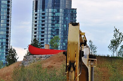
Canoe Landing Address: Canoe Landing, 95 Fort York Blvd, Toronto, ON M5V 3Y2, Canada street in Toronto
Attractions near Canoe Landing
Fit Streets,Best Body Bootcamp (Downtown),Canoe Landing Park,Cityplace,Terry Fox Miracle Mile,Canoe Landing Park,Arbar,Big Red Canoe,Club Parade,Cafe 66,Hunters Landing,Rejoice Shoes,Bishops Landing,Homelife Frontier Realty Inc. Brokerage,Hunters Landing Bar Grill Hub Restaurant,BOBO Tea & Juice,Dog Park - Canoe Landing Park,Rejoice Shoes,Macho Tex Mex Radio Bar,Macho Radio BarHow to get to popular attractions in Toronto with public transit
Fresh On Spadina, Toronto,TTC #511 Bathurst Streetcar, Toronto,Ancaster, Ontario, Hamilton,Wayne Gretzky's Toronto, Toronto,Charles Street Transit Terminal, Kitchener,Burlington Bay James N. Allan Skyway, Hamilton,Cn Tower, Toronto,Erin Mills Town Centre, Mississauga,Starbucks, Toronto,Mapleview Shopping Centre, Burlington,Lawrence Subway Station, Toronto,GoodLife Fitness Centres, Toronto,Outlet Collection at Niagara, Niagara-On-The-Lake,TTC 505 Dundas Streetcar, Toronto,Whitby GO Station, Whitby,The Junction, Toronto,Gateway Terminal, Brampton,The Keg Steakhouse + Bar - Keg Mansion, Toronto,The Rivoli, Toronto,Appleby GO Station, BurlingtonGet around Toronto by public transit!
Traveling around Toronto has never been so easy. See step by step directions as you travel to any attraction, street or major public transit station. View bus and train schedules, arrival times, service alerts and detailed routes on a map, so you know exactly how to get to anywhere in Toronto.
When traveling to any destination around Toronto use Moovit's Live Directions with Get Off Notifications to know exactly where and how far to walk, how long to wait for your line, and how many stops are left. Moovit will alert you when it's time to get off — no need to constantly re-check whether yours is the next stop.
Wondering how to use public transit in Toronto or how to pay for public transit in Toronto? Moovit public transit app can help you navigate your way with public transit easily, and at minimum cost. It includes public transit fees, ticket prices, and costs. Looking for a map of Toronto public transit lines? Moovit public transit app shows all public transit maps in Toronto with all bus, subway, train or Streetcar routes and stops on an interactive map.
Toronto has 4 transit type(s), including: bus, subway, train or Streetcar, operated by several transit agencies, including TTC, TTC Streetcar, Toronto Subway, GO Transit Bus, GO Transit, Amtrak, York Region Transit, Grand River Transit, Guelph Transit, grt, Hamilton Street Railway, MiWay, Brampton Transit, Burlington Transit and Oakville Transit