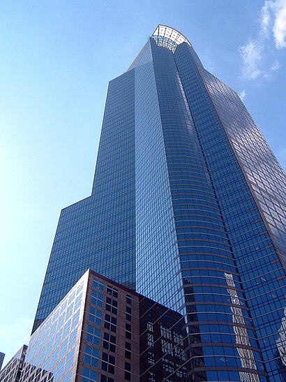
Directions to Capella Tower (Minneapolis) with public transportation
The following transit lines have routes that pass near Capella Tower
How to get to Capella Tower by bus?
Click on the bus route to see step by step directions with maps, line arrival times and updated time schedules.
Bus stations near Capella Tower in Minneapolis
- 6th St S & 2nd Ave / 3rd Ave S, 1 min walk,
- 2nd Ave S & 6th St - Stop Group H, 1 min walk,
- 2nd Ave S & 7th St - Stop Group G, 2 min walk,
- 2 Av S at 6 St S NE Corner, 2 min walk,
- 2nd Ave S & 5th St - Stop Group F, 3 min walk,
- 7th St S & 3rd Ave / 2nd Ave S, 3 min walk,
- 7th St & 3rd/4th Ave Station, 3 min walk,
- Marquette Ave & 6th St - Stop Group A, 3 min walk,
Light Rail stations near Capella Tower in Minneapolis
- Government Plaza, 3 min walk,
Bus lines to Capella Tower in Minneapolis
- 14, Broadway / Robbinsdale / Via France,
- 94, Express / Mpls-Via Snell / Downtown,
- 355, Express / Woodbury,
- 363, Express / St Paul / Minneapolis,
- 764, Express / Winnetka / Starlite Ctr,
- 467, Express / Minneapolis,
- 645, Ltd Stop / Minneapolis,
- 667, Express / Downtown,
- 673, Express / Downtown,
- 766, Express / Richardson Pr / Cartway Rd,
- 768, Express / Noble P&R,
- 781, Trip 4 / Maple Grove / Transit Sta,
- 785, Trip 2 / Maple Grove / Parkway Sta,
- 578, Express / Minn Dr / Southdale,
- 824, Ltd Stop / University / Northtown,
- 850, Express / Foley P&R,
- 852, Express / Northtown / Anoka Tech,
- 760, ,
- 761, ,
- 763, ,
What are the closest stations to Capella Tower?
The closest stations to Capella Tower are:
- 6th St S & 2nd Ave / 3rd Ave S is 43 yards away, 1 min walk.
- 2nd Ave S & 6th St - Stop Group H is 46 yards away, 1 min walk.
- 2nd Ave S & 7th St - Stop Group G is 108 yards away, 2 min walk.
- 2 Av S at 6 St S NE Corner is 110 yards away, 2 min walk.
- 2nd Ave S & 5th St - Stop Group F is 174 yards away, 3 min walk.
- 7th St S & 3rd Ave / 2nd Ave S is 207 yards away, 3 min walk.
- 7th St & 3rd/4th Ave Station is 233 yards away, 3 min walk.
- Government Plaza is 237 yards away, 3 min walk.
- Marquette Ave & 6th St - Stop Group A is 242 yards away, 3 min walk.
Which bus lines stop near Capella Tower?
These bus lines stop near Capella Tower: 14, 17, 22, 3, 645.
What’s the nearest light rail station to Capella Tower in Minneapolis?
The nearest light rail station to Capella Tower in Minneapolis is Government Plaza. It’s a 3 min walk away.
What’s the nearest bus stop to Capella Tower in Minneapolis?
The nearest bus stops to Capella Tower in Minneapolis are 6th St S & 2nd Ave / 3rd Ave S and 2nd Ave S & 6th St - Stop Group H. The closest one is a 1 min walk away.
What time is the first light rail to Capella Tower in Minneapolis?
The METRO BLUE LINE is the first light rail that goes to Capella Tower in Minneapolis. It stops nearby at 4:24 AM.
What time is the last light rail to Capella Tower in Minneapolis?
The METRO BLUE LINE is the last light rail that goes to Capella Tower in Minneapolis. It stops nearby at 12:47 AM.
What time is the first bus to Capella Tower in Minneapolis?
The METRO D LINE is the first bus that goes to Capella Tower in Minneapolis. It stops nearby at 4:49 AM.
What time is the last bus to Capella Tower in Minneapolis?
The METRO C LINE is the last bus that goes to Capella Tower in Minneapolis. It stops nearby at 1:12 AM.
See Capella Tower, Minneapolis, on the map
Public Transit to Capella Tower in Minneapolis
Wondering how to get to Capella Tower in Minneapolis, United States? Moovit helps you find the best way to get to Capella Tower with step-by-step directions from the nearest public transit station.
Moovit provides free maps and live directions to help you navigate through your city. View schedules, routes, timetables, and find out how long does it take to get to Capella Tower in real time.
Looking for the nearest stop or station to Capella Tower? Check out this list of stops closest to your destination: 6th St S & 2nd Ave / 3rd Ave S; 2nd Ave S & 6th St - Stop Group H; 2nd Ave S & 7th St - Stop Group G; 2 Av S at 6 St S NE Corner; 2nd Ave S & 5th St - Stop Group F; 7th St S & 3rd Ave / 2nd Ave S; 7th St & 3rd/4th Ave Station; Government Plaza; Marquette Ave & 6th St - Stop Group A.
Bus: 14, 17, 22, 3, 645, 94, 355, 363, 764, 467, 667, 673, 766, 578, 824, 850, 852, 760, 761, 763, 460, 465, METRO ORANGE LINE, 250, 264, 270, 600, 5, 755, 784.
Want to see if there’s another route that gets you there at an earlier time? Moovit helps you find alternative routes or times. Get directions from and directions to Capella Tower easily from the Moovit App or Website.
We make riding to Capella Tower easy, which is why over 1.5 million users, including users in Minneapolis, trust Moovit as the best app for public transit. You don’t need to download an individual bus app or train app, Moovit is your all-in-one transit app that helps you find the best bus time or train time available.
For information on prices of bus, costs and ride fares to Capella Tower, please check the Moovit app.
Use the app to navigate to popular places including to the airport, hospital, stadium, grocery store, mall, coffee shop, school, college, and university.
Capella Tower Address: 225 S 6th St street in Minneapolis
Attractions near Capella Tower
Nicolet Tech,Us Bank Plaza,Dawn Jurkovich - Ameriprise Financial Services,CROWNE PLAZA HOTEL-Northstar,Project Wellness Chair Massage,Hennepin County Government Center,Hennepin County Courthouse,Ameriprise Financial Center,300 South 6th Street,Easy Bail Bonds Coco,Urbansitter,300 6th St S,Maple Grove, City of,Minneapolis Government Center DVS, Aka DMV,Metro Transit Service Center,Transperfect Translations,WESTIN-Minneapolis,Government Center Plaza,The Westin Minneapolis,Fifth Street TowersHow to get to popular attractions in Minneapolis with public transit
University of Minnesota Twin Cities Campus, Minneapolis,Duk Duk Daze, New Hope,Shakopee, MN, Shakopee,Chicago Ave, Minneapolis,Portland Ave S & 78th St / American Blvd, Bloomington,Tartan High School, Oakdale,Concourse C/G Connector,Riverview Theater, Minneapolis,Co Rd 73 (Hopkins Crossroad) & Fairfield Rd, Minnetonka,W Broadway Ave / Lyndale Ave N, Minneapolis,Minnesota Timberwolves, Minneapolis,Minnehaha Falls, Minneapolis,Burlington Coat Factory, St. Louis Park,Southdale Shopping Center, Edina,225 Smith Avenue North, St. Paul,Metro Transit - Target / Knollwood, St. Louis Park,Cub Foods, Minneapolis,South Bloomington Transit Center, Bloomington,St. Paul Processing & Distribution Center USPS Eagan, Eagan,Central High School Service Station, St. PaulGet around Minneapolis - St. Paul, MN by public transit!
Traveling around Minneapolis - St. Paul, MN has never been so easy. See step by step directions as you travel to any attraction, street or major public transit station. View bus and train schedules, arrival times, service alerts and detailed routes on a map, so you know exactly how to get to anywhere in Minneapolis - St. Paul, MN.
When traveling to any destination around Minneapolis - St. Paul, MN use Moovit's Live Directions with Get Off Notifications to know exactly where and how far to walk, how long to wait for your line, and how many stops are left. Moovit will alert you when it's time to get off — no need to constantly re-check whether yours is the next stop.
Wondering how to use public transit in Minneapolis - St. Paul, MN or how to pay for public transit in Minneapolis - St. Paul, MN? Moovit public transit app can help you navigate your way with public transit easily, and at minimum cost. It includes public transit fees, ticket prices, and costs. Looking for a map of Minneapolis - St. Paul, MN public transit lines? Moovit public transit app shows all public transit maps in Minneapolis - St. Paul, MN with all Bus, Train and Light Rail routes and stops on an interactive map.
Minneapolis - St. Paul, MN has 3 transit type(s), including: Bus, Train and Light Rail, operated by several transit agencies, including Metro Transit , Metro Transit, MVTA, Plymouth Metrolink, SouthWest Transit, Maple Grove, University of Minnesota, Airport (MAC), Amtrak, Mankato Transit System, SMART, Megabus, FlixBus-us, Greyhound-us