See Minnehaha Falls, Minneapolis, on the map
Directions to Minnehaha Falls (Minneapolis) with public transportation
The following transit lines have routes that pass near Minnehaha Falls
 Bus:
Bus: - Light Rail:
How to get to Minnehaha Falls by bus?
Click on the bus route to see step by step directions with maps, line arrival times and updated time schedules.
Bus stations near Minnehaha Falls in Minneapolis
- 46th Ave S & Godfrey Rd, 8 min walk,
- 46th St E & 44th Ave S, 8 min walk,
- 46th St & 46th Ave Station, 9 min walk,
- 46th St & Minnehaha Station, 11 min walk,
Light Rail stations near Minnehaha Falls in Minneapolis
- 38th Street, 12 min walk,
- Fort Snelling, 40 min walk,
Bus lines to Minnehaha Falls in Minneapolis
- 23, 38th Street / Uptown,
- 74, Downtown,
- METRO A LINE, 46 St Station / Rapid,
- 7, Minnehaha / 46st Sta / Cedar Point,
- 9, Bryn Mawr / Park Pl,
What are the closest stations to Minnehaha Falls?
The closest stations to Minnehaha Falls are:
- 46th Ave S & Godfrey Rd is 591 yards away, 8 min walk.
- 46th St E & 44th Ave S is 631 yards away, 8 min walk.
- 46th St & 46th Ave Station is 726 yards away, 9 min walk.
- 46th St & Minnehaha Station is 927 yards away, 11 min walk.
- 38th Street is 993 yards away, 12 min walk.
- Fort Snelling is 3408 yards away, 40 min walk.
Which bus lines stop near Minnehaha Falls?
These bus lines stop near Minnehaha Falls: 23, 446, 7, 74, 9, METRO A LINE.
Which light rail line stops near Minnehaha Falls?
METRO BLUE LINE
What’s the nearest light rail station to Minnehaha Falls in Minneapolis?
The nearest light rail station to Minnehaha Falls in Minneapolis is 38th Street. It’s a 12 min walk away.
What’s the nearest bus stop to Minnehaha Falls in Minneapolis?
The nearest bus stops to Minnehaha Falls in Minneapolis are 46th Ave S & Godfrey Rd and 46th St E & 44th Ave S. The closest one is a 8 min walk away.
What time is the first light rail to Minnehaha Falls in Minneapolis?
The AIRPORT SHUTTLE is the first light rail that goes to Minnehaha Falls in Minneapolis. It stops nearby at 3:10 AM.
What time is the last light rail to Minnehaha Falls in Minneapolis?
The METRO BLUE LINE is the last light rail that goes to Minnehaha Falls in Minneapolis. It stops nearby at 12:31 AM.
What time is the first bus to Minnehaha Falls in Minneapolis?
The METRO A LINE is the first bus that goes to Minnehaha Falls in Minneapolis. It stops nearby at 4:26 AM.
What time is the last bus to Minnehaha Falls in Minneapolis?
The METRO A LINE is the last bus that goes to Minnehaha Falls in Minneapolis. It stops nearby at 1:29 AM.
How much is the bus fare to Minnehaha Falls?
The bus fare to Minnehaha Falls costs about $2.00 - $2.50.
How much is the light rail fare to Minnehaha Falls?
The light rail fare to Minnehaha Falls costs about $2.00 - $2.50.
See Minnehaha Falls, Minneapolis, on the map
Public Transit to Minnehaha Falls in Minneapolis
Wondering how to get to Minnehaha Falls in Minneapolis, United States? Moovit helps you find the best way to get to Minnehaha Falls with step-by-step directions from the nearest public transit station.
Moovit provides free maps and live directions to help you navigate through your city. View schedules, routes, timetables, and find out how long does it take to get to Minnehaha Falls in real time.
Looking for the nearest stop or station to Minnehaha Falls? Check out this list of stops closest to your destination: 46th Ave S & Godfrey Rd; 46th St E & 44th Ave S; 46th St & 46th Ave Station; 46th St & Minnehaha Station; 38th Street; Fort Snelling.
Bus:Light Rail:
Want to see if there’s another route that gets you there at an earlier time? Moovit helps you find alternative routes or times. Get directions from and directions to Minnehaha Falls easily from the Moovit App or Website.
We make riding to Minnehaha Falls easy, which is why over 1.5 million users, including users in Minneapolis, trust Moovit as the best app for public transit. You don’t need to download an individual bus app or train app, Moovit is your all-in-one transit app that helps you find the best bus time or train time available.
For information on prices of bus and light rail, costs and ride fares to Minnehaha Falls, please check the Moovit app.
Use the app to navigate to popular places including to the airport, hospital, stadium, grocery store, mall, coffee shop, school, college, and university.
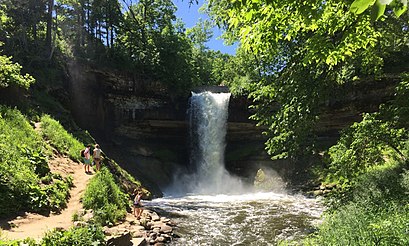
Minnehaha Falls Address: South Minnehaha Park Drive street in Minneapolis
Attractions near Minnehaha Falls
Minnehaha Falls View Area,Sea Salt Eatery,Minnehaha Park,Water Works,Marquis Online,Lower Glen Trail,A Locksmith Service,50th Street/Minnehaha Park,Tipsy Steer,Falls Coffee,Minnehaha Park - Wabun G,Beck46,Minnehaha Regional Park,Wabun Picnic Area,Wakpada Apartments,Cafe Ceres,Point-One Home Health,Lowa,Sushi Avenue,Legacy BuildingHow to get to popular attractions in Minneapolis with public transit
Southdale Transit Center, Edina,Cedar Grove Transit Station, Eagan,Metro Transit Route 264, Roseville,Juut Salon and Spa, Minneapolis,Walter F. Mondale Hall, Minneapolis,Bulk Reef Supply, Golden Valley,Target Field, Minneapolis,Delta Employee Bus Stop #1,Team Member Entrance Mystic Lake, Prior Lake,Bass Lake Road & Highway 169, Plymouth,Amc Rosedale 16, Roseville,Hmong College Prep Academy, St. Paul,Richfield, MN, Richfield,Hampton Inn & Suites Minneapolis / Downtown, Minneapolis,Sun Ray Shopping Center, St. Paul,Ameriprise Financial Center, Minneapolis,MN 36 / US 61 Interchange, Maplewood,The Pourhouse, Minneapolis,Blue Cross and Blue Shield of Minnesota (Silver Bell), Eagan,The Brothel, Brooklyn ParkGet around Minneapolis by public transit!
Traveling around Minneapolis has never been so easy. See step by step directions as you travel to any attraction, street or major public transit station. View bus and train schedules, arrival times, service alerts and detailed routes on a map, so you know exactly how to get to anywhere in Minneapolis.
When traveling to any destination around Minneapolis use Moovit's Live Directions with Get Off Notifications to know exactly where and how far to walk, how long to wait for your line, and how many stops are left. Moovit will alert you when it's time to get off — no need to constantly re-check whether yours is the next stop.
Wondering how to use public transit in Minneapolis or how to pay for public transit in Minneapolis? Moovit public transit app can help you navigate your way with public transit easily, and at minimum cost. It includes public transit fees, ticket prices, and costs. Looking for a map of Minneapolis public transit lines? Moovit public transit app shows all public transit maps in Minneapolis with all bus or light rail routes and stops on an interactive map.
Minneapolis has 2 transit type(s), including: bus or light rail, operated by several transit agencies, including Metro Transit , Metro Transit, Metro Transit, MVTA, Plymouth Metrolink, SouthWest Transit, Maple Grove, University of Minnesota, Airport (MAC), Amtrak, Mankato Transit System, SMART, Megabus, FlixBus-us and Greyhound-us