How to get to Capitol by bus?
Click on the bus route to see step by step directions with maps, line arrival times and updated time schedules.
From Marie-Baum-Schule Heidelberg, Wieblingen
154 minFrom Globus Getränkemarkt, Ludwigshafen-Oggersheim
100 minFrom Neuenheimer Feld, Neuenheim
126 minFrom Globus Getränkecenter, Ludwigshafen-Oggersheim
100 minFrom Hans-Warsch-Platz,Ludwigshafen Oggersheim, Ludwigshafen-Oggersheim
63 minFrom Universitätsklinikum Heidelberg-Notaufnahme, Neuenheim
131 minFrom Thoraxklinik Heidelberg, Neuenheim
134 minFrom Möbel Höffner, Schwetzingen
60 minFrom GRN-Klinik Schwetzingen, Schwetzingen
111 min
How to get to Capitol by train?
Click on the train route to see step by step directions with maps, line arrival times and updated time schedules.
Light Rail stations near Capitol in Neckarstadt-Ost/Wohlgelegen
Bus stops near Capitol in Neckarstadt-Ost/Wohlgelegen
Bus lines to Capitol in Neckarstadt-Ost/Wohlgelegen
What are the closest stations to Capitol?
The closest stations to Capitol are:
- Alte Feuerwache is 192 meters away, 3 min walk.
- Mannheim, Alte Feuerwache is 229 meters away, 4 min walk.
- Kurpfalzbrücke is 668 meters away, 9 min walk.
- Mannheim, Kurpfalzbrücke Bstg E is 670 meters away, 9 min walk.
Which bus lines stop near Capitol?
These bus lines stop near Capitol: 71, 710, 74, RNV 60, RNV 63.
Which train lines stop near Capitol?
These train lines stop near Capitol: RB35, S9.
Which light rail lines stop near Capitol?
These light rail lines stop near Capitol: 1, 15, 4, 4A, RNV 15.
What’s the nearest light rail station to Capitol in Neckarstadt-Ost/Wohlgelegen?
The nearest light rail station to Capitol in Neckarstadt-Ost/Wohlgelegen is Alte Feuerwache. It’s a 3 min walk away.
What’s the nearest bus station to Capitol in Neckarstadt-Ost/Wohlgelegen?
The nearest bus station to Capitol in Neckarstadt-Ost/Wohlgelegen is Alte Feuerwache. It’s a 3 min walk away.
What time is the first light rail to Capitol in Neckarstadt-Ost/Wohlgelegen?
The 1 is the first light rail that goes to Capitol in Neckarstadt-Ost/Wohlgelegen. It stops nearby at 3:06 AM.
What time is the last light rail to Capitol in Neckarstadt-Ost/Wohlgelegen?
The 1 is the last light rail that goes to Capitol in Neckarstadt-Ost/Wohlgelegen. It stops nearby at 3:06 AM.
What time is the first bus to Capitol in Neckarstadt-Ost/Wohlgelegen?
The RNV 53 is the first bus that goes to Capitol in Neckarstadt-Ost/Wohlgelegen. It stops nearby at 5:11 AM.
What time is the last bus to Capitol in Neckarstadt-Ost/Wohlgelegen?
The 2 is the last bus that goes to Capitol in Neckarstadt-Ost/Wohlgelegen. It stops nearby at 1:08 AM.
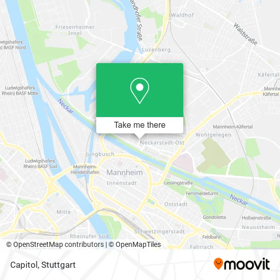
See Capitol, Neckarstadt-Ost/Wohlgelegen, on the map
Public Transit to Capitol in Neckarstadt-Ost/Wohlgelegen
Wondering how to get to Capitol in Neckarstadt-Ost/Wohlgelegen? Moovit helps you find the best way to get to Capitol with step-by-step directions from the nearest public transit station.
Moovit provides free maps and live directions to help you navigate through your city. View schedules, routes, timetables, and find out how long does it take to get to Capitol in real time.
Looking for the nearest stop or station to Capitol? Check out this list of stops closest to your destination: Alte Feuerwache; Mannheim; Kurpfalzbrücke; Mannheim.
Bus: 71, 710, 74, RNV 60, RNV 63, 2, 4, 4A, 55, 62, RNV 62.Train: RB35, S9.Light Rail: 1, 15, 4, 4A, RNV 15.
Want to see if there’s another route that gets you there at an earlier time? Moovit helps you find alternative routes or times. Get directions from and directions to Capitol easily from the Moovit App or Website.
We make riding to Capitol easy, which is why over 1.5 million users, including users in Neckarstadt-Ost/Wohlgelegen, trust Moovit as the best app for public transit. You don’t need to download an individual bus app or train app, Moovit is your all-in-one transit app that helps you find the best bus time or train time available.
For information on prices of bus, light rail and train, costs and ride fares to Capitol, please check the Moovit app.
Use the app to navigate to popular places including to the airport, hospital, stadium, grocery store, mall, coffee shop, school, college, and university.
Capitol Address: Waldhofstraße 2 68169 Mannheim street in Neckarstadt-Ost/Wohlgelegen
- Rampenlicht im Casino,
- Gemeinnütziges Kin,
- Comedyschule Mannheim,
- Konzertbüro Augsburg,
- Gospelchor Forst,
- Casino | Capitol,
- McDonald's,
- Greatlooking.De,
- Rechtsanwalt Achim Rathgeb,
- Upgrade Unternehmensberatung,
- Mannheim Verkehrsrecht Anwalt,
- Cafe Marmaris,
- Wohlfühl- und Schönheitsoase,
- Great Looking,
- Kiosk Ismail Uydur,
- Kiosk am Messplatz,
- Sengün,
- Achim Rathgeb,
- Spanisches Restaurant la Sevillana,
- Ristorante da Raffaele
Places Near Capitol (Neckarstadt-Ost/Wohlgelegen)
- Geilhaus Haus 33a, Reutlingen-Betzingen,
- Hauptbahnhof Stuttgart, Stuttgart-Mitte,
- Mercedes-Benz Museum (Mercedes Museum Stuttgart), Bad Cannstatt,
- SI-Centrum, Möhringen,
- Wilhelma (U-Bahn Wilhelma), Bad Cannstatt,
- Hanns-Martin-Schleyer-Halle, Bad Cannstatt,
- Mettingen Eros-Center Puff Laufhaus, Esslingen Am Neckar,
- Hanns-Martin-Schleyer-Halle (Stuttgart Hans-Martin-Schleyerhalle), Bad Cannstatt,
- Marmorsaal Im Weissenburgpark, Stuttgart-Süd,
- Pariser Platz Stuttgart, Stuttgart-Mitte,
- Im Wizemann (Halle), Bad Cannstatt,
- Klinikum Stuttgart - Katharinenhospital, Stuttgart-Mitte,
- Porsche-Arena, Bad Cannstatt,
- Schleyerhalle, Bad Cannstatt,
- Gasometer Pforzheim, Pforzheim,
- FlixBus Haltestelle, Stuttgart,
- Mercedes-Benz Museum, Bad Cannstatt,
- Waldfriedhof, Degerloch,
- Gleis 101/102 (tief), Stuttgart-Mitte,
- Porsche Museum, Zuffenhausen
How to get to popular places in Stuttgart with public transit
Get around Neckarstadt-Ost/Wohlgelegen by public transit!
Traveling around Neckarstadt-Ost/Wohlgelegen has never been so easy. See step by step directions as you travel to any attraction, street or major public transit station. View bus and train schedules, arrival times, service alerts and detailed routes on a map, so you know exactly how to get to anywhere in Neckarstadt-Ost/Wohlgelegen.
When traveling to any destination around Neckarstadt-Ost/Wohlgelegen use Moovit's Live Directions with Get Off Notifications to know exactly where and how far to walk, how long to wait for your line, and how many stops are left. Moovit will alert you when it's time to get off — no need to constantly re-check whether yours is the next stop.
Wondering how to use public transit in Neckarstadt-Ost/Wohlgelegen or how to pay for public transit in Neckarstadt-Ost/Wohlgelegen? Moovit public transit app can help you navigate your way with public transit easily, and at minimum cost. It includes public transit fees, ticket prices, and costs. Looking for a map of Neckarstadt-Ost/Wohlgelegen public transit lines? Moovit public transit app shows all public transit maps in Neckarstadt-Ost/Wohlgelegen with all Bus, Train, Subway, Light Rail, Ferry, S-Bahn and Funicular routes and stops on an interactive map.
Stuttgart has 7 transit type(s), including: Bus, Train, Subway, Light Rail, Ferry, S-Bahn and Funicular, operated by several transit agencies, including SSB - Stadtbahn, SSB, SSB - Seilbahn / Zacke, S-Bahn Stuttgart, Rhein-Neckar-Verkehr GmbH (rnv), Karlsruher Verkehrsverbund, DB AG, DB Regiobus BW, Arverio Baden-Württemberg GmbH, DB RegioNetz Verkehrs GmbH Westfrankenbahn, DB Regio AG Baden-Württemberg, Südwestdeutsche Verkehrs-AG, DB Regio AG Mitte Region Hessen, DB and Bodensee-Oberschwaben-Bahn
Public transit lines with stations closest to Capitol in Neckarstadt-Ost/Wohlgelegen
Bus lines with stations closest to Capitol in Neckarstadt-Ost/Wohlgelegen
Alte Feuerwache
 2Kurpfalzbrücke - Neckarstadt West
- 4(Bad Dürkheim Bf –) Oggersheim Comeniusstraße – LU Hauptbahnhof – Berliner Platz Bf LU Mitte – Universität – MA Hauptbahnhof – Wasserturm – Paradeplatz – Abendakademie – Alte Feuerwache – Universitätsklinikum – Waldfriedhof
- 4A(Bad Dürkheim Bf –) Oggersheim Comeniusstraße – LU Hauptbahnhof – Berliner Platz Bf LU Mitte – Universität – MA Hauptbahnhof – Wasserturm – Paradeplatz – Abendakademie – Alte Feuerwache – Universitätsklinikum – Waldfriedhof
- 55Kurpfalzbrücke – Weidenwörth – Luzenberg – Waldstraße – Waldfriedhof – Käfertaler Wald – Käfertal Bf