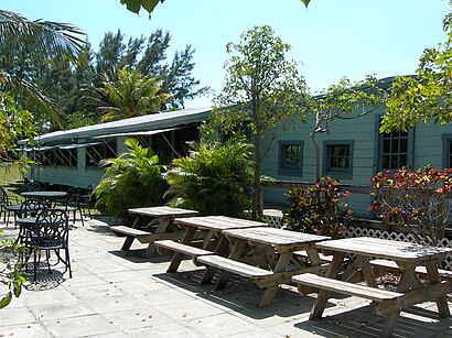
Directions to Caps Place (Deerfield Beach) with public transportation
The following transit lines have routes that pass near Caps Place
How to get to Caps Place by bus?
Click on the bus route to see step by step directions with maps, line arrival times and updated time schedules.
Bus stations near Caps Place in Deerfield Beach
- Us1/Ne 25 S,11 min walk,
Bus lines to Caps Place in Deerfield Beach
- 10,Central Terminal,
What are the closest stations to Caps Place?
The closest stations to Caps Place are:
- Us1/Ne 25 S is 860 yards away, 11 min walk.
Which bus lines stop near Caps Place?
These bus lines stop near Caps Place: 10, 83.
What’s the nearest bus stop to Caps Place in Deerfield Beach?
The nearest bus stop to Caps Place in Deerfield Beach is Us1/Ne 25 S. It’s a 11 min walk away.
See Caps Place, Deerfield Beach, on the map
Public Transit to Caps Place in Deerfield Beach
Wondering how to get to Caps Place in Deerfield Beach, United States? Moovit helps you find the best way to get to Caps Place with step-by-step directions from the nearest public transit station.
Moovit provides free maps and live directions to help you navigate through your city. View schedules, routes, timetables, and find out how long does it take to get to Caps Place in real time.
Looking for the nearest stop or station to Caps Place? Check out this list of stops closest to your destination: Us1/Ne 25 S.
Bus:1083
Want to see if there’s another route that gets you there at an earlier time? Moovit helps you find alternative routes or times. Get directions from and directions to Caps Place easily from the Moovit App or Website.
We make riding to Caps Place easy, which is why over 1.5 million users, including users in Deerfield Beach, trust Moovit as the best app for public transit. You don’t need to download an individual bus app or train app, Moovit is your all-in-one transit app that helps you find the best bus time or train time available.
For information on prices of bus, costs and ride fares to Caps Place, please check the Moovit app.
Use the app to navigate to popular places including to the airport, hospital, stadium, grocery store, mall, coffee shop, school, college, and university.
Location: Deerfield Beach, Miami
Attractions near Caps Place
Weiss Spencer & Levin Inc,NE 22 Ave,Amasianing,Carols Doll Room,South Florida Consulting,2185 NE 27th Ct,Angel Jewelry & Accessories,Acut Beyond Inc,Latitude 26 Designs Inc,Scandex Systems Inc,Bradshaw Plumbing,William J Benak Construction,2385 NE 27th St,Vmg,abbas pool,Walker's,CIM Int Corp,Caribbean Procurement Inc,2840 NE 22nd Ave,Albanese Home Builder IncHow to get to popular attractions in Deerfield Beach with public transit
Publix, Miami,Seminole Casino Coconut Creek, Deerfield Beach,Deerfield Beach, Deerfield Beach,Regal Cinemas Sawgrass 23 & IMAX, Plantation,Palm Beach Gardens, Jupiter,The Diplomat Beach Resort, Hollywood,Roger Dean Stadium, Jupiter,Promenade at Coconut Creek, Deerfield Beach,Cinemark Boynton Beach, Boynton Beach-Delray Beach,Hunters, Fort Lauderdale,Novecento, Miami,Flanigan's Seafood Bar & Grill, North Westside,Walmart Supercenter, Miramar-Pembroke Pines,Regal Cinemas Royal Palm Beach 18 RPX, Royal Palm Beach-West Jupiter,The Cheesecake Factory, North Westside,St. Mary's Medical Center, West Palm Beach,Costco Wholesale, Davie,Coral Springs, FL, Coral Springs-Margate,LA Fitness, Boca Raton,The Pub Pembroke, Miramar-Pembroke PinesGet around Deerfield Beach by public transit!
Traveling around Deerfield Beach has never been so easy. See step by step directions as you travel to any attraction, street or major public transit station. View bus and train schedules, arrival times, service alerts and detailed routes on a map, so you know exactly how to get to anywhere in Deerfield Beach.
When traveling to any destination around Deerfield Beach use Moovit's Live Directions with Get Off Notifications to know exactly where and how far to walk, how long to wait for your line, and how many stops are left. Moovit will alert you when it's time to get off — no need to constantly re-check whether yours is the next stop.
Wondering how to use public transit in Deerfield Beach or how to pay for public transit in Deerfield Beach? Moovit public transit app can help you navigate your way with public transit easily, and at minimum cost. It includes public transit fees, ticket prices, and costs. Looking for a map of Deerfield Beach public transit lines? Moovit public transit app shows all public transit maps in Deerfield Beach with all bus routes and stops on an interactive map.
Deerfield Beach has 1 transit type(s), including: bus, operated by several transit agencies, including Miami-Dade Transit, Miami-Dade Transit, Miami Dade Transit-Rail, Tri-Rail, Miami-Dade Transit, Broward County Transit, Palm Tran, Brightline, Brightline, MARTY, City of Homestead Trolley, Key West Transit, Treasure Coast Connector, GoLine IRT and Amtrak