How to get to Car Auto Plus by bus?
Click on the bus route to see step by step directions with maps, line arrival times and updated time schedules.
From Good Samaritan Hospital, Baltimore
43 minFrom Hopkins Plaza, Baltimore
41 minFrom I-695 @ Exit 27 (Dulaney Valley Road/MD 146), Baltimore County
52 minFrom Randallstown, MD, Baltimore County
59 minFrom Baltimore City Circuit Court, Baltimore
45 minFrom Medstar Harbor Hospital, Baltimore
62 minFrom I-83 Exit 16 (Timonium Road), Baltimore County
75 minFrom I-695 Exit 29 (Loch Raven Blvd (MD 542)/Cromwell Bridge Rd), Baltimore County
56 minFrom Nick's Fish House, Baltimore
56 minFrom Oriole Park At Camden Yards, Baltimore
42 min
How to get to Car Auto Plus by metro?
Click on the metro route to see step by step directions with maps, line arrival times and updated time schedules.
Bus stops near Car Auto Plus in Baltimore
Light Rail stations near Car Auto Plus in Baltimore
- Woodberry, 20 min walk,VIEW
Metro station near Car Auto Plus in Baltimore
- Rogers Ave Metro, 22 min walk,VIEW
Bus lines to Car Auto Plus in Baltimore
What are the closest stations to Car Auto Plus?
The closest stations to Car Auto Plus are:
- Park Heights Ave & Shirley Ave Sb is 8 yards away, 1 min walk.
- Reisterstown Rd & Grantly Ave FS Sb is 178 yards away, 3 min walk.
- Cold Spring Ln & Reisterstown Rd Eb is 400 yards away, 5 min walk.
- Woodberry is 1622 yards away, 20 min walk.
- Rogers Ave Metro is 1806 yards away, 22 min walk.
Which bus lines stop near Car Auto Plus?
These bus lines stop near Car Auto Plus: 28, 83, 85.
Which metro line stops near Car Auto Plus?
METRO (Towards Owing Mills)
What’s the nearest light rail station to Car Auto Plus in Baltimore?
The nearest light rail station to Car Auto Plus in Baltimore is Woodberry. It’s a 20 min walk away.
What’s the nearest metro station to Car Auto Plus in Baltimore?
The nearest metro station to Car Auto Plus in Baltimore is Rogers Ave Metro. It’s a 22 min walk away.
What’s the nearest bus station to Car Auto Plus in Baltimore?
The nearest bus station to Car Auto Plus in Baltimore is Park Heights Ave & Shirley Ave Sb. It’s a 1 min walk away.
What time is the first light rail to Car Auto Plus in Baltimore?
The LIGHT RAILLINK is the first light rail that goes to Car Auto Plus in Baltimore. It stops nearby at 4:26 AM.
What time is the last light rail to Car Auto Plus in Baltimore?
The LIGHT RAILLINK is the last light rail that goes to Car Auto Plus in Baltimore. It stops nearby at 12:47 AM.
What time is the first metro to Car Auto Plus in Baltimore?
The METRO is the first metro that goes to Car Auto Plus in Baltimore. It stops nearby at 4:56 AM.
What time is the last metro to Car Auto Plus in Baltimore?
The METRO is the last metro that goes to Car Auto Plus in Baltimore. It stops nearby at 12:19 AM.
What time is the first bus to Car Auto Plus in Baltimore?
The 83 is the first bus that goes to Car Auto Plus in Baltimore. It stops nearby at 4:04 AM.
What time is the last bus to Car Auto Plus in Baltimore?
The 85 is the last bus that goes to Car Auto Plus in Baltimore. It stops nearby at 2:16 AM.
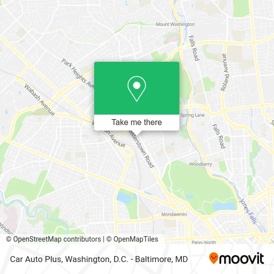
See Car Auto Plus, Baltimore, on the map
Public Transit to Car Auto Plus in Baltimore
Wondering how to get to Car Auto Plus in Baltimore? Moovit helps you find the best way to get to Car Auto Plus with step-by-step directions from the nearest public transit station.
Moovit provides free maps and live directions to help you navigate through your city. View schedules, routes, timetables, and find out how long does it take to get to Car Auto Plus in real time.
Looking for the nearest stop or station to Car Auto Plus? Check out this list of stops closest to your destination: Park Heights Ave & Shirley Ave Sb; Reisterstown Rd & Grantly Ave FS Sb; Cold Spring Ln & Reisterstown Rd Eb; Woodberry; Rogers Ave Metro.
Bus: 28, 83, 85.Metro: METRO.
Want to see if there’s another route that gets you there at an earlier time? Moovit helps you find alternative routes or times. Get directions from and directions to Car Auto Plus easily from the Moovit App or Website.
We make riding to Car Auto Plus easy, which is why over 1.5 million users, including users in Baltimore, trust Moovit as the best app for public transit. You don’t need to download an individual bus app or train app, Moovit is your all-in-one transit app that helps you find the best bus time or train time available.
For information on prices of bus, metro and light rail, costs and ride fares to Car Auto Plus, please check the Moovit app.
Use the app to navigate to popular places including to the airport, hospital, stadium, grocery store, mall, coffee shop, school, college, and university.
Car Auto Plus Address: 4213 Reisterstown Rd Baltimore, MD 21215 street in Baltimore
- Halal DMV,
- Mike & Movers,
- B Y Automotive,
- Park Heights Medical Clinic,
- Baltimore Physical Therapy Pain Management,
- A& J Auto Detailing and Hand Carwash,
- Deeply Rooted,
- AA & Adam,
- MD Home Buyer List,
- Amazon Locker-Fidele,
- Libertyx Bitcoin ATM,
- True Way Apostolic Wotcc,
- King Crab ATL,
- Pimlico Park Heights Ave,
- Park Heights Ave and Cold Spring,
- Park Heights W Cold Spring Ln,
- Park Heights Ave (cold spring lane and park heights),
- Vulcan Materials Company,
- Spring Food Market,
- Big Tymers Communications
Places Near Car Auto Plus (Baltimore)
- Rock Creek Tennis Center, Washington,
- Basilica of the National Shrine, Washington,
- Sibley Memorial Hospital, Washington,
- Museum Of The Bible, Washington,
- The Anthem, Washington,
- Camden Yards, Baltimore,
- Westfield Montgomery Mall, Montgomery County,
- PG Mall, Prince George's County,
- Georgetown, Washington,
- Amazon Hq2, Arlington County,
- National Theatre, Washington,
- National Zoo, Washington,
- M&T Bank Stadium, Baltimore,
- Washington National Cathedral, Washington,
- National Museum of African American History and Culture, Washington,
- Washington DC VA Medical Center, Washington,
- Pennsylvania Ave NW (3rd st and pennsylvania), Washington,
- Warner Theatre, Washington,
- Marriott Marquis Washington, DC, Washington,
- Capital One Arena, Washington
How to get to popular places in Washington, D.C. - Baltimore, MD with public transit
Get around Baltimore by public transit!
Traveling around Baltimore has never been so easy. See step by step directions as you travel to any attraction, street or major public transit station. View bus and train schedules, arrival times, service alerts and detailed routes on a map, so you know exactly how to get to anywhere in Baltimore.
When traveling to any destination around Baltimore use Moovit's Live Directions with Get Off Notifications to know exactly where and how far to walk, how long to wait for your line, and how many stops are left. Moovit will alert you when it's time to get off — no need to constantly re-check whether yours is the next stop.
Wondering how to use public transit in Baltimore or how to pay for public transit in Baltimore? Moovit public transit app can help you navigate your way with public transit easily, and at minimum cost. It includes public transit fees, ticket prices, and costs. Looking for a map of Baltimore public transit lines? Moovit public transit app shows all public transit maps in Baltimore with all Bus, Train, Metro, Light Rail and Ferry routes and stops on an interactive map.
Washington, D.C. - Baltimore, MD has 5 transit type(s), including: Bus, Train, Metro, Light Rail and Ferry, operated by several transit agencies, including WMATA, Montgomery County Ride On, Fairfax Connector, TheBus, PRTC, DASH - Alexandria, Arlington Transit (ART), RTA of Central Maryland, MDOT MTA, MDOT MTA Light RailLink, MDOT MTA Commuter Bus, MDOT MTA Local Bus, FXBGO!, Virginia Railway Express (VRE) and MARC