How to get to Cardinal Elementary School by bus?
Click on the bus route to see step by step directions with maps, line arrival times and updated time schedules.
From Smithsonian National Museum of Natural History, Washington
77 minFrom Washington Harbor, Washington
52 minFrom Enid A. Haupt Garden, Washington
77 minFrom Smithsonian National Museum of Natural History (National Museum of Natural History), Washington
81 minFrom Hyatt Centric Arlington, Arlington County
44 minFrom The Anthem, Washington
79 minFrom Pasquerilla Healthcare Center, Georgetown University, Washington
58 minFrom The District by Hilton Club, Washington
56 minFrom National Museum of Natural History, Washington
77 minFrom Royal Sonesta Washington DC, Washington
73 min
How to get to Cardinal Elementary School by metro?
Click on the metro route to see step by step directions with maps, line arrival times and updated time schedules.
From Smithsonian National Museum of Natural History, Washington
49 minFrom Washington Harbor, Washington
50 minFrom Enid A. Haupt Garden, Washington
49 minFrom Smithsonian National Museum of Natural History (National Museum of Natural History), Washington
50 minFrom Hyatt Centric Arlington, Arlington County
37 minFrom The Anthem, Washington
60 minFrom The District by Hilton Club, Washington
47 minFrom National Museum of Natural History, Washington
49 minFrom Royal Sonesta Washington DC, Washington
55 min
Bus stop near Cardinal Elementary School in Arlington County
- Washington Bl+N Mckinley Rd, 3 min walk,VIEW
Metro station near Cardinal Elementary School in Arlington County
- East Falls Church, 32 min walk,VIEW
Bus lines to Cardinal Elementary School in Arlington County
- F50, West To Vienna,VIEW
What are the closest stations to Cardinal Elementary School?
The closest stations to Cardinal Elementary School are:
- Washington Bl+N Mckinley Rd is 147 yards away, 3 min walk.
- East Falls Church is 2713 yards away, 32 min walk.
Which bus line stops near Cardinal Elementary School?
F50 (East To Ballston)
Which metro lines stop near Cardinal Elementary School?
These metro lines stop near Cardinal Elementary School: ORANGE, SILVER.
What’s the nearest bus station to Cardinal Elementary School in Arlington County?
The nearest bus station to Cardinal Elementary School in Arlington County is Washington Bl+N Mckinley Rd. It’s a 3 min walk away.
What time is the first metro to Cardinal Elementary School in Arlington County?
The ORANGE is the first metro that goes to Cardinal Elementary School in Arlington County. It stops nearby at 5:07 AM.
What time is the last metro to Cardinal Elementary School in Arlington County?
The SILVER is the last metro that goes to Cardinal Elementary School in Arlington County. It stops nearby at 12:31 AM.
What time is the first bus to Cardinal Elementary School in Arlington County?
The F50 is the first bus that goes to Cardinal Elementary School in Arlington County. It stops nearby at 6:15 AM.
What time is the last bus to Cardinal Elementary School in Arlington County?
The F50 is the last bus that goes to Cardinal Elementary School in Arlington County. It stops nearby at 12:03 AM.
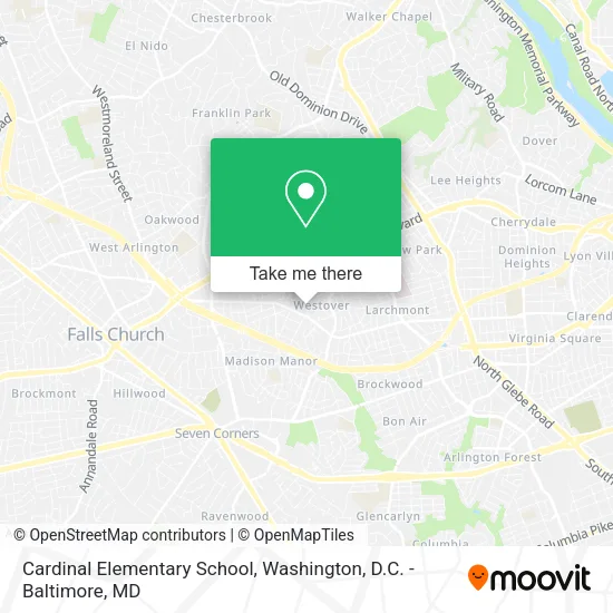
See Cardinal Elementary School, Arlington County, on the map
Public Transit to Cardinal Elementary School in Arlington County
Wondering how to get to Cardinal Elementary School in Arlington County? Moovit helps you find the best way to get to Cardinal Elementary School with step-by-step directions from the nearest public transit station.
Moovit provides free maps and live directions to help you navigate through your city. View schedules, routes, timetables, and find out how long does it take to get to Cardinal Elementary School in real time.
Looking for the nearest stop or station to Cardinal Elementary School? Check out this list of stops closest to your destination: Washington Bl+N Mckinley Rd; East Falls Church.
Bus: F50.Metro: ORANGE, SILVER.
Want to see if there’s another route that gets you there at an earlier time? Moovit helps you find alternative routes or times. Get directions from and directions to Cardinal Elementary School easily from the Moovit App or Website.
We make riding to Cardinal Elementary School easy, which is why over 1.5 million users, including users in Arlington County, trust Moovit as the best app for public transit. You don’t need to download an individual bus app or train app, Moovit is your all-in-one transit app that helps you find the best bus time or train time available.
For information on prices of bus and metro, costs and ride fares to Cardinal Elementary School, please check the Moovit app.
Use the app to navigate to popular places including to the airport, hospital, stadium, grocery store, mall, coffee shop, school, college, and university.
Cardinal Elementary School Address: 18th Street North street in Arlington County
- Wells Fargo,
- Westover Market Beer Garden,
- Highland Park,
- Westover Arlington VA USA,
- Andy's Lawn Landscape,
- The Fitness Break,
- Sea Change Development,
- Mace Park,
- Eric Purvis,
- Fly Me To the Moon Bounce,
- Soaring Starts Early Learning & Arts,
- Overlee Community Association (Overlee Community Pool),
- Elizabeth Neville,
- Purple Can Club,
- Billy's Deli Cafe,
- Abw Appliances - Arlin,
- Maid Brigade,
- Westover Park,
- Hammy's Snail Shack,
- Eyeconic
Places Near Cardinal Elementary School (Arlington County)
- PG Mall, Prince George's County,
- Sibley Memorial Hospital, Washington,
- Marriott Marquis Washington, DC, Washington,
- Washington National Cathedral, Washington,
- M&T Bank Stadium, Baltimore,
- National Museum of African American History and Culture, Washington,
- Camden Yards, Baltimore,
- Georgetown, Washington,
- Basilica of the National Shrine, Washington,
- National Zoo, Washington,
- Washington DC VA Medical Center, Washington,
- Westfield Montgomery Mall, Montgomery County,
- Amazon Hq2, Arlington County,
- Museum Of The Bible, Washington,
- Pennsylvania Ave NW (3rd st and pennsylvania), Washington,
- Rock Creek Tennis Center, Washington,
- Capital One Arena, Washington,
- Warner Theatre, Washington,
- National Theatre, Washington,
- The Anthem, Washington
How to get to popular places in Washington, D.C. - Baltimore, MD with public transit
Get around Arlington County by public transit!
Traveling around Arlington County has never been so easy. See step by step directions as you travel to any attraction, street or major public transit station. View bus and train schedules, arrival times, service alerts and detailed routes on a map, so you know exactly how to get to anywhere in Arlington County.
When traveling to any destination around Arlington County use Moovit's Live Directions with Get Off Notifications to know exactly where and how far to walk, how long to wait for your line, and how many stops are left. Moovit will alert you when it's time to get off — no need to constantly re-check whether yours is the next stop.
Wondering how to use public transit in Arlington County or how to pay for public transit in Arlington County? Moovit public transit app can help you navigate your way with public transit easily, and at minimum cost. It includes public transit fees, ticket prices, and costs. Looking for a map of Arlington County public transit lines? Moovit public transit app shows all public transit maps in Arlington County with all Bus, Train, Metro, Light Rail and Ferry routes and stops on an interactive map.
Washington, D.C. - Baltimore, MD has 5 transit type(s), including: Bus, Train, Metro, Light Rail and Ferry, operated by several transit agencies, including WMATA, Montgomery County Ride On, Fairfax Connector, TheBus, PRTC, DASH - Alexandria, Arlington Transit (ART), RTA of Central Maryland, MDOT MTA, MDOT MTA Light RailLink, MDOT MTA Commuter Bus, MDOT MTA Local Bus, FXBGO!, Virginia Railway Express (VRE) and MARC