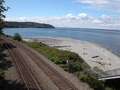
Directions to Carkeek Park (Seattle) with public transportation
The following transit lines have routes that pass near Carkeek Park
How to get to Carkeek Park by bus?
Click on the bus route to see step by step directions with maps, line arrival times and updated time schedules.
Bus stations near Carkeek Park in Seattle
- Nw 100th Pl & 7th Ave Nw, 20 min walk,
Bus lines to Carkeek Park in Seattle
- D LINE, Downtown Seattle Uptown,
- 28, Broadview,
What are the closest stations to Carkeek Park?
The closest stations to Carkeek Park are:
- Nw 100th Pl & 7th Ave Nw is 1658 yards away, 20 min walk.
Which bus lines stop near Carkeek Park?
These bus lines stop near Carkeek Park: 28, 40, D LINE.
See Carkeek Park, Seattle, on the map
Public Transit to Carkeek Park in Seattle
Wondering how to get to Carkeek Park in Seattle, United States? Moovit helps you find the best way to get to Carkeek Park with step-by-step directions from the nearest public transit station.
Moovit provides free maps and live directions to help you navigate through your city. View schedules, routes, timetables, and find out how long does it take to get to Carkeek Park in real time.
Looking for the nearest stop or station to Carkeek Park? Check out this list of stops closest to your destination: Nw 100th Pl & 7th Ave Nw.
Bus: 28, 40, D LINE.
Want to see if there’s another route that gets you there at an earlier time? Moovit helps you find alternative routes or times. Get directions from and directions to Carkeek Park easily from the Moovit App or Website.
We make riding to Carkeek Park easy, which is why over 1.5 million users, including users in Seattle, trust Moovit as the best app for public transit. You don’t need to download an individual bus app or train app, Moovit is your all-in-one transit app that helps you find the best bus time or train time available.
For information on prices of bus, costs and ride fares to Carkeek Park, please check the Moovit app.
Use the app to navigate to popular places including to the airport, hospital, stadium, grocery store, mall, coffee shop, school, college, and university.
Location: Seattle, Seattle - Tacoma, WA
Attractions near Carkeek Park
Precision Genome Engineering,Venema Creek,Tiny Trees Preschool - Carkeek Park,1265 NW Carkeek Park Rd,Carkeek Pump Station And Cso Treatment Facility,Pipers Creek Trail,Piper Canyon Rd,12th Avenue Hillclimb,10608 12th Ave NW,1404 NW Norcross Way,10608 12th Avenue Northwest,Mohlendorph Creek,1404 NW Woodbine Way,11th Ave NW,1231 NW 116th St,10578 14th Ave NW,City of Seattle Environmental Education,921 NW 107th St,915 NW Carkeek Park Rd,Northwest Carkeek Park RoadHow to get to popular attractions in Seattle with public transit
Phinney Ridge Neighborhood, Seattle,Starbucks, Seattle,Washington State Fair & Events Center, Puyallup,Everett, WA, Everett,Walmart Supercenter, Lakewood,City of University Place, University Place,Stadium Thriftway, Tacoma,Dale Turner Family YMCA, Shoreline,Safeway, South Hill,City of Lacey, Lacey,Tacoma Dome - Transit Center, Tacoma,Boeing, 40-88, Everett,University Village, Seattle,Seattle Pacific University, Seattle,Alaska Airlines Gold Coast Center, Seatac,Red Robin Gourmet Burgers, Bothell,Space Needle, Seattle,Edmonds Community College, Lynnwood,Costco Wholesale, Tacoma,Sumner Station, SumnerGet around Seattle - Tacoma, WA by public transit!
Traveling around Seattle - Tacoma, WA has never been so easy. See step by step directions as you travel to any attraction, street or major public transit station. View bus and train schedules, arrival times, service alerts and detailed routes on a map, so you know exactly how to get to anywhere in Seattle - Tacoma, WA.
When traveling to any destination around Seattle - Tacoma, WA use Moovit's Live Directions with Get Off Notifications to know exactly where and how far to walk, how long to wait for your line, and how many stops are left. Moovit will alert you when it's time to get off — no need to constantly re-check whether yours is the next stop.
Wondering how to use public transit in Seattle - Tacoma, WA or how to pay for public transit in Seattle - Tacoma, WA? Moovit public transit app can help you navigate your way with public transit easily, and at minimum cost. It includes public transit fees, ticket prices, and costs. Looking for a map of Seattle - Tacoma, WA public transit lines? Moovit public transit app shows all public transit maps in Seattle - Tacoma, WA with all Bus, Train, Light Rail and Ferry routes and stops on an interactive map.
Seattle - Tacoma, WA has 4 transit type(s), including: Bus, Train, Light Rail and Ferry, operated by several transit agencies, including Sound Transit, Seattle Streetcar, Metro Transit, Whatcom Transportation Authority, Mason Transit Authority, Snoqualmie Valley Transportation (SVT), Snoqualmie Valley Transportation, Amtrak, Island Transit, Kitsap Transit, Intercity Transit, Everett Transit, Community Transit, Skagit Transit, Pierce Transit