See Carver Vocational-Technical High School, Baltimore, on the map
Directions to Carver Vocational-Technical High School (Baltimore) with public transportation
The following transit lines have routes that pass near Carver Vocational-Technical High School
 Bus:
Bus: - Train:
- Metro:
How to get to Carver Vocational-Technical High School by bus?
Click on the bus route to see step by step directions with maps, line arrival times and updated time schedules.
How to get to Carver Vocational-Technical High School by train?
Click on the train route to see step by step directions with maps, line arrival times and updated time schedules.
How to get to Carver Vocational-Technical High School by metro?
Click on the metro route to see step by step directions with maps, line arrival times and updated time schedules.
Bus stations near Carver Vocational-Technical High School in Baltimore
- Bentalou St & Presbury St Nb,7 min walk,
- Fulton Ave & Baker St Nb,9 min walk,
- North Ave & Bentalou St Eb,10 min walk,
Bus lines to Carver Vocational-Technical High School in Baltimore
- 26,Patapsco Lr,
- CITYLINK NAVY,Mondawmin Metro,
- CITYLINK GOLD,Canton Crossing,
What are the closest stations to Carver Vocational-Technical High School?
The closest stations to Carver Vocational-Technical High School are:
- Bentalou St & Presbury St Nb is 558 yards away, 7 min walk.
- Fulton Ave & Baker St Nb is 729 yards away, 9 min walk.
- North Ave & Bentalou St Eb is 838 yards away, 10 min walk.
Which bus lines stop near Carver Vocational-Technical High School?
These bus lines stop near Carver Vocational-Technical High School: 26, CITYLINK GOLD, CITYLINK NAVY.
Which train line stops near Carver Vocational-Technical High School?
MARC
Which metro line stops near Carver Vocational-Technical High School?
METRO
What’s the nearest bus stop to Carver Vocational-Technical High School in Baltimore?
The nearest bus stop to Carver Vocational-Technical High School in Baltimore is Bentalou St & Presbury St Nb. It’s a 7 min walk away.
See Carver Vocational-Technical High School, Baltimore, on the map
Public Transit to Carver Vocational-Technical High School in Baltimore
Wondering how to get to Carver Vocational-Technical High School in Baltimore, United States? Moovit helps you find the best way to get to Carver Vocational-Technical High School with step-by-step directions from the nearest public transit station.
Moovit provides free maps and live directions to help you navigate through your city. View schedules, routes, timetables, and find out how long does it take to get to Carver Vocational-Technical High School in real time.
Looking for the nearest stop or station to Carver Vocational-Technical High School? Check out this list of stops closest to your destination: Bentalou St & Presbury St Nb; Fulton Ave & Baker St Nb; North Ave & Bentalou St Eb.
Bus:Train:Metro:
Want to see if there’s another route that gets you there at an earlier time? Moovit helps you find alternative routes or times. Get directions from and directions to Carver Vocational-Technical High School easily from the Moovit App or Website.
We make riding to Carver Vocational-Technical High School easy, which is why over 1.5 million users, including users in Baltimore, trust Moovit as the best app for public transit. You don’t need to download an individual bus app or train app, Moovit is your all-in-one transit app that helps you find the best bus time or train time available.
For information on prices of bus, metro and train, costs and ride fares to Carver Vocational-Technical High School, please check the Moovit app.
Use the app to navigate to popular places including to the airport, hospital, stadium, grocery store, mall, coffee shop, school, college, and university.
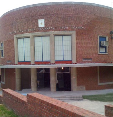
Carver Vocational-Technical High School Address: Presstman Street street in Baltimore
Attractions near Carver Vocational-Technical High School
Carver Vocational High School,1508 North Pulaski Street,Carver Vo-Tech High School,Brighton St & Smallwood St,Bentalou St & Presstman St NB ,2003 Presstman St,Bentalou Presstman,Payson St & Presstman,1521 N Bentalou St,Bmore Diva Nails,Payson and Baker St,Bentalou and Baker St,Baker & Bentalou St,Estevez Grocery Deli,2315 Baker St,Presbury St Smallwood,N Bentalou St (bentalou & winchester),Bentalou and Winch St,Winchester St,N Bentalou St (winchester and bentalou)How to get to popular attractions in Baltimore with public transit
Dave & Buster's, Anne Arundel County,Hyatt Regency Baltimore Inner Harbor, Baltimore,Urbana, Washington,Baltimore Farmers' Market & Bazaar, Baltimore,Pigtown / Washington Village, Baltimore,Hamilton's Bar & Grill, Washington,Federal Center SW Metro Station, Washington,Shaw's Tavern, Washington,Nando's Peri-Peri, Washington,P.J. Clarke's, Washington,Renaissance Baltimore Harborplace Hotel, Baltimore,Big Bear Cafe, Washington,Hank's Oyster Bar, Washington,New Psalmist Baptist Church, Baltimore County,AMC Owings Mills 17, Baltimore County,Hyatt Regency Reston, Fairfax County,Looney's Pub, Baltimore,Under Armour, Baltimore,Bluejacket Brewery, Washington,Toki Underground, WashingtonGet around Baltimore by public transit!
Traveling around Baltimore has never been so easy. See step by step directions as you travel to any attraction, street or major public transit station. View bus and train schedules, arrival times, service alerts and detailed routes on a map, so you know exactly how to get to anywhere in Baltimore.
When traveling to any destination around Baltimore use Moovit's Live Directions with Get Off Notifications to know exactly where and how far to walk, how long to wait for your line, and how many stops are left. Moovit will alert you when it's time to get off — no need to constantly re-check whether yours is the next stop.
Wondering how to use public transit in Baltimore or how to pay for public transit in Baltimore? Moovit public transit app can help you navigate your way with public transit easily, and at minimum cost. It includes public transit fees, ticket prices, and costs. Looking for a map of Baltimore public transit lines? Moovit public transit app shows all public transit maps in Baltimore with all bus, metro or train routes and stops on an interactive map.
Baltimore has 3 transit type(s), including: bus, metro or train, operated by several transit agencies, including WMATA, WMATA, Montgomery County Ride On, Fairfax Connector, TheBus, DC Circulator, MDOT MTA, Marc, MDOT MTA, MDOT MTA, Virginia Railway Express (VRE), PRTC, DASH - Alexandria, Arlington Transit (ART) and DC Streetcar