Cassia/Tomb of Nero stop - Friday schedule
| Line | Direction | Time |
|---|---|---|
| N201 | Piazza Venezia | 3:17 AM |
| N201 | Piazza Venezia | 3:17 AM |
| N201 | Piazza Venezia | 3:22 AM |
| N201 | Piazza Venezia | 3:22 AM |
| N201 | Piazza Venezia | 3:50 AM |
| N201 | Piazza Venezia | 3:50 AM |
| N201 | Piazza Venezia | 4:20 AM |
| N201 | Piazza Venezia | 4:20 AM |
| N201 | Piazza Venezia | 4:51 AM |
| N201 | Piazza Venezia | 4:51 AM |
| 301 | Giulio Cesare/Lepanto (Metro A) | 5:18 AM |
| 201 | Mancini | 5:19 AM |
| N201 | Piazza Venezia | 5:23 AM |
| N201 | Piazza Venezia | 5:23 AM |
| 201 | Mancini | 5:31 AM |
| COTRAL | Rome | Cornelia Terminal | 5:32 AM |
| 301 | Giulio Cesare/Lepanto (Metro A) | 5:35 AM |
| 223 | Termini (Metro A-Metro B-Railway) | 5:42 AM |
| 201 | Mancini | 5:44 AM |
| COTRAL | Rome | Cornelia Terminal | 5:48 AM |
| 301 | Giulio Cesare/Lepanto (Metro A) | 5:52 AM |
| 201 | Mancini | 5:57 AM |
| 223 | Termini (Metro A-Metro B-Railway) | 6:04 AM |
| COTRAL | Rome | Cornelia Terminal | 6:05 AM |
| 301 | Giulio Cesare/Lepanto (Metro A) | 6:07 AM |
Directions to Cassia/Tomb of Nero stop (Roma) with public transit
The following transit lines have routes that pass near Cassia/Tomb of Nero
 Bus: 301, 201, N201, 223, COTRAL.
- Train: FL3.
How to get to Cassia/Tomb of Nero stop by bus?
Click on the bus route to see step by step directions with maps, line arrival times and updated time schedules.
How to get to Cassia/Tomb of Nero stop by train?
Click on the train route to see step by step directions with maps, line arrival times and updated time schedules.
Bus stops near Cassia/Tomb of Nero stop in Roma
- Cassia/Tomb of Nero, 1 min walk,
- Cassia/Villa S. Pietro (H), 5 min walk,
- San Godenzo Square/Massarosa, 9 min walk,
- Largo Sperlonga, 12 min walk,
Train stations near Cassia/Tomb of Nero station in Roma
- Vigna Clara, 20 min walk,
Bus lines to Cassia/Tomb of Nero stop in Roma
- 201, Mancini,
- N201, Piazza Venezia,
- 223, La Giustiniana Station (FL3),
- 301, Giulio Cesare/Lepanto (Metro A),
- COTRAL, Blera to Piazza Giovanni XXIII,
- COTRAL, Manziana - Roma Cornelia,
- COTRAL, Blera - Roma Cornelia,
- COTRAL, Manziana - Roma Saxa Rubra,
- COTRAL, Viterbo - Roma Cornelia,
- 226, Grottarossa/Istituto Asisium,
- 029, Saxa Rubra Station,
What are the closest stations to Cassia/Tomb of Nero?
The closest stations to Cassia/Tomb of Nero are:
- Cassia/Tomb of Nero stop is 74 meters away, 1 min walk.
- Cassia/Villa S. Pietro (H) stop is 349 meters away, 5 min walk.
- San Godenzo Square/Massarosa stop is 687 meters away, 9 min walk.
- Largo Sperlonga stop is 885 meters away, 12 min walk.
- Vigna Clara station is 1530 meters away, 20 min walk.
Which bus line stops near Cassia/Tomb of Nero?
301 (Grottarossa/Istituto Asisium)
Which train line stops near Cassia/Tomb of Nero?
FL3 (Viterbo)
What’s the nearest train station to Cassia/Tomb of Nero in Roma?
The nearest train station to Cassia/Tomb of Nero in Roma is Vigna Clara. It’s a 20 min walk away.
What’s the nearest bus station to Cassia/Tomb of Nero in Roma?
The nearest bus station to Cassia/Tomb of Nero in Roma is Cassia/Tomb of Nero. It’s a 1 min walk away.
What time is the first train to Cassia/Tomb of Nero in Roma?
The FL3 is the first train that goes to Cassia/Tomb of Nero in Roma. It stops nearby at 5:56 AM.
What time is the last train to Cassia/Tomb of Nero in Roma?
The FL3 is the last train that goes to Cassia/Tomb of Nero in Roma. It stops nearby at 11:01 PM.
What time is the first bus to Cassia/Tomb of Nero in Roma?
The N201 is the first bus that goes to Cassia/Tomb of Nero in Roma. It stops nearby at 3:04 AM.
What time is the last bus to Cassia/Tomb of Nero in Roma?
The N201 is the last bus that goes to Cassia/Tomb of Nero in Roma. It stops nearby at 3:28 AM.
Cassia/Tomb of Nero station
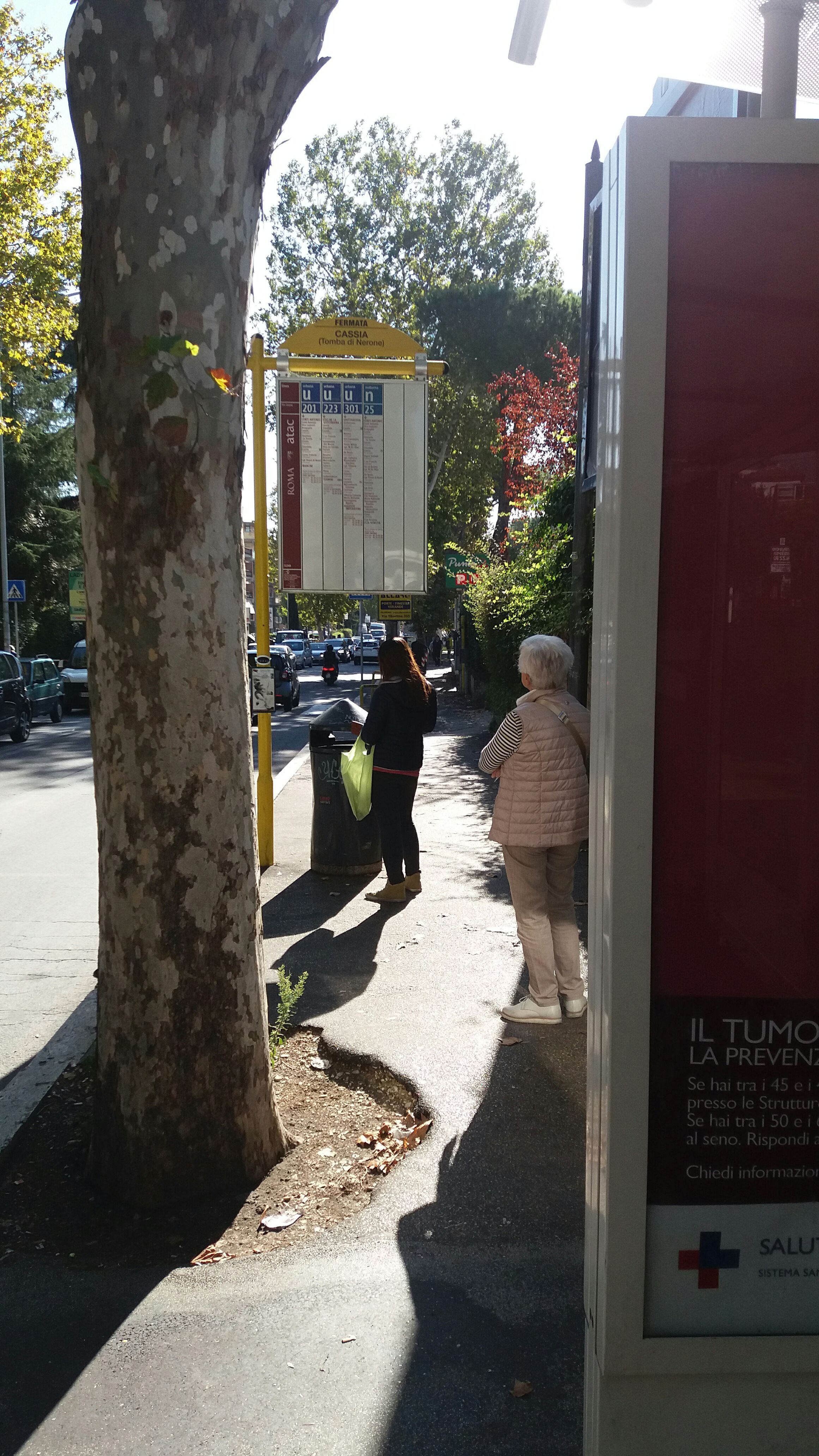 Taken by Anonymous
See Cassia/Tomb of Nero stop, Roma, on the map
Public transit to Cassia/Tomb of Nero stop (ID: 72249) in Roma
Looking for directions to Cassia/Tomb of Nero in Roma, Italy?
Download the Moovit App to find the current schedule and step-by-step directions for Bus or Train routes that pass through Cassia/Tomb of Nero.
Looking for the nearest stops closest to Cassia/Tomb of Nero ? Check out this list of closest stops to your destination: Cassia/Tomb of Nero; Cassia/Villa S. Pietro (H); San Godenzo Square/Massarosa; Largo Sperlonga; Vigna Clara.
Bus: 301, 201, N201, 223, COTRAL, COTRAL, COTRAL, COTRAL, COTRAL, 226, 029.Train: FL3.
We make riding on public transit to Cassia/Tomb of Nero easy, which is why over 1.7 billion users, including users in Roma trust Moovit as the best app for public transit.
Use the app to navigate to popular places including to the airport, hospital, stadium, grocery store, mall, coffee shop, school, college, and university.
Cassia/Tomb of Nero stop’s code is 72249
The first line to this stop is N201, at 3:17 AM, and the last line is N201 at 2:55 AM.
This stop serves Cotral and ATAC’s lines
Popular routes from Cassia/Tomb of Nero stop, Roma
- Cassia/Tomb of Nero,
- Cassia/Villa S. Pietro (H),
- San Godenzo Square/Massarosa,
- Largo Sperlonga
Bus stops near Cassia/Tomb of Nero stop
- Vigna Clara
Train station near Cassia/Tomb of Nero station
- Medaglie D'Oro/Marziale,
- Trionfale/Monte Gaudio,
- Longoni/Inps,
- Anzio Colony,
- Mancini,
- Acilia,
- Moricone,
- Tarquinia,
- Petrella Fiumata,
- Vetralla | Via Cassia (Km 62),
- Provincial Road 77b, Spinoretico,
- Via Piave, 19,
- Casetta Mattei/Corviale,
- Bravetta/Pisana,
- Colosseum,
- Portonaccio/Casal Bertone,
- Santa Marinella | Via Aurelia (Santa Severa),
- Anzio | Ardeatina Street (Lido Dei Pini),
- Bufalotta/Monte Gennaro,
- Ladispoli, Europa Avenue Conad Mare
Popular public transit stations in Roma
Get around Roma by public transit!
Traveling around Roma has never been so easy. See step by step directions as you travel to any attraction, street or major public transit station. View bus and train schedules, arrival times, service alerts and detailed routes on a map, so you know exactly how to get to anywhere in Roma.
When traveling to any destination around Roma use Moovit's Live Directions with Get Off Notifications to know exactly where and how far to walk, how long to wait for your line, and how many stops are left. Moovit will alert you when it's time to get off — no need to constantly re-check whether yours is the next stop.
Wondering how to use public transit in Roma or how to pay for public transit in Roma? Moovit public transit app can help you navigate your way with public transit easily, and at minimum cost. It includes public transit fees, ticket prices, and costs. Looking for a map of Roma public transit lines? Moovit public transit app shows all public transit maps in Roma with all Bus, Train, Metro, Light Rail, Ferry, Funicular and Gondola routes and stops on an interactive map.
Rome and Lazio has 7 transit type(s), including: Bus, Train, Metro, Light Rail, Ferry, Funicular and Gondola, operated by several transit agencies, including ATAC, Cotral, Trenitalia, Troiani Transportation Services, BIS, ATR Mobility, Tuscia, Shuttle, Seatour, Troiani Bus Lines, CSC Mobility, Terravision, ATRAL, Tambus and Sitbus