See Castellolí on the map
Directions to Castellolí with public transportation
The following transit lines have routes that pass near Castellolí
 Bus:
Bus:
How to get to Castellolí by bus?
Click on the bus route to see step by step directions with maps, line arrival times and updated time schedules.
Bus stations near Castellolí
- Castellolí,7 min walk,
Bus lines to Castellolí
- 131,Lleida - Barcelona,
- L0183,Les Borges Blanques - Guimerà - Igualada - Barcelona,
- L0361,Guissona - Igualada - Barcelona,
- L0371,Igualada - Barcelona (pel Bruc),
- L0372,Igualada - Aeroport del Prat,
- L0380,Igualada - Segur de Calafell - Coma-ruga,
What are the closest stations to Castellolí?
The closest stations to Castellolí are:
- Castellolí is 451 meters away, 7 min walk.
Which bus lines stop near Castellolí?
These bus lines stop near Castellolí: L0183, L0361, L0371.
What’s the nearest bus stop to Castellolí?
The nearest bus stop to Castellolí is Castellolí. It’s a 7 min walk away.
What time is the first bus to Castellolí?
The L0371 is the first bus that goes to Castellolí. It stops nearby at 5:38 AM.
What time is the last bus to Castellolí?
The L0371 is the last bus that goes to Castellolí. It stops nearby at 11:21 PM.
How much is the train fare to Castellolí?
The train fare to Castellolí costs about €2.55 - €7.40.
How much is the metro fare to Castellolí?
The metro fare to Castellolí costs about €2.55.
How much is the bus fare to Castellolí?
The bus fare to Castellolí costs about €2.55 - €3.65.
How much is the funicular fare to Castellolí?
The funicular fare to Castellolí costs about €2.55.
See Castellolí on the map
Public Transportation to Castellolí
Wondering how to get to Castellolí, Spain? Moovit helps you find the best way to get to Castellolí with step-by-step directions from the nearest public transit station.
Moovit provides free maps and live directions to help you navigate through your city. View schedules, routes, timetables, and find out how long does it take to get to Castellolí in real time.
Looking for the nearest stop or station to Castellolí? Check out this list of stops closest to your destination: Castellolí.
Bus:
Want to see if there’s another route that gets you there at an earlier time? Moovit helps you find alternative routes or times. Get directions from and directions to Castellolí easily from the Moovit App or Website.
We make riding to Castellolí easy, which is why over 1.5 million users, including users in Castellolí, trust Moovit as the best app for public transit. You don’t need to download an individual bus app or train app, Moovit is your all-in-one transit app that helps you find the best bus time or train time available.
For information on prices of bus, train, funicular and metro, costs and ride fares to Castellolí, please check the Moovit app.
Use the app to navigate to popular places including to the airport, hospital, stadium, grocery store, mall, coffee shop, school, college, and university.
Castellolí Address: Castellolí, 08719, Barcelona, España street in Castellolí
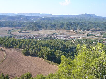
Castellolí is a municipality in the comarca area of the Anoia in Catalonia, Spain.Wiki
Attractions near Castellolí
Pere y Digna,Verdures Xavi de Rubio,Decoagua,Penya Blau Grana Caste,Castellolí,Adrenalina Paintball,Obaga Del Castell,Carretera Nacional IIa Km 560,Parcmotor Castellolí,Carretera N-II Km. 560,Ca N'Aguilera,Cal Bep,Parcmotor - Circuit Escola,Coll Del Bruc,Cal Xaus,Samsara Ioga,La Vinya Nova,Masia Can Pala,Restaurant Montserrat Park,ForbrucHow to get to popular attractions in Castellolí with public transit
Pont de Pedra, Girona,Zona Franca, Barcelona,FGC Sabadell Rambla, Sabadell,Playa Malgrat de Mar, Malgrat De Mar,Cinesa Diagonal, Barcelona,METRO Tetuan, Barcelona,Esplugues De Llobregat, Esplugues De Llobregat,Barcelona,Sant Joan Despí, Sant Joan Despí,Estación RENFE Passeig de Gràcia, Barcelona,Hewlett-Packard, Sant Cugat Del Vallès,Sede Mango, Palau-Solità I Plegamans,Igualada, Igualada,Ikea, L'Hospitalet De Llobregat,Club Natació Sabadell, Sabadell,Park Güell, Barcelona,Alella, Alella,Centre Comercial Diagonal Mar, Barcelona,RENFE Terrassa Est, Terrassa,Grand Hotel Central, BarcelonaGet around Castellolí by public transit!
Traveling around Castellolí has never been so easy. See step by step directions as you travel to any attraction, street or major public transit station. View bus and train schedules, arrival times, service alerts and detailed routes on a map, so you know exactly how to get to anywhere in Castellolí.
When traveling to any destination around Castellolí use Moovit's Live Directions with Get Off Notifications to know exactly where and how far to walk, how long to wait for your line, and how many stops are left. Moovit will alert you when it's time to get off — no need to constantly re-check whether yours is the next stop.
Wondering how to use public transit in Castellolí or how to pay for public transit in Castellolí? Moovit public transit app can help you navigate your way with public transit easily, and at minimum cost. It includes public transit fees, ticket prices, and costs. Looking for a map of Castellolí public transit lines? Moovit public transit app shows all public transit maps in Castellolí with all bus, train, funicular or metro routes and stops on an interactive map.
Castellolí has 4 transit type(s), including: bus, train, funicular or metro, operated by several transit agencies, including TMB, FGC, FGC, Rodalies de Catalunya, Rodalies de Catalunya, Renfe Operadora, SNCF, Trambaix, Trambesòs, Aeri de Montserrat, Teleféricos de Barcelona, FGC, Tibidabo, FGC and TMB