See Castelmaurou on the map
Directions to Castelmaurou with public transportation
The following transit lines have routes that pass near Castelmaurou
 Bus:
Bus: - Train:
How to get to Castelmaurou by bus?
Click on the bus route to see step by step directions with maps, line arrival times and updated time schedules.
Bus stations near Castelmaurou
- Castelmaurou Mairie,1 min walk,
- Castelmaurou - Mairie,2 min walk,
Train stations near Castelmaurou
- Montrabé,55 min walk,
- Gragnague,60 min walk,
Bus lines to Castelmaurou
- 68,Castelmaurou Mairie,
- 355,Villemur-Sur-Tarn / Toulouse,
What are the closest stations to Castelmaurou?
The closest stations to Castelmaurou are:
- Castelmaurou Mairie is 24 meters away, 1 min walk.
- Castelmaurou - Mairie is 56 meters away, 2 min walk.
- Montrabé is 4269 meters away, 55 min walk.
- Gragnague is 4670 meters away, 60 min walk.
Which bus line stops near Castelmaurou?
73
What’s the nearest bus stop to Castelmaurou?
The nearest bus stop to Castelmaurou is Castelmaurou Mairie. It’s a 1 min walk away.
What time is the first train to Castelmaurou?
The C2 is the first train that goes to Castelmaurou. It stops nearby at 8:04 AM.
What time is the last train to Castelmaurou?
The C2 is the last train that goes to Castelmaurou. It stops nearby at 9:38 PM.
What time is the first bus to Castelmaurou?
The 355 is the first bus that goes to Castelmaurou. It stops nearby at 9:15 AM.
What time is the last bus to Castelmaurou?
The 355 is the last bus that goes to Castelmaurou. It stops nearby at 6:04 PM.
See Castelmaurou on the map
Public Transportation to Castelmaurou
Wondering how to get to Castelmaurou, France? Moovit helps you find the best way to get to Castelmaurou with step-by-step directions from the nearest public transit station.
Moovit provides free maps and live directions to help you navigate through your city. View schedules, routes, timetables, and find out how long does it take to get to Castelmaurou in real time.
Looking for the nearest stop or station to Castelmaurou? Check out this list of stops closest to your destination: Castelmaurou Mairie; Castelmaurou - Mairie; Montrabé; Gragnague.
Bus:Train:
Want to see if there’s another route that gets you there at an earlier time? Moovit helps you find alternative routes or times. Get directions from and directions to Castelmaurou easily from the Moovit App or Website.
We make riding to Castelmaurou easy, which is why over 1.5 million users, including users in Castelmaurou, trust Moovit as the best app for public transit. You don’t need to download an individual bus app or train app, Moovit is your all-in-one transit app that helps you find the best bus time or train time available.
For information on prices of bus and metro, costs and ride fares to Castelmaurou, please check the Moovit app.
Use the app to navigate to popular places including to the airport, hospital, stadium, grocery store, mall, coffee shop, school, college, and university.
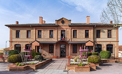
Castelmaurou Address: Rue des Anciens Combattants d'Afrique du Nord street in Castelmaurou
Castelmaurou (French pronunciation: [kastɛlmoʁu]; Occitan: Castèlmauron) is a commune in the Haute-Garonne department in southwestern France.Wiki
Attractions near Castelmaurou
Salle des Fetes,Up2pay,Médecine du Travail Artisanat et Interentreprises,Camille Ithourburu,Ligue Midi-Pyrã Nã es Football,Barrère,Alvaro el Nomade,L'Atelier des Pipelettes,Lauture Didier,Entreprise Amri Salah,Gennah,Apef,Station Pizza la K'Bane 88,Scm Drs Cazaubon Corniquet Blancardi,Cabinet Dentair,Ragi Arnaud,Dr Ancely,Trehein Laurent,Grosfillex Toulouse Fenêtres-Fabricant Fenêtre Porte Portail-Menuiserie Pvc Alu Bois,Les Papillons de NuitHow to get to popular attractions in Castelmaurou with public transit
Collège Jean-Pierre Vernant, Toulouse,Hôpital Psychiatrique Gérard Marchant, Toulouse,Leclerc, Toulouse,Jardin Japonais, Toulouse,Résidence Saint-Exupéry, Toulouse,Conseil Régional, Toulouse,Mairie De Villeneuve-Tolosane, Villeneuve-Tolosane,Seysses, Seysses,Place Du Président Wilson, Toulouse,Saint-Jory, Saint-Jory,Faculté De Pharmacie - Toulouse III, Toulouse,Lycée Charles De Gaulle, Muret,Résidence Abitel, Toulouse,Piscine Nakache, Toulouse,Iut-A Paul Sabatier, Toulouse,Lycée Henri De Toulouse-Lautrec, Toulouse,Hôpital Joseph Ducuing, Toulouse,Lycée Ort Maurice Grynfogel, Colomiers,Galeries Lafayette, Toulouse,Lycée Saint-Exupéry, BlagnacGet around Castelmaurou by public transit!
Traveling around Castelmaurou has never been so easy. See step by step directions as you travel to any attraction, street or major public transit station. View bus and train schedules, arrival times, service alerts and detailed routes on a map, so you know exactly how to get to anywhere in Castelmaurou.
When traveling to any destination around Castelmaurou use Moovit's Live Directions with Get Off Notifications to know exactly where and how far to walk, how long to wait for your line, and how many stops are left. Moovit will alert you when it's time to get off — no need to constantly re-check whether yours is the next stop.
Wondering how to use public transit in Castelmaurou or how to pay for public transit in Castelmaurou? Moovit public transit app can help you navigate your way with public transit easily, and at minimum cost. It includes public transit fees, ticket prices, and costs. Looking for a map of Castelmaurou public transit lines? Moovit public transit app shows all public transit maps in Castelmaurou with all bus or metro routes and stops on an interactive map.
Castelmaurou has 2 transit type(s), including: bus or metro, operated by several transit agencies, including Métro de Toulouse, Métro de Toulouse, Tisséo tramway, Tisséo, SNCF VOYAGEURS and HAUTE-GARONNE