See Castelseprio on the map
Directions to Castelseprio with public transportation
The following transit lines have routes that pass near Castelseprio
 Bus:
Bus: - Train:
How to get to Castelseprio by bus?
Click on the bus route to see step by step directions with maps, line arrival times and updated time schedules.
How to get to Castelseprio by train?
Click on the train route to see step by step directions with maps, line arrival times and updated time schedules.
Bus stations near Castelseprio
- Gornate Olona, Battisti/Marconi,Torba,1 min walk,
Train stations near Castelseprio
- Tradate,36 min walk,
Bus lines to Castelseprio
- V135,Carnago Roma Fr. Cimitero,
What are the closest stations to Castelseprio?
The closest stations to Castelseprio are:
- Gornate Olona, Battisti/Marconi,Torba is 0 meters away, 1 min walk.
- Tradate is 2810 meters away, 36 min walk.
Which bus lines stop near Castelseprio?
These bus lines stop near Castelseprio: H601, V135.
Which train line stops near Castelseprio?
R22
What’s the nearest bus stop to Castelseprio?
The nearest bus stop to Castelseprio is Gornate Olona, Battisti/Marconi,Torba. It’s a 1 min walk away.
What time is the first train to Castelseprio?
The R22 is the first train that goes to Castelseprio. It stops nearby at 5:32 AM.
What time is the last train to Castelseprio?
The R22 is the last train that goes to Castelseprio. It stops nearby at 11:26 PM.
How much is the train fare to Castelseprio?
The train fare to Castelseprio costs about €1.40 - €9.30.
See Castelseprio on the map
Public Transportation to Castelseprio
Wondering how to get to Castelseprio, Italy? Moovit helps you find the best way to get to Castelseprio with step-by-step directions from the nearest public transit station.
Moovit provides free maps and live directions to help you navigate through your city. View schedules, routes, timetables, and find out how long does it take to get to Castelseprio in real time.
Looking for the nearest stop or station to Castelseprio? Check out this list of stops closest to your destination: Gornate Olona; Tradate.
Bus:Train:
Want to see if there’s another route that gets you there at an earlier time? Moovit helps you find alternative routes or times. Get directions from and directions to Castelseprio easily from the Moovit App or Website.
We make riding to Castelseprio easy, which is why over 1.5 million users, including users in Milan and Lombardy, trust Moovit as the best app for public transit. You don’t need to download an individual bus app or train app, Moovit is your all-in-one transit app that helps you find the best bus time or train time available.
For information on prices of train, bus and metro, costs and ride fares to Castelseprio, please check the Moovit app.
Use the app to navigate to popular places including to the airport, hospital, stadium, grocery store, mall, coffee shop, school, college, and university.
Location: Milan and Lombardy
Popular routes to Castelseprio
Attractions near Castelseprio
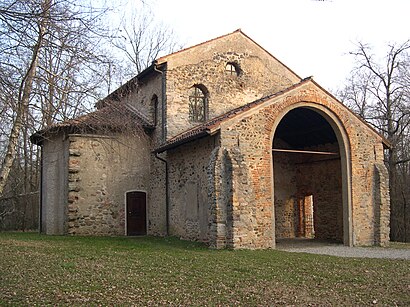
Torba,Monastero Di Torba,La Cucina del Sole Onlus,Castelseprio Archaeological Park,Polo Museale Regionale della Lombardia,Parco Archeologico Di Castel Seprio,Castelseprio,Santa Maria Foris Portas,Sadepan Chimica S.r.l.,Impresa Edile M.T.S. di Massironi Stefano & C,Studio Devadatta,Poretti Vannuccio,La Gornatese di Alini Alberto & C.,Castelseprio,Ilizia,Cimitero Comunale,Erredi Impianti di Roguzzi Davide,Chiosco al Bosco,Carglass,Serri ClaudioHow to get to popular attractions in Milan and Lombardy with public transit
Arco Della Pace, Giussano,Bergamo Città Alta, Bergamo,Stazione Lecco, Lecco,Bicocca Village, Milano,Piazza Castello, Milano,Area Servizio Somaglia Ovest, Somaglia,MediaWorld, Milano,Mantova, Mantova,Porta Genova M2, Milano,Roserio, Milano,Aeroporto Di Linate, Segrate,Teatro Degli Arcimboldi, Milano,Piazza Napoli, Milano,Pirelli HangarBicocca, Milano,Università Bocconi, Milano,Edizioni Condé Nast, Milano,Università Bicocca - Scienza, Milano,Accursio/Sonnino, Milano,Via Ripamonti - Via Quaranta, Milano,Loreto, MilanoGet around Milan and Lombardy by public transit!
Traveling around Milan and Lombardy has never been so easy. See step by step directions as you travel to any attraction, street or major public transit station. View bus and train schedules, arrival times, service alerts and detailed routes on a map, so you know exactly how to get to anywhere in Milan and Lombardy.
When traveling to any destination around Milan and Lombardy use Moovit's Live Directions with Get Off Notifications to know exactly where and how far to walk, how long to wait for your line, and how many stops are left. Moovit will alert you when it's time to get off — no need to constantly re-check whether yours is the next stop.
Wondering how to use public transit in Milan and Lombardy or how to pay for public transit in Milan and Lombardy? Moovit public transit app can help you navigate your way with public transit easily, and at minimum cost. It includes public transit fees, ticket prices, and costs. Looking for a map of Milan and Lombardy public transit lines? Moovit public transit app shows all public transit maps in Milan and Lombardy with all train, bus or metro routes and stops on an interactive map.
Milan and Lombardy has 3 transit type(s), including: train, bus or metro, operated by several transit agencies, including ATM, ATM, ATM, Trenord, Trenitalia, Autoguidovie S.p.A., NET, Movibus, ATM, ASF Autolinee, Autostradale S.r.l., Terravision, AirPullman, TEB and ATB