See Castlefrank STN., Toronto, on the map
Directions to Castlefrank STN. (Toronto) with public transportation
The following transit lines have routes that pass near Castlefrank STN.
 Bus:
Bus: - Train:
- Subway:
How to get to Castlefrank STN. by bus?
Click on the bus route to see step by step directions with maps, line arrival times and updated time schedules.
How to get to Castlefrank STN. by train?
Click on the train route to see step by step directions with maps, line arrival times and updated time schedules.
How to get to Castlefrank STN. by subway?
Click on the subway route to see step by step directions with maps, line arrival times and updated time schedules.
Bus stations near Castlefrank STN. in Toronto
- Bloor St East At Castle Frank Rd,1 min walk,
- Castle Frank Station,1 min walk,
Subway stations near Castlefrank STN. in Toronto
- Castle Frank ,2 min walk,
Bus lines to Castlefrank STN. in Toronto
- 300A,3450 Danforth Ave,
- 300B,Kennedy Station - Platform B,
- 300S,Bloor St West at Bathurst St,
- 94,Castle Frank Station,
- 94A,Ossington Station,
- 94B,Wellesley Station,
- 65,Dockside Dr at Queens Quay East,
What are the closest stations to Castlefrank STN.?
The closest stations to Castlefrank STN. are:
- Bloor St East At Castle Frank Rd is 18 meters away, 1 min walk.
- Castle Frank is 62 meters away, 2 min walk.
- Castle Frank Station is 67 meters away, 1 min walk.
Which bus lines stop near Castlefrank STN.?
These bus lines stop near Castlefrank STN.: 100, 94, 97.
Which train lines stop near Castlefrank STN.?
These train lines stop near Castlefrank STN.: RH, UP.
Which subway line stops near Castlefrank STN.?
2
What’s the nearest subway station to Castlefrank STN. in Toronto?
The nearest subway station to Castlefrank STN. in Toronto is Castle Frank. It’s a 2 min walk away.
What’s the nearest bus stop to Castlefrank STN. in Toronto?
The nearest bus stops to Castlefrank STN. in Toronto are Bloor St East At Castle Frank Rd and Castle Frank Station. The closest one is a 1 min walk away.
See Castlefrank STN., Toronto, on the map
Public Transit to Castlefrank STN. in Toronto
Wondering how to get to Castlefrank STN. in Toronto, Canada? Moovit helps you find the best way to get to Castlefrank STN. with step-by-step directions from the nearest public transit station.
Moovit provides free maps and live directions to help you navigate through your city. View schedules, routes, timetables, and find out how long does it take to get to Castlefrank STN. in real time.
Looking for the nearest stop or station to Castlefrank STN.? Check out this list of stops closest to your destination: Bloor St East At Castle Frank Rd; Castle Frank ; Castle Frank Station.
Bus:Train:Subway:
Want to see if there’s another route that gets you there at an earlier time? Moovit helps you find alternative routes or times. Get directions from and directions to Castlefrank STN. easily from the Moovit App or Website.
We make riding to Castlefrank STN. easy, which is why over 1.5 million users, including users in Toronto, trust Moovit as the best app for public transit. You don’t need to download an individual bus app or train app, Moovit is your all-in-one transit app that helps you find the best bus time or train time available.
For information on prices of subway, bus and train, costs and ride fares to Castlefrank STN., please check the Moovit app.
Use the app to navigate to popular places including to the airport, hospital, stadium, grocery store, mall, coffee shop, school, college, and university.
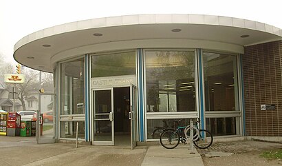
Castlefrank STN. Address: 74 Castle Frank Rd street in Toronto
Attractions near Castlefrank STN.
Bloor St East at Castle Frank Rd,Parliament Road C200 Bridge,Castle Frank,83 Castle Frank Rd,TTC-Castle Frank,687 Bloor Street East,Castle Frank Station,Gateway Newstands,680 Bloor St E,Castle Frank Subway Station,HWY-5,Entermark Interiors,If Inc,728 Bloor St E,9 Castle Frank Cres,Chateau Cheema,TTC Bus #65 Parliament,Broadview Bridge,Bloor St E,Castle Frank CrescentHow to get to popular attractions in Toronto with public transit
City of Burlington, Burlington,Walmart Supercentre, Burlington,Yorkdale Shopping Centre, Toronto,Meadowvale Town Centre, Mississauga,Phoenix Restaurant 金鳳餐廳, Markham,Lawrence Subway Station, Toronto,Kinka Izakaya, Toronto,York University, Toronto,Jack Astor's Bar & Grill, Toronto,Oshawa GO Station, Oshawa,IKEA, Burlington,Mapleview Shopping Centre, Burlington,Burlington Bay James N. Allan Skyway, Hamilton,Burlington GO Station, Burlington,GoodLife Fitness Centres, Toronto,Rogers Centre, Toronto,Oshawa, Ontario, Oshawa,Wayne Gretzky's Toronto, Toronto,Outlet Collection at Niagara, Niagara-On-The-Lake,Cambridge, Ontario, CambridgeGet around Toronto by public transit!
Traveling around Toronto has never been so easy. See step by step directions as you travel to any attraction, street or major public transit station. View bus and train schedules, arrival times, service alerts and detailed routes on a map, so you know exactly how to get to anywhere in Toronto.
When traveling to any destination around Toronto use Moovit's Live Directions with Get Off Notifications to know exactly where and how far to walk, how long to wait for your line, and how many stops are left. Moovit will alert you when it's time to get off — no need to constantly re-check whether yours is the next stop.
Wondering how to use public transit in Toronto or how to pay for public transit in Toronto? Moovit public transit app can help you navigate your way with public transit easily, and at minimum cost. It includes public transit fees, ticket prices, and costs. Looking for a map of Toronto public transit lines? Moovit public transit app shows all public transit maps in Toronto with all subway, bus or train routes and stops on an interactive map.
Toronto has 3 transit type(s), including: subway, bus or train, operated by several transit agencies, including TTC, TTC Streetcar, Toronto Subway, GO Transit Bus, GO Transit, Amtrak, York Region Transit, Grand River Transit, Guelph Transit, grt, Hamilton Street Railway, MiWay, Brampton Transit, Burlington Transit and Oakville Transit