Directions to Catholic Mutual Group (Alexandria) with public transportation
The following transit lines have routes that pass near Catholic Mutual Group
 Bus: 33, 36A, 36B, A70, 34.
- Train: PALMETTO, FREDERICKSBURG LINE, MANASSAS LINE.
- Metro: BLUE, YELLOW, METRO STATION CLOSURE SHUTTLE.
How to get to Catholic Mutual Group by bus?
Click on the bus route to see step by step directions with maps, line arrival times and updated time schedules.
From C&O Canal Towpath, Washington
104 minFrom Urban Roast, Washington
99 minFrom Calvert St NW, Washington
91 minFrom Children's Hospital, Washington
104 minFrom Embassy Of Russia, Washington
88 minFrom Yours Truly DC, Washington
83 minFrom Songbyrd Music House & Record Cafe, Washington
106 minFrom Buzzard Point, Washington
144 minFrom Balian Springs, Fairfax County
78 minFrom Senate Hearing Room G50, Dirksen Building, Washington
122 min
How to get to Catholic Mutual Group by train?
Click on the train route to see step by step directions with maps, line arrival times and updated time schedules.
How to get to Catholic Mutual Group by metro?
Click on the metro route to see step by step directions with maps, line arrival times and updated time schedules.
Bus stops near Catholic Mutual Group in Alexandria
Metro stations near Catholic Mutual Group in Alexandria
Train station near Catholic Mutual Group in Alexandria
- Crystal City, 40 min walk,VIEW
Bus lines to Catholic Mutual Group in Alexandria
What are the closest stations to Catholic Mutual Group?
The closest stations to Catholic Mutual Group are:
- E Glebe Rd + Montrose Av is 174 yards away, 3 min walk.
- Richmond Hwy + E Glebe Rd is 207 yards away, 3 min walk.
- E Glebe Rd + Main Line Blvd is 245 yards away, 3 min walk.
- Potomac Yard is 1287 yards away, 16 min walk.
- Crystal City is 3294 yards away, 39 min walk.
Which bus lines stop near Catholic Mutual Group?
These bus lines stop near Catholic Mutual Group: 33, 36A, 36B, A70.
Which train line stops near Catholic Mutual Group?
PALMETTO (Savannah)
Which metro lines stop near Catholic Mutual Group?
These metro lines stop near Catholic Mutual Group: BLUE, YELLOW.
What’s the nearest metro station to Catholic Mutual Group in Alexandria?
The nearest metro station to Catholic Mutual Group in Alexandria is Potomac Yard. It’s a 16 min walk away.
What’s the nearest bus station to Catholic Mutual Group in Alexandria?
The nearest bus stations to Catholic Mutual Group in Alexandria are E Glebe Rd + Montrose Av, Richmond Hwy + E Glebe Rd and E Glebe Rd + Main Line Blvd. The closest one is a 3 min walk away.
What time is the first metro to Catholic Mutual Group in Alexandria?
The YELLOW is the first metro that goes to Catholic Mutual Group in Alexandria. It stops nearby at 5:06 AM.
What time is the last metro to Catholic Mutual Group in Alexandria?
The YELLOW is the last metro that goes to Catholic Mutual Group in Alexandria. It stops nearby at 12:33 AM.
What time is the first train to Catholic Mutual Group in Alexandria?
The MANASSAS LINE is the first train that goes to Catholic Mutual Group in Alexandria. It stops nearby at 6:04 AM.
What time is the last train to Catholic Mutual Group in Alexandria?
The MANASSAS LINE is the last train that goes to Catholic Mutual Group in Alexandria. It stops nearby at 7:15 PM.
What time is the first bus to Catholic Mutual Group in Alexandria?
The 33 is the first bus that goes to Catholic Mutual Group in Alexandria. It stops nearby at 5:07 AM.
What time is the last bus to Catholic Mutual Group in Alexandria?
The A70 is the last bus that goes to Catholic Mutual Group in Alexandria. It stops nearby at 12:57 AM.
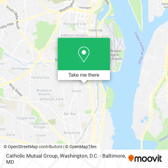
See Catholic Mutual Group, Alexandria, on the map
Public Transit to Catholic Mutual Group in Alexandria
Wondering how to get to Catholic Mutual Group in Alexandria? Moovit helps you find the best way to get to Catholic Mutual Group with step-by-step directions from the nearest public transit station.
Moovit provides free maps and live directions to help you navigate through your city. View schedules, routes, timetables, and find out how long does it take to get to Catholic Mutual Group in real time.
Looking for the nearest stop or station to Catholic Mutual Group? Check out this list of stops closest to your destination: E Glebe Rd + Montrose Av; Richmond Hwy + E Glebe Rd; E Glebe Rd + Main Line Blvd; Potomac Yard; Crystal City.
Bus: 33, 36A, 36B, A70, 34, A1X.Train: PALMETTO, FREDERICKSBURG LINE, MANASSAS LINE.Metro: BLUE, YELLOW, METRO STATION CLOSURE SHUTTLE.
Want to see if there’s another route that gets you there at an earlier time? Moovit helps you find alternative routes or times. Get directions from and directions to Catholic Mutual Group easily from the Moovit App or Website.
We make riding to Catholic Mutual Group easy, which is why over 1.5 million users, including users in Alexandria, trust Moovit as the best app for public transit. You don’t need to download an individual bus app or train app, Moovit is your all-in-one transit app that helps you find the best bus time or train time available.
For information on prices of bus, metro and train, costs and ride fares to Catholic Mutual Group, please check the Moovit app.
Use the app to navigate to popular places including to the airport, hospital, stadium, grocery store, mall, coffee shop, school, college, and university.
Catholic Mutual Group Address: 200 E Glebe Rd Alexandria, VA 22305 street in Alexandria
- The World Bank,
- Beyond,
- Omar's Pitas & Platters,
- Batteries Plus Bulbs,
- Los Tres Amigos Tex Mex Italian Cuisine,
- Codmist,
- Granite Telecomm VA,
- Ready 2 Go Cabinet,
- The Men's Home,
- Target Alexandria,
- Auto Check Auto Repair,
- Tenderfix by Noah Schnapp,
- Shell,
- Richmond Hwy and Glebe Rd,
- Potomac Yard Shuttle,
- Aquia Episcopal Church,
- Del Ray Wellness Center,
- Orangetheory Fitness,
- Extra Space Storage,
- Robyn E. Brickel, Ma LMFT LLC D / B/A Brickel and Associates
Places Near Catholic Mutual Group (Alexandria)
- National Zoo, Washington,
- PG Mall, Prince George's County,
- Westfield Montgomery Mall, Montgomery County,
- Washington National Cathedral, Washington,
- National Mall, Washington,
- Museum Of The Bible, Washington,
- National Museum of African American History and Culture, Washington,
- Rock Creek Tennis Center, Washington,
- Marriott Marquis Washington, DC, Washington,
- M&T Bank Stadium, Baltimore,
- Pennsylvania Ave NW (3rd st and pennsylvania), Washington,
- Georgetown, Washington,
- Capital One Arena, Washington,
- Basilica of the National Shrine, Washington,
- Sibley Memorial Hospital, Washington,
- Washington DC VA Medical Center, Washington,
- Warner Theatre, Washington,
- The Anthem, Washington,
- Amazon Hq2, Arlington County,
- Camden Yards, Baltimore
How to get to popular places in Washington, D.C. - Baltimore, MD with public transit
Get around Alexandria by public transit!
Traveling around Alexandria has never been so easy. See step by step directions as you travel to any attraction, street or major public transit station. View bus and train schedules, arrival times, service alerts and detailed routes on a map, so you know exactly how to get to anywhere in Alexandria.
When traveling to any destination around Alexandria use Moovit's Live Directions with Get Off Notifications to know exactly where and how far to walk, how long to wait for your line, and how many stops are left. Moovit will alert you when it's time to get off — no need to constantly re-check whether yours is the next stop.
Wondering how to use public transit in Alexandria or how to pay for public transit in Alexandria? Moovit public transit app can help you navigate your way with public transit easily, and at minimum cost. It includes public transit fees, ticket prices, and costs. Looking for a map of Alexandria public transit lines? Moovit public transit app shows all public transit maps in Alexandria with all Bus, Train, Metro, Light Rail and Ferry routes and stops on an interactive map.
Washington, D.C. - Baltimore, MD has 5 transit type(s), including: Bus, Train, Metro, Light Rail and Ferry, operated by several transit agencies, including WMATA, Montgomery County Ride On, Fairfax Connector, TheBus, PRTC, DASH - Alexandria, Arlington Transit (ART), RTA of Central Maryland, MDOT MTA, MDOT MTA Light RailLink, MDOT MTA Commuter Bus, MDOT MTA Local Bus, FXBGO!, Virginia Railway Express (VRE) and MARC