How to get to Cecchini Matteo by bus?
Click on the bus route to see step by step directions with maps, line arrival times and updated time schedules.
From Pistoia Zoo, Pistoia
273 minFrom Quetzal Club. The Legendary '90s, Serravalle Pistoiese
201 minFrom San Jacopo Hospital, Pistoia
254 minFrom Sandro Pertini Street, Pistoia
245 minFrom Ludovico Lazzaro Zamenhof Street, Pistoia
241 minFrom Adua Avenue, Pistoia
232 minFrom Panorama, Pistoia
279 minFrom Pistoia Hospital, Pistoia
252 minFrom Doganaccia, Cutigliano
154 min
Bus stop near Cecchini Matteo in Piteglio
- Prataccio, 3 min walk,VIEW
What are the closest stations to Cecchini Matteo?
The closest stations to Cecchini Matteo are:
- Prataccio is 171 meters away, 3 min walk.
Which bus line stops near Cecchini Matteo?
70 (Le Piastre Campari Fountain)
What’s the nearest bus station to Cecchini Matteo in Piteglio?
The nearest bus station to Cecchini Matteo in Piteglio is Prataccio. It’s a 3 min walk away.
What time is the first bus to Cecchini Matteo in Piteglio?
The 70 is the first bus that goes to Cecchini Matteo in Piteglio. It stops nearby at 6:48 AM.
What time is the last bus to Cecchini Matteo in Piteglio?
The 70 is the last bus that goes to Cecchini Matteo in Piteglio. It stops nearby at 6:19 PM.
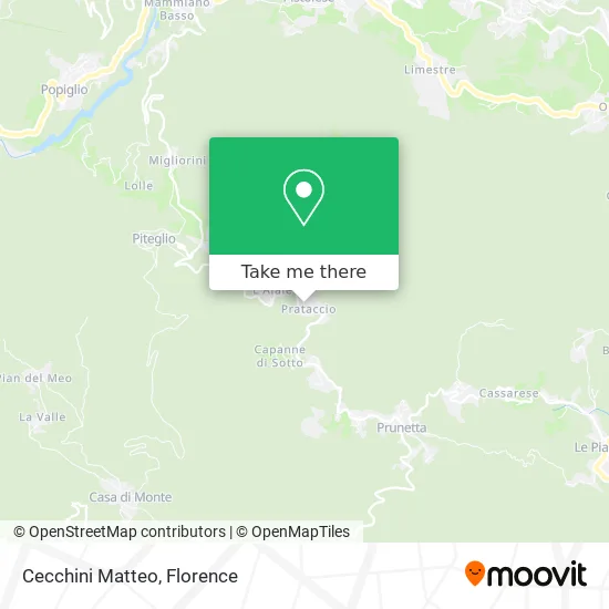
See Cecchini Matteo, Piteglio, on the map
Public Transit to Cecchini Matteo in Piteglio
Wondering how to get to Cecchini Matteo in Piteglio? Moovit helps you find the best way to get to Cecchini Matteo with step-by-step directions from the nearest public transit station.
Moovit provides free maps and live directions to help you navigate through your city. View schedules, routes, timetables, and find out how long does it take to get to Cecchini Matteo in real time.
Looking for the nearest stop or station to Cecchini Matteo? Check out this list of stops closest to your destination: Prataccio.
Bus: 70, PIT.
Want to see if there’s another route that gets you there at an earlier time? Moovit helps you find alternative routes or times. Get directions from and directions to Cecchini Matteo easily from the Moovit App or Website.
We make riding to Cecchini Matteo easy, which is why over 1.5 million users, including users in Piteglio, trust Moovit as the best app for public transit. You don’t need to download an individual bus app or train app, Moovit is your all-in-one transit app that helps you find the best bus time or train time available.
For information on prices of bus and train, costs and ride fares to Cecchini Matteo, please check the Moovit app.
Use the app to navigate to popular places including to the airport, hospital, stadium, grocery store, mall, coffee shop, school, college, and university.
Cecchini Matteo Address: Via Africo, 13 51028 San Marcello Piteglio street in Piteglio
- Mimmo's Holiday House,
- Gaddi Paola Grocery,
- Ducceschi Giacomo,
- Elledilizia,
- L'Abbondanza Farm,
- White Rabbit's Den,
- Simona,
- Grotto of the Madonna of Rio Buío,
- Capecchi by Giulio and Francesca Capecchi,
- Prunetta,
- Reno River Spring,
- La Forgia,
- Gessica and Glenda Grocery,
- Cream and Chocolate,
- Ducceschi Daniele,
- Pro-Loco Prunetta,
- Vanessa Hairdresser Men-Women,
- Grocery and Pastry Shop Ducceshi Angela,
- Silvana Boutique,
- Cream and Chocolate
Places Near Cecchini Matteo (Piteglio)
- I Gigli, Campi Bisenzio,
- Tobacco Manufacture, Florence,
- Campi Bisenzio, Campi Bisenzio,
- Santa Maria Nuova Hospital, Florence,
- IKEA Florence, Sesto Fiorentino,
- Cascine Park, Florence,
- Torregalli Hospital Scandicci *, Scandicci,
- Nelson Mandela Forum, Florence,
- Asmana, Campi Bisenzio,
- Michelangelo Square, Florence,
- Santa Maria Novella Station, Florence,
- Piero Palagi Hospital Facility-Florence, Florence,
- Mandela Forum (Nelson Mandela Forum), Florence,
- Artemio Franchi Municipal Stadium, Florence,
- Field of Mars, Florence,
- Verdi Theater, Florence,
- Michelangelo Square, Florence,
- Wanny Palace, Florence,
- Viola Park, Bagno a Ripoli,
- OOO, Florence
How to get to popular places in Florence with public transit
Get around Piteglio by public transit!
Traveling around Piteglio has never been so easy. See step by step directions as you travel to any attraction, street or major public transit station. View bus and train schedules, arrival times, service alerts and detailed routes on a map, so you know exactly how to get to anywhere in Piteglio.
When traveling to any destination around Piteglio use Moovit's Live Directions with Get Off Notifications to know exactly where and how far to walk, how long to wait for your line, and how many stops are left. Moovit will alert you when it's time to get off — no need to constantly re-check whether yours is the next stop.
Wondering how to use public transit in Piteglio or how to pay for public transit in Piteglio? Moovit public transit app can help you navigate your way with public transit easily, and at minimum cost. It includes public transit fees, ticket prices, and costs. Looking for a map of Piteglio public transit lines? Moovit public transit app shows all public transit maps in Piteglio with all Bus, Train, Light Rail, Ferry and Funicular routes and stops on an interactive map.
Florence has 5 transit type(s), including: Bus, Train, Light Rail, Ferry and Funicular, operated by several transit agencies, including Florence Urban - Tuscan Bus Lines, GEST, Florence and Province - Tuscan Bus Lines, Livorno and Province - Tuscan Bus Lines, Arezzo, Florence and Provinces - Tuscan Bus Lines, Prato and Province - Tuscan Bus Lines, Massa, Carrara and Province - Tuscan Bus Lines, Pisa and Province - Tuscan Bus Lines, Grosseto, Siena and Provinces - Tuscan Bus Lines, Arezzo, Siena and Provinces - Tuscan Bus Lines, Pistoia and Province - Tuscan Bus Lines, Siena and Province - Tuscan Bus Lines, Arezzo and Province - Tuscan Bus Lines, Lucca and Province - Tuscan Bus Lines and Trenitalia