See Cedar Grove Transit Station, Eagan, on the map
Directions to Cedar Grove Transit Station (Eagan) with public transportation
The following transit lines have routes that pass near Cedar Grove Transit Station
 Bus:
Bus:
How to get to Cedar Grove Transit Station by bus?
Click on the bus route to see step by step directions with maps, line arrival times and updated time schedules.
Bus stations near Cedar Grove Transit Station in Eagan
- Cedar Grove Transit Station,1 min walk,
- Cedar Grove Transit Station Busway,2 min walk,
- Twin Cities Premium Outlets,6 min walk,
Bus lines to Cedar Grove Transit Station in Eagan
- METRO RED LINE,Mall Of America,
- 440,Apple Valley Transit Station,
- 442,Burnsville Center,
- 444,Savage Park & Ride,
- 445,Eagan / Dodd & Opperman,
- 475,University Of Minnesota,
- 4FUN,Valleyfair/Canterbury/Mystic,
What are the closest stations to Cedar Grove Transit Station?
The closest stations to Cedar Grove Transit Station are:
- Cedar Grove Transit Station Busway is 10 yards away, 2 min walk.
- Cedar Grove Transit Station is 23 yards away, 1 min walk.
- Twin Cities Premium Outlets is 468 yards away, 6 min walk.
Which bus lines stop near Cedar Grove Transit Station?
These bus lines stop near Cedar Grove Transit Station: 440, 444, METRO RED LINE.
What’s the nearest bus stop to Cedar Grove Transit Station in Eagan?
The nearest bus stop to Cedar Grove Transit Station in Eagan is Cedar Grove Transit Station Busway. It’s a 2 min walk away.
What time is the first bus to Cedar Grove Transit Station in Eagan?
The METRO RED LINE is the first bus that goes to Cedar Grove Transit Station in Eagan. It stops nearby at 3:55 AM.
What time is the last bus to Cedar Grove Transit Station in Eagan?
The METRO RED LINE is the last bus that goes to Cedar Grove Transit Station in Eagan. It stops nearby at 12:19 AM.
How much is the bus fare to Cedar Grove Transit Station?
The bus fare to Cedar Grove Transit Station costs about $2.00.
How much is the light rail fare to Cedar Grove Transit Station?
The light rail fare to Cedar Grove Transit Station costs about $2.00 - $2.50.
See Cedar Grove Transit Station, Eagan, on the map
Public Transit to Cedar Grove Transit Station in Eagan
Wondering how to get to Cedar Grove Transit Station in Eagan, United States? Moovit helps you find the best way to get to Cedar Grove Transit Station with step-by-step directions from the nearest public transit station.
Moovit provides free maps and live directions to help you navigate through your city. View schedules, routes, timetables, and find out how long does it take to get to Cedar Grove Transit Station in real time.
Looking for the nearest stop or station to Cedar Grove Transit Station? Check out this list of stops closest to your destination: Cedar Grove Transit Station Busway; Cedar Grove Transit Station; Twin Cities Premium Outlets.
Bus:
Want to see if there’s another route that gets you there at an earlier time? Moovit helps you find alternative routes or times. Get directions from and directions to Cedar Grove Transit Station easily from the Moovit App or Website.
We make riding to Cedar Grove Transit Station easy, which is why over 1.5 million users, including users in Eagan, trust Moovit as the best app for public transit. You don’t need to download an individual bus app or train app, Moovit is your all-in-one transit app that helps you find the best bus time or train time available.
For information on prices of bus and light rail, costs and ride fares to Cedar Grove Transit Station, please check the Moovit app.
Use the app to navigate to popular places including to the airport, hospital, stadium, grocery store, mall, coffee shop, school, college, and university.
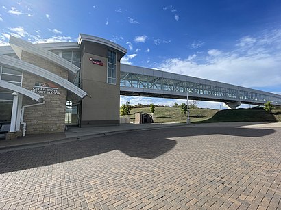
Cedar Grove Transit Station Address: Nicols Road street in Eagan
Attractions near Cedar Grove Transit Station
Eyeology Optical and Gift Boutique,Studio Three,Shinigami Tattoos,Waxed by Bailey,Atheria Skin,Eagan Outlets Pkwy,Entrance MN-77 N,Under Armour Factory House,The North Face,Haugen Lawrence D,Jockey Outlet,Cross Town Cleaning,Sherwin-Williams,Fairfield Inn & Suites,Columbia Outlet Store,Christopher & Banks Outlet,Journeys Kidz,Ichiran Ramen,STARBUCKS,New Balance Factory StoreHow to get to popular attractions in Eagan with public transit
Allina Health West St. Paul Clinic, West St. Paul,Como Park Senior High School, St. Paul,Amc Rosedale 16, Roseville,Boston Scientific Building 10, Arden Hills,Rice Park, St. Paul,The Pourhouse, Minneapolis,Hmong College Prep Academy, St. Paul,Target, Richfield,Fort Snelling Army Reserve Center,Target Center, Minneapolis,Valley View Apartments, Golden Valley,Sun Ray Shopping Center, St. Paul,Buca di Beppo Italian Restaurant, Burnsville,Burnsville Transit Station, Burnsville,MN 36 / US 61 Interchange, Maplewood,Fabian Seafood Truck, Minneapolis,Juut Salon and Spa, Minneapolis,Ridgedale Center, Minnetonka,Ids Center, Minneapolis,First Avenue, MinneapolisGet around Eagan by public transit!
Traveling around Eagan has never been so easy. See step by step directions as you travel to any attraction, street or major public transit station. View bus and train schedules, arrival times, service alerts and detailed routes on a map, so you know exactly how to get to anywhere in Eagan.
When traveling to any destination around Eagan use Moovit's Live Directions with Get Off Notifications to know exactly where and how far to walk, how long to wait for your line, and how many stops are left. Moovit will alert you when it's time to get off — no need to constantly re-check whether yours is the next stop.
Wondering how to use public transit in Eagan or how to pay for public transit in Eagan? Moovit public transit app can help you navigate your way with public transit easily, and at minimum cost. It includes public transit fees, ticket prices, and costs. Looking for a map of Eagan public transit lines? Moovit public transit app shows all public transit maps in Eagan with all bus or light rail routes and stops on an interactive map.
Eagan has 2 transit type(s), including: bus or light rail, operated by several transit agencies, including Metro Transit , Metro Transit, Metro Transit, MVTA, Plymouth Metrolink, SouthWest Transit, Maple Grove, University of Minnesota, Airport (MAC), Amtrak, Mankato Transit System, SMART, Megabus, FlixBus-us and Greyhound-us