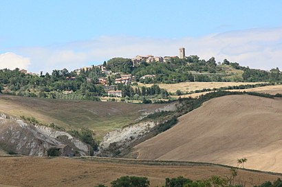
Directions to Celle Sul Rigo (San Casciano Dei Bagni) with public transportation
The following transit lines have routes that pass near Celle Sul Rigo
Bus stations near Celle Sul Rigo in San Casciano Dei Bagni
- Celle Sul Rigo-Loc. Pianetto, 2 min walk,
Bus lines to Celle Sul Rigo in San Casciano Dei Bagni
- T10, Chiusi Stazione,
What are the closest stations to Celle Sul Rigo?
The closest stations to Celle Sul Rigo are:
- Celle Sul Rigo-Loc. Pianetto is 113 meters away, 2 min walk.
Which bus line stops near Celle Sul Rigo?
T10
What’s the nearest bus stop to Celle Sul Rigo in San Casciano Dei Bagni?
The nearest bus stop to Celle Sul Rigo in San Casciano Dei Bagni is Celle Sul Rigo-Loc. Pianetto. It’s a 2 min walk away.
See Celle Sul Rigo, San Casciano Dei Bagni, on the map
Public Transit to Celle Sul Rigo in San Casciano Dei Bagni
Wondering how to get to Celle Sul Rigo in San Casciano Dei Bagni, Italy? Moovit helps you find the best way to get to Celle Sul Rigo with step-by-step directions from the nearest public transit station.
Moovit provides free maps and live directions to help you navigate through your city. View schedules, routes, timetables, and find out how long does it take to get to Celle Sul Rigo in real time.
Looking for the nearest stop or station to Celle Sul Rigo? Check out this list of stops closest to your destination: Celle Sul Rigo-Loc. Pianetto.
Bus: T10.
Want to see if there’s another route that gets you there at an earlier time? Moovit helps you find alternative routes or times. Get directions from and directions to Celle Sul Rigo easily from the Moovit App or Website.
We make riding to Celle Sul Rigo easy, which is why over 1.5 million users, including users in San Casciano Dei Bagni, trust Moovit as the best app for public transit. You don’t need to download an individual bus app or train app, Moovit is your all-in-one transit app that helps you find the best bus time or train time available.
For information on prices of bus and train, costs and ride fares to Celle Sul Rigo, please check the Moovit app.
Use the app to navigate to popular places including to the airport, hospital, stadium, grocery store, mall, coffee shop, school, college, and university.
Celle Sul Rigo Address: Via Torno al Fosso street in San Casciano Dei Bagni
Attractions near Celle Sul Rigo
Celle sul Rigo,Donatelli Carlo,La Primavera da Fabio,L'Appalto Alimentari -Tabacchi - Edicola,Lavanderia Bianchi di Marabissi Antonella,Celle sul Rigo-Loc. Pianetto,Tanta Roba di Pinzi Eleonora,Mori Coluzzi Lydia,Forno F.lli Fabbrizzi,Chicercatrova,Gori Rita Tabacchi Alimentari,Menchetti dal 1946,La Fontanella Country House,Villa Bellavista,La Novella Azienda Agricola,Podere San Lorenzo,Comune di Sciano dei Bagni,Agriturismo Tenuta Macetona,Celle sul Rigo-Loc. Palombaio Km. 9,5,Ponte a Rigo-al Km 28,1 Ss 321How to get to popular attractions in San Casciano Dei Bagni with public transit
Montecatini, Montecatini-Terme,Sesto Fiorentino, Sesto Fiorentino,Polo Scientifico E Tecnologico, Sesto Fiorentino,Firenze Santa Maria Novella (SMN) (ZMS), Firenze,Stazione Firenze Statuto, Firenze,Piazza San Marco, Firenze,Barberino Del Mugello, Barberino Di Mugello,San Jacopino, Firenze,Istituto Di Istruzione Superiore Gobetti Volta, Bagno A Ripoli,Novoli, Firenze,Varlungo, Firenze,Alamanni - Stazione Santa Maria Novella, Firenze,Piazza San Marco, Prato,Centro Commerciale ""I Gigli"", Campi Bisenzio,Villa Costanza, Scandicci,Novella, Firenze,Scandicci, Scandicci,Piazza San Firenze, Firenze,Design Campus, Calenzano,Piazza Della Santissima Annunziata, FirenzeGet around Florence by public transit!
Traveling around Florence has never been so easy. See step by step directions as you travel to any attraction, street or major public transit station. View bus and train schedules, arrival times, service alerts and detailed routes on a map, so you know exactly how to get to anywhere in Florence.
When traveling to any destination around Florence use Moovit's Live Directions with Get Off Notifications to know exactly where and how far to walk, how long to wait for your line, and how many stops are left. Moovit will alert you when it's time to get off — no need to constantly re-check whether yours is the next stop.
Wondering how to use public transit in Florence or how to pay for public transit in Florence? Moovit public transit app can help you navigate your way with public transit easily, and at minimum cost. It includes public transit fees, ticket prices, and costs. Looking for a map of Florence public transit lines? Moovit public transit app shows all public transit maps in Florence with all Bus, Train, Light Rail, Ferry and Funicular routes and stops on an interactive map.
Florence has 5 transit type(s), including: Bus, Train, Light Rail, Ferry and Funicular, operated by several transit agencies, including Firenze urbano - Autolinee Toscane, GEST, Firenze e provincia - Autolinee Toscane, Firenze, Prato e province - Autolinee Toscane, Livorno e provincia - Autolinee Toscane, Arezzo, Firenze e province - Autolinee Toscane, Pistoia e provincia - Autolinee Toscane, Lucca e provincia - Autolinee Toscane, Prato e provincia - Autolinee Toscane, Massa, Carrara e provincia - Autolinee Toscane, Pisa e provincia - Autolinee Toscane, Arezzo, Siena e province - Autolinee Toscane, Grosseto, Siena e province - Autolinee Toscane, Grosseto e provincia - Autolinee Toscane, Siena e provincia - Autolinee Toscane