Directions to Cenap (Centro) with public transportation
The following transit lines have routes that pass near Cenap
How to get to Cenap by bus?
Click on the bus route to see step by step directions with maps, line arrival times and updated time schedules.
From Expotrade Convention Center, Pinhais
49 minFrom Teatro Positivo, Cic
50 minFrom Hospital São Vicente - Cic, Cic
46 minFrom Muffato Max Linha Verde, Pinheirinho
31 minFrom Parque Tingui, São João
40 minFrom Terminal do Sitio Cercado, Sítio Cercado
46 minFrom Rua Oliveira Viana, Hauer
25 minFrom Rua Lodovico Kaminski 2055, Augusta
62 minFrom Rua Almirante Tamandaré, Almirante Tamandaré
52 minFrom Copel - Agência de Atendimento, Boqueirão
23 min
Bus stops near Cenap in Centro
- Av. Marechal Floriano Peixoto, 990, 2 min walk,VIEW
- Universidade Tecnológica, 2 min walk,VIEW
- Praça Eufrásio Correia (Linha especial), 3 min walk,VIEW
- Av. Sete de Setembro, 2902, 3 min walk,VIEW
- Alferes Poli, 4 min walk,VIEW
- Av. Sete de Setembro, 3223, 5 min walk,VIEW
- Av. Visconde de Guarapuava, 2646 (Instituto de Criminalística), 5 min walk,VIEW
- R. Desembargador Westphalen, 824 (Universidade Tecnológica), 5 min walk,VIEW
- Praça Rui Barbosa, 6 min walk,VIEW
Bus lines to Cenap in Centro
- 509 MAD. BOQUEIRÃO, Praça Carlos Gomes → Terminal Boqueirão,VIEW
- 519 MAD. SÃO FRANCISCO / IGUAPE, Terminal Boqueirão → Praça Carlos Gomes,VIEW
- 500 LIGEIRÃO BOQUEIRÃO, Terminal Boqueirão → Praça Carlos Gomes,VIEW
- 503 BOQUEIRÃO, Praça Carlos Gomes → Terminal Boqueirão,VIEW
- 550 LIGEIRÃO PINHEIRINHO / CARLOS GOMES, Terminal Pinheirinho → Praça Carlos Gomes,VIEW
- X48 ESPECIAL EUFRÁSIO CORREIA / RUI BARBOSA, Praça Eufrásio Correia ↺ Praça Rui Barbosa (Circular),VIEW
- 308 MAD. CENTENÁRIO / RUI BARBOSA, Praça Rui Barbosa → Terminal Centenário,VIEW
- 309 MAD. CENTENÁRIO, Praça Rui Barbosa ↺ Terminal Centenário (Circular),VIEW
- X49 REFORÇO PORTÃO / CABRAL, Terminal Portão → Terminal Cabral,VIEW
- 203 SANTA CÂNDIDA / CAPÃO RASO, Terminal Capão Raso → Terminal Santa Cândida,VIEW
- 250 LIGEIRÃO NORTE / SUL, Terminal Pinheirinho → Terminal Santa Cândida,VIEW
- 209 MAD. SANTA CÂNDIDA / CAPÃO RASO, Terminal Capão Raso → Terminal Santa Cândida (via Praça Rui Barbosa),VIEW
- H01 ARAUCÁRIA / GUADALUPE, Terminal Guadalupe → Terminal Araucária,VIEW
- G72 AREIA BRANCA / GUADALUPE, Terminal Guadalupe → Areia Branca,VIEW
- G72 QUITANDINHA / GUADALUPE, Terminal Guadalupe → Quitandinha,VIEW
- H97 ANGÉLICA / GUADALUPE, Terminal Guadalupe → Terminal Angélica,VIEW
- 387 PALOTINOS, Terminal Centenário → Praça Rui Barbosa,VIEW
- 461 SANTA BÁRBARA, Santa Bárbara → Praça Rui Barbosa,VIEW
- 462 PETRÓPOLIS, Ouro Verde → Praça Rui Barbosa,VIEW
- 463 SOLITUDE / PLANTA EVARISTO, Planta Evaristo / Solitude → Praça Carlos Gomes,VIEW
What are the closest stations to Cenap?
The closest stations to Cenap are:
- Av. Marechal Floriano Peixoto, 990 is 88 meters away, 2 min walk.
- Universidade Tecnológica is 103 meters away, 2 min walk.
- Praça Eufrásio Correia (Linha especial) is 187 meters away, 3 min walk.
- Av. Sete de Setembro, 2902 is 217 meters away, 3 min walk.
- Alferes Poli is 295 meters away, 4 min walk.
- Av. Sete de Setembro, 3223 is 313 meters away, 5 min walk.
- Av. Visconde de Guarapuava, 2646 (Instituto de Criminalística) is 336 meters away, 5 min walk.
- R. Desembargador Westphalen, 824 (Universidade Tecnológica) is 374 meters away, 5 min walk.
- Praça Rui Barbosa is 394 meters away, 6 min walk.
Which bus lines stop near Cenap?
These bus lines stop near Cenap: 203 SANTA CÂNDIDA / CAPÃO RASO, 500 LIGEIRÃO BOQUEIRÃO, 550 LIGEIRÃO PINHEIRINHO / CARLOS GOMES, 607 COLOMBO / CIC, 703 CAIUÁ, B06 GUARAITUBA / RUI BARBOSA (VIA MARACANÃ / SEMIDIRETO).
What’s the nearest bus station to Cenap in Centro?
The nearest bus stations to Cenap in Centro are Av. Marechal Floriano Peixoto, 990 and Universidade Tecnológica. The closest one is a 2 min walk away.
What time is the first bus to Cenap in Centro?
The 509 MAD. BOQUEIRÃO is the first bus that goes to Cenap in Centro. It stops nearby at 3:01 AM.
What time is the last bus to Cenap in Centro?
The 209 MAD. SANTA CÂNDIDA / CAPÃO RASO is the last bus that goes to Cenap in Centro. It stops nearby at 2:51 AM.
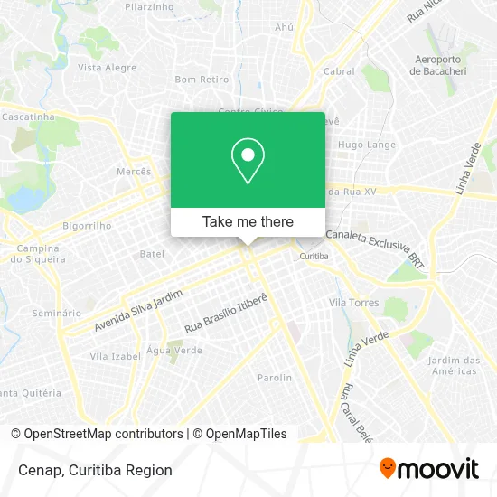
See Cenap, Centro, on the map
Public Transit to Cenap in Centro
Wondering how to get to Cenap in Centro? Moovit helps you find the best way to get to Cenap with step-by-step directions from the nearest public transit station.
Moovit provides free maps and live directions to help you navigate through your city. View schedules, routes, timetables, and find out how long does it take to get to Cenap in real time.
Looking for the nearest stop or station to Cenap? Check out this list of stops closest to your destination: Av. Marechal Floriano Peixoto; Universidade Tecnológica; Praça Eufrásio Correia (Linha especial); Av. Sete de Setembro; Alferes Poli; Av. Sete de Setembro; Av. Visconde de Guarapuava; R. Desembargador Westphalen; Praça Rui Barbosa.
Bus: 203 SANTA CÂNDIDA / CAPÃO RASO, 500 LIGEIRÃO BOQUEIRÃO, 550 LIGEIRÃO PINHEIRINHO / CARLOS GOMES, 607 COLOMBO / CIC, 703 CAIUÁ, B06 GUARAITUBA / RUI BARBOSA (VIA MARACANÃ / SEMIDIRETO), 509 MAD. BOQUEIRÃO, 519 MAD. SÃO FRANCISCO / IGUAPE, 503 BOQUEIRÃO, X48 ESPECIAL EUFRÁSIO CORREIA / RUI BARBOSA, 308 MAD. CENTENÁRIO / RUI BARBOSA, 309 MAD. CENTENÁRIO.
Want to see if there’s another route that gets you there at an earlier time? Moovit helps you find alternative routes or times. Get directions from and directions to Cenap easily from the Moovit App or Website.
We make riding to Cenap easy, which is why over 1.5 million users, including users in Centro, trust Moovit as the best app for public transit. You don’t need to download an individual bus app or train app, Moovit is your all-in-one transit app that helps you find the best bus time or train time available.
For information on prices of bus, costs and ride fares to Cenap, please check the Moovit app.
Use the app to navigate to popular places including to the airport, hospital, stadium, grocery store, mall, coffee shop, school, college, and university.
Cenap Address: Av. Marechal Floriano Peixoto, 864 street in Centro
- Seicho-No-Ie Núcleo Rebouças,
- Hospital IPO,
- Caixa Economica Federal da UTFPR,
- Teatro EBANX Regina Vogue,
- Nacional Inn Curitiba Hotel,
- DAMAT - UTFPR,
- CAFIS,
- Estação Tubo Universidade Tecnológica,
- Estação Tubo UTFPR,
- CEFET Pr.,
- Avenida Visconde de Guarapuava,
- Ponto De Onibus Araucaria / Curitiba,
- Linha H01 Troncal Ctba / Araucária,
- Linha 301 Expresso Pinhais / Rui Barbosa,
- Camara Municipal De Curitiba,
- Casa do Sapateiro,
- Ri Happy,
- Universidade Tecnológica Federal Do Paraná - Campus Curitiba - Sede Centro,
- Sé Recursos Humanos,
- Restaurante Hibisco
Places Near Cenap (Centro)
- Park Shopping Barigüi, Mossunguê,
- Hospital Erasto Gaertner, Jardim Das Américas,
- Pontifícia Universidade Católica do Paraná (PUCPR), Prado Velho,
- Shopping Estação, Rebouças,
- Hospital do Rocio, Campo,
- Rua Martim Afonso 558, Mercês,
- Hhhhh, Fazendinha,
- Hospital de Clínicas (HC - UFPR), Centro,
- Shopping Palladium, Portão,
- Hospital Angelina Caron, Campina Grande Do Sul,
- Hospital Madalena Sofia, Bairro Alto,
- Hospital Nossa Senhora Das Graças, Mercês,
- Jardim Botânico de Curitiba PR, Centro,
- Jockey Plaza Shopping Center, Tarumã,
- Parque Barigui, Mercês,
- Campo Largo, Campo,
- Rua General Mário Tourinho, Campina Do Siqueira,
- Hospital Universitário Evangélico de Curitiba, Bigorrilho,
- Arena Da Baixada - Curitiba,
- Hospital Da Cruz Vermelha, Batel
How to get to popular places in Curitiba Region with public transit
Get around Centro by public transit!
Traveling around Centro has never been so easy. See step by step directions as you travel to any attraction, street or major public transit station. View bus and train schedules, arrival times, service alerts and detailed routes on a map, so you know exactly how to get to anywhere in Centro.
When traveling to any destination around Centro use Moovit's Live Directions with Get Off Notifications to know exactly where and how far to walk, how long to wait for your line, and how many stops are left. Moovit will alert you when it's time to get off — no need to constantly re-check whether yours is the next stop.
Wondering how to use public transit in Centro or how to pay for public transit in Centro? Moovit public transit app can help you navigate your way with public transit easily, and at minimum cost. It includes public transit fees, ticket prices, and costs. Looking for a map of Centro public transit lines? Moovit public transit app shows all public transit maps in Centro with all Bus and Cable Car routes and stops on an interactive map.
Curitiba Region has 2 transit type(s), including: Bus and Cable Car, operated by several transit agencies, including Sistema Integrado de Mobilidade (URBS), Sistema Integrado de Mobilidade (AMEP), URBS (Cartões bancários e Dinheiro), URBS (Cartões bancários / Cartão URBS), AMEP (Cartões bancários / Cartão MetroCard), AMEP (Cartões bancários / Cartão MetroCard / Dinheiro), Viação Colombo (Dinheiro), TRIAR (Cartão TRIAR / Dinheiro), Empresa Curitiba Cerro Azul (Dinheiro), Expresso Nossa Senhora da Penha (Dinheiro), Empresa Campo Alto Tijucas (Dinheiro), Auto Viação São José (Cartão VEM / Dinheiro), BRT S/A (Cartão VEM / Dinheiro), TransPiedade (Cartão Cidadão / Dinheiro) and Oceânica Sul (Cartão Transporte / Dinheiro)