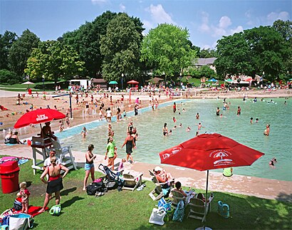
See Centennial Beach, Naperville, on the map
Previously published: also available in very high resolution at fineartamerica#com
Directions to Centennial Beach (Naperville) with public transportation
The following transit lines have routes that pass near Centennial Beach
 Bus:
Bus: - Train:
How to get to Centennial Beach by bus?
Click on the bus route to see step by step directions with maps, line arrival times and updated time schedules.
How to get to Centennial Beach by train?
Click on the train route to see step by step directions with maps, line arrival times and updated time schedules.
Which bus line stops near Centennial Beach?
530
Which train line stops near Centennial Beach?
BNSF
See Centennial Beach, Naperville, on the map
Previously published: also available in very high resolution at fineartamerica#com
Public Transit to Centennial Beach in Naperville
Wondering how to get to Centennial Beach in Naperville, United States? Moovit helps you find the best way to get to Centennial Beach with step-by-step directions from the nearest public transit station.
Moovit provides free maps and live directions to help you navigate through your city. View schedules, routes, timetables, and find out how long does it take to get to Centennial Beach in real time.
Bus:Train:
Want to see if there’s another route that gets you there at an earlier time? Moovit helps you find alternative routes or times. Get directions from and directions to Centennial Beach easily from the Moovit App or Website.
We make riding to Centennial Beach easy, which is why over 1.5 million users, including users in Naperville, trust Moovit as the best app for public transit. You don’t need to download an individual bus app or train app, Moovit is your all-in-one transit app that helps you find the best bus time or train time available.
For information on prices of bus and train, costs and ride fares to Centennial Beach, please check the Moovit app.
Use the app to navigate to popular places including to the airport, hospital, stadium, grocery store, mall, coffee shop, school, college, and university.
Centennial Beach Address: Honorary Sindt Memorial Court street in Naperville
Previously published: also available in very high resolution at fineartamerica#com
Attractions near Centennial Beach
Centennial Beach Bathhouse,Mr. & Mrs. Naperville,Moser Tower,Visitor Center,Naperville Riverwalk,The Festival of Colors,St Paddy's Day 5K,River Walk Grand Pavilion,Millennium Carillon,530 Jackson Ave,River Bend Heights,Knoch Park,Centennial Park,Centennial Skate Facility,Netzley Quarry,Last Fling Main Stage,294 S West St,S West St,Naperville Trolley & Tours,601 W Jackson AveHow to get to popular attractions in Naperville with public transit
Rt 83 & Thorndale, Bensenville,Stateville Correctional Center, Crest Hill,Chama Gaucha Brazilian Steakhouse, Downers Grove,10 S Lasalle, Chicago,Ballydoyle Irish Pub, Downers Grove,Portage Park Neighborhood, Chicago,Metra - Vernon Hills, Vernon Hills,Texas Roadhouse, Naperville,Metra - Wheaton, Wheaton,LEGOLAND Discovery Center, Schaumburg,Randhurst Village, Mount Prospect,Chicago Ridge Mall, Chicago Ridge,Mallard Lake Apartments, Wheeling,Joliet Junior College, Joliet,Saint Xavier University (Warde Academic Center), Chicago,Hamburger Mary's / Andersonville Brewing, Chicago,Metra - 55th / 56th / 57th St, Chicago,Palos Heights, IL,1350 North Lake Shore Drive Apartments, Chicago,Chicago Marriott Southwest at Burr Ridge, Burr RidgeGet around Naperville by public transit!
Traveling around Naperville has never been so easy. See step by step directions as you travel to any attraction, street or major public transit station. View bus and train schedules, arrival times, service alerts and detailed routes on a map, so you know exactly how to get to anywhere in Naperville.
When traveling to any destination around Naperville use Moovit's Live Directions with Get Off Notifications to know exactly where and how far to walk, how long to wait for your line, and how many stops are left. Moovit will alert you when it's time to get off — no need to constantly re-check whether yours is the next stop.
Wondering how to use public transit in Naperville or how to pay for public transit in Naperville? Moovit public transit app can help you navigate your way with public transit easily, and at minimum cost. It includes public transit fees, ticket prices, and costs. Looking for a map of Naperville public transit lines? Moovit public transit app shows all public transit maps in Naperville with all bus or train routes and stops on an interactive map.
Naperville has 2 transit type(s), including: bus or train, operated by several transit agencies, including CTA 'L', Metra, Northern Indiana Commuter Transportation District, CTA, PACE, O'Hare International Airport Shuttle Bus, Gary Public Transit, Amtrak, River Valley Metro, Valpo Transit, DeKalb Public Transit, FlixBus-us, Greyhound-us, Van Galder (Coach USA) and Wisconsin Coach Lines