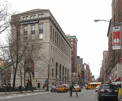
Directions to Central Savings Bank Building (Manhattan) with public transportation
The following transit lines have routes that pass near Central Savings Bank Building
How to get to Central Savings Bank Building by bus?
Click on the bus route to see step by step directions with maps, line arrival times and updated time schedules.
How to get to Central Savings Bank Building by train?
Click on the train route to see step by step directions with maps, line arrival times and updated time schedules.
How to get to Central Savings Bank Building by subway?
Click on the subway route to see step by step directions with maps, line arrival times and updated time schedules.
Bus stations near Central Savings Bank Building in Manhattan
- W 72 St/Amsterdam Av, 1 min walk,
- Amsterdam Av/W 72 St, 1 min walk,
- Broadway & W 71 St, 1 min walk,
- W 72 St/Broadway, 1 min walk,
Subway stations near Central Savings Bank Building in Manhattan
- 79 St, 3 min walk,
- 72 St, 10 min walk,
Bus lines to Central Savings Bank Building in Manhattan
- M72, East Side York Av Crosstown,
- BXM2, Riverdale 263 St Via H. Hudson Pky,
- M7, 14 St Via Columbus Via 7 Av,
- M11, Riverbank 145 St Via 10 Av,
- M104, 41 St Via Broadway/7 Av,
- M5, Limited Washington Heights Gw Bridge,
- M57, West Side Broadway-72 St Crosstown,
What are the closest stations to Central Savings Bank Building?
The closest stations to Central Savings Bank Building are:
- W 72 St/Amsterdam Av is 21 yards away, 1 min walk.
- Amsterdam Av/W 72 St is 22 yards away, 1 min walk.
- Broadway & W 71 St is 40 yards away, 1 min walk.
- W 72 St/Broadway is 55 yards away, 1 min walk.
- 79 St is 201 yards away, 3 min walk.
- 72 St is 797 yards away, 10 min walk.
Which bus lines stop near Central Savings Bank Building?
These bus lines stop near Central Savings Bank Building: M104, M5, M66, M7, M79-SBS, SIM1C.
Which train lines stop near Central Savings Bank Building?
These train lines stop near Central Savings Bank Building: HEMPSTEAD BRANCH, PATH.
Which subway lines stop near Central Savings Bank Building?
These subway lines stop near Central Savings Bank Building: 1, 2, 3.
What’s the nearest subway station to Central Savings Bank Building in Manhattan?
The nearest subway station to Central Savings Bank Building in Manhattan is 79 St. It’s a 3 min walk away.
What’s the nearest bus stop to Central Savings Bank Building in Manhattan?
The nearest bus stops to Central Savings Bank Building in Manhattan are W 72 St/Amsterdam Av, Amsterdam Av/W 72 St, Broadway & W 71 St and W 72 St/Broadway. The closest one is a 1 min walk away.
What time is the first subway to Central Savings Bank Building in Manhattan?
The 3 is the first subway that goes to Central Savings Bank Building in Manhattan. It stops nearby at 3:02 AM.
What time is the last subway to Central Savings Bank Building in Manhattan?
The A is the last subway that goes to Central Savings Bank Building in Manhattan. It stops nearby at 4:00 AM.
What time is the first bus to Central Savings Bank Building in Manhattan?
The M7 is the first bus that goes to Central Savings Bank Building in Manhattan. It stops nearby at 3:02 AM.
What time is the last bus to Central Savings Bank Building in Manhattan?
The M7 is the last bus that goes to Central Savings Bank Building in Manhattan. It stops nearby at 3:02 AM.
How much is the bus fare to Central Savings Bank Building?
The bus fare to Central Savings Bank Building costs about $2.90.
How much is the subway fare to Central Savings Bank Building?
The subway fare to Central Savings Bank Building costs about $2.90.
See Central Savings Bank Building, Manhattan, on the map
Public Transit to Central Savings Bank Building in Manhattan
Wondering how to get to Central Savings Bank Building in Manhattan, United States? Moovit helps you find the best way to get to Central Savings Bank Building with step-by-step directions from the nearest public transit station.
Moovit provides free maps and live directions to help you navigate through your city. View schedules, routes, timetables, and find out how long does it take to get to Central Savings Bank Building in real time.
Looking for the nearest stop or station to Central Savings Bank Building? Check out this list of stops closest to your destination: W 72 St/Amsterdam Av; Amsterdam Av/W 72 St; Broadway & W 71 St; W 72 St/Broadway; 79 St; 72 St.
Bus: M104, M5, M66, M7, M79-SBS, SIM1C, M72, BXM2, M11.Train: HEMPSTEAD BRANCH, PATH.Subway: 1, 2, 3, A, B, C.
Want to see if there’s another route that gets you there at an earlier time? Moovit helps you find alternative routes or times. Get directions from and directions to Central Savings Bank Building easily from the Moovit App or Website.
We make riding to Central Savings Bank Building easy, which is why over 1.5 million users, including users in Manhattan, trust Moovit as the best app for public transit. You don’t need to download an individual bus app or train app, Moovit is your all-in-one transit app that helps you find the best bus time or train time available.
For information on prices of subway, bus and train, costs and ride fares to Central Savings Bank Building, please check the Moovit app.
Use the app to navigate to popular places including to the airport, hospital, stadium, grocery store, mall, coffee shop, school, college, and university.
Central Savings Bank Building Address: Broadway street in Manhattan
Attractions near Central Savings Bank Building
Visalia,Fitzgerald Condominium,Invigorating Classical Acupuncture & Massage Therapy,Robinson Capital,Amsterdam Avenue & West 74th Street,74th St & Amsterdam,Amda Inc,Amsterdam Barber Shop (Amsterdam Barbershop),Miriam,Jacques Torres Chocolate,Ansonia Hotel,2101-2109 Broadway,Manhattan Dishwasher Repair,EV Charging Station,72nd Street,W 74th St (74th street and broadway),Arepas Grill,Beacon Theatre (Beacon Wines and Spirits),Beacon Theater,Beacon Theatre (Beacon Theater)How to get to popular attractions in Manhattan with public transit
Garfield, NJ, Garfield, Nj,Plainfield, NJ, Plainfield, Nj,Bellevue Hospital, Manhattan,Jersery Gardens Mall, Elizabeth, Nj,Manhattan, NY, Manhattan,Roosevelt Avenue, Queens,NewYork-Presbyterian Brooklyn Methodist Hospital,Bronx Zoo, Bronx,89-17 Sutphin Boulevard, Queens,Little Italy in the Bronx, Bronx,Madison Avenue, Manhattan,Saint Patrick's Old Cathedral, Manhattan,Vineland New Jersey, Vineland, Nj,Brooklyn Cruise Terminal,Dix Hills, NY, Dix Hills, Ny,Castle Clinton National Monument, Manhattan,Jackson Heights Roosevelt Avenue 74th Street Station, Queens,225 Broadway, Manhattan,Westbury, NY, Westbury, Ny,The Cloisters (Met Cloisters), ManhattanGet around New York - New Jersey by public transit!
Traveling around New York - New Jersey has never been so easy. See step by step directions as you travel to any attraction, street or major public transit station. View bus and train schedules, arrival times, service alerts and detailed routes on a map, so you know exactly how to get to anywhere in New York - New Jersey.
When traveling to any destination around New York - New Jersey use Moovit's Live Directions with Get Off Notifications to know exactly where and how far to walk, how long to wait for your line, and how many stops are left. Moovit will alert you when it's time to get off — no need to constantly re-check whether yours is the next stop.
Wondering how to use public transit in New York - New Jersey or how to pay for public transit in New York - New Jersey? Moovit public transit app can help you navigate your way with public transit easily, and at minimum cost. It includes public transit fees, ticket prices, and costs. Looking for a map of New York - New Jersey public transit lines? Moovit public transit app shows all public transit maps in New York - New Jersey with all Bus, Train, Subway, Light Rail, Ferry and Cable Car routes and stops on an interactive map.
New York - New Jersey has 6 transit type(s), including: Bus, Train, Subway, Light Rail, Ferry and Cable Car, operated by several transit agencies, including MTA Subway, Metro-North Railroad, LIRR, PATH, Shore Line East, MTA Bus Company, MTA New York City Transit - Express routes, MTA Bus, NJ Transit, NYC Ferry, NICE bus, Bee-Line Bus, NJ Transit Rail, Norwalk Transit District, CTTransit - Waterbury-Meriden