Directions to Centro De Artes Da UFF (Niterói) with public transportation
The following transit lines have routes that pass near Centro De Artes Da UFF
 Bus: 1775D (EXECUTIVO), 2740D (EXECUTIVO), 2755D (EXECUTIVO), 755D, 775D.
- Ferry: PRAÇA ARARIBÓIA - PRAÇA XV.
How to get to Centro De Artes Da UFF by bus?
Click on the bus route to see step by step directions with maps, line arrival times and updated time schedules.
From Almirante Barroso, Centro
41 minFrom Rua São Cristóvão / Rua Benedito Otoni, Imperial De São Cristóvão
38 minFrom Praça Serzedelo Corrêa, 15, Copacabana
53 minFrom Cidade Nova, Cidade Nova
30 minFrom Rua Almirante Alexandrino, Santa Teresa
53 minFrom Universidade Santa Úrsula, Botafogo
44 minFrom Hospital Servidores Do Estado/Rj, Gamboa
47 minFrom Rua Voluntários da Pátria 445, Botafogo
46 minFrom Casa De Portugal, Rio Comprido
42 minFrom Rua Barata Ribeiro, 370, Copacabana
53 min
How to get to Centro De Artes Da UFF by ferry?
Click on the ferry route to see step by step directions with maps, line arrival times and updated time schedules.
Bus stops near Centro De Artes Da UFF in Niterói
- Praça Getúlio Vargas | Reitoria UFF, 3 min walk,VIEW
- Rua Miguel De Frias 6-52, 3 min walk,VIEW
- Praça Getúlio Vargas, 4 min walk,VIEW
- Rua Álvares De Azevedo, 60, 5 min walk,VIEW
- Rua Gaviao Peixoto 50 Icaraí Niterói - Rio De Janeiro 24220 Brasil, 9 min walk,VIEW
- Rua Gavião Peixoto 86 Icaraí Niterói, 10 min walk,VIEW
Ferry station near Centro De Artes Da UFF in Niterói
- Praça Araribóia ⛴, 41 min walk,VIEW
Bus lines to Centro De Artes Da UFF in Niterói
- 43.2, Cubango ( 22 Novembro) X Terminal João Goulart,VIEW
- 49.2, São José X Leader,VIEW
- 47, Vital Brazil - Centro (Via Praia de Icaraí),VIEW
- 740D, Charitas - Leblon (BRS I - via Copacabana / T. Gentileza / Ipanema),VIEW
- 755D, Charitas - Gávea (BRS I - via Túnel Santa Bárbara),VIEW
- 760D, Charitas - Galeão ✈,VIEW
- 775D, Charitas - Gávea (BRS I - via Lapa / Gasômetro),VIEW
- 785D, Charitas - Barra da Tijuca (BRS I - via Túnel Santa Bárbara),VIEW
- 1760D (EXECUTIVO), Charitas - Galeão ✈,VIEW
- 1775D (EXECUTIVO), Charitas - Gávea (BRS I - via Lapa / Gasômetro),VIEW
- 1785D (EXECUTIVO), Charitas - Barra da Tijuca (Via Túnel Santa Bárbara),VIEW
- 2740D (EXECUTIVO), Charitas - Leblon (BRS I - via Copacabana / T. Gentileza / Ipanema),VIEW
- 2755D (EXECUTIVO), Charitas - Gávea (Brs I - Via Túnel Santa Bárbara),VIEW
- OC3, OCEÂNICA 3,VIEW
- 32, CACHOEIRA X TERMINAL RODOVIARIO,VIEW
- 33, JURUJUBA X TERMINAL RODOVIARIO,VIEW
- 46, VÁRZEA DAS MOÇAS X CENTRO,VIEW
- 740D, CHARITAS X LEBLON,VIEW
- 2740D, CHARITAS X LEBLON,VIEW
- 61, Venda Da Cruz,VIEW
What are the closest stations to Centro De Artes Da UFF?
The closest stations to Centro De Artes Da UFF are:
- Praça Getúlio Vargas | Reitoria UFF is 144 meters away, 3 min walk.
- Rua Miguel De Frias 6-52 is 176 meters away, 3 min walk.
- Praça Getúlio Vargas is 270 meters away, 4 min walk.
- Rua Álvares De Azevedo, 60 is 359 meters away, 5 min walk.
- Rua Gaviao Peixoto 50 Icaraí Niterói - Rio De Janeiro 24220 Brasil is 612 meters away, 9 min walk.
- Rua Gavião Peixoto 86 Icaraí Niterói is 747 meters away, 10 min walk.
- Praça Araribóia ⛴ is 3128 meters away, 41 min walk.
Which bus lines stop near Centro De Artes Da UFF?
These bus lines stop near Centro De Artes Da UFF: 1775D (EXECUTIVO), 2740D (EXECUTIVO), 2755D (EXECUTIVO), 755D, 775D.
Which ferry line stops near Centro De Artes Da UFF?
PRAÇA ARARIBÓIA - PRAÇA XV (Praça Araribóia)
What’s the nearest bus station to Centro De Artes Da UFF in Niterói?
The nearest bus stations to Centro De Artes Da UFF in Niterói are Praça Getúlio Vargas | Reitoria UFF and Rua Miguel De Frias 6-52. The closest one is a 3 min walk away.
What time is the first bus to Centro De Artes Da UFF in Niterói?
The 61 is the first bus that goes to Centro De Artes Da UFF in Niterói. It stops nearby at 3:05 AM.
What time is the last bus to Centro De Artes Da UFF in Niterói?
The 46 is the last bus that goes to Centro De Artes Da UFF in Niterói. It stops nearby at 3:10 AM.
What time is the first ferry to Centro De Artes Da UFF in Niterói?
The PRAÇA ARARIBÓIA - PRAÇA XV is the first ferry that goes to Centro De Artes Da UFF in Niterói. It stops nearby at 5:40 AM.
What time is the last ferry to Centro De Artes Da UFF in Niterói?
The PRAÇA ARARIBÓIA - PRAÇA XV is the last ferry that goes to Centro De Artes Da UFF in Niterói. It stops nearby at 11:50 PM.
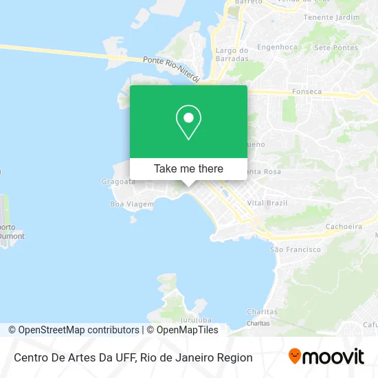
See Centro De Artes Da UFF, Niterói, on the map
Public Transit to Centro De Artes Da UFF in Niterói
Wondering how to get to Centro De Artes Da UFF in Niterói? Moovit helps you find the best way to get to Centro De Artes Da UFF with step-by-step directions from the nearest public transit station.
Moovit provides free maps and live directions to help you navigate through your city. View schedules, routes, timetables, and find out how long does it take to get to Centro De Artes Da UFF in real time.
Looking for the nearest stop or station to Centro De Artes Da UFF? Check out this list of stops closest to your destination: Praça Getúlio Vargas | Reitoria UFF; Rua Miguel De Frias 6-52; Praça Getúlio Vargas; Rua Álvares De Azevedo; Rua Gaviao Peixoto 50 Icaraí Niterói - Rio De Janeiro 24220 Brasil; Rua Gavião Peixoto 86 Icaraí Niterói; Praça Araribóia ⛴.
Bus: 1775D (EXECUTIVO), 2740D (EXECUTIVO), 2755D (EXECUTIVO), 755D, 775D, 43.2, 49.2, 47, 740D, 61, 2905D (EXECUTIVO), 53, 57, 570D, 49.1, 60, 03, 31.Ferry: PRAÇA ARARIBÓIA - PRAÇA XV.
Want to see if there’s another route that gets you there at an earlier time? Moovit helps you find alternative routes or times. Get directions from and directions to Centro De Artes Da UFF easily from the Moovit App or Website.
We make riding to Centro De Artes Da UFF easy, which is why over 1.5 million users, including users in Niterói, trust Moovit as the best app for public transit. You don’t need to download an individual bus app or train app, Moovit is your all-in-one transit app that helps you find the best bus time or train time available.
For information on prices of bus and ferry, costs and ride fares to Centro De Artes Da UFF, please check the Moovit app.
Use the app to navigate to popular places including to the airport, hospital, stadium, grocery store, mall, coffee shop, school, college, and university.
Centro De Artes Da UFF Address: Rua Miguel de Frias street in Niterói
- Uff (Reitoria Uff),
- Reitoria Da Universidade Federal Fluminense,
- Teatro da UFF,
- Centro de Artes UFF,
- UFF - Reitoria,
- Centro de Artes UFF (Cine Arte UFF),
- A-B,
- Praia João Caetano,
- Lanchonete Ponto Jovem,
- Avenida Jornalista Alberto Francisco Torres / Rua Praia Icarai,
- Rua Praia Icarai / Rua Miguel de Frias,
- Clínica Santa Beatriz Icaraí,
- Praia de Icarai 177,
- Árvore Da Patrícia,
- 704,
- Itaú Personnalité - Icaraí,
- Centro Clínico de Icaraí,
- Bisturi Material Hospitalar,
- Ponto de Ônibus,
- Praça Almirante Getúlio Vargas, Icaraí
Places Near Centro De Artes Da UFF (Niterói)
- Norte Shopping, Cachambi,
- Hospital Federal Do Andaraí, Andaraí,
- Feirão De Malhas, Duque De Caxias,
- Feira Livre da Gloria, Glória,
- Rio De Janeiro,
- Shopping Downtown, Barra Da Tijuca,
- Hospital Pedro Ernesto, Vila Isabel,
- Rodoviária Novo Rio (Rodoviária do Rio de Janeiro), Santo Cristo,
- Niterói, Niterói,
- Rua Ulysses Guimarães 16, Cidade Nova,
- Shopping Nova América, Del Castilho,
- Avenida Venezuela 134, Saúde,
- Hospital Municipal Ronaldo Gazolla, Acari,
- Shopping Rio Sul, Botafogo,
- Praia do Arpoador, Ipanema,
- Museu Do Amanhã, Centro,
- Hospital Federal Cardoso Fontes, Jacarepaguá,
- Rua Licínio Cardoso, São Francisco Xavier,
- Avenida Rio Branco, Centro,
- Shopping RioSul, Botafogo
How to get to popular places in Rio de Janeiro Region with public transit
Get around Niterói by public transit!
Traveling around Niterói has never been so easy. See step by step directions as you travel to any attraction, street or major public transit station. View bus and train schedules, arrival times, service alerts and detailed routes on a map, so you know exactly how to get to anywhere in Niterói.
When traveling to any destination around Niterói use Moovit's Live Directions with Get Off Notifications to know exactly where and how far to walk, how long to wait for your line, and how many stops are left. Moovit will alert you when it's time to get off — no need to constantly re-check whether yours is the next stop.
Wondering how to use public transit in Niterói or how to pay for public transit in Niterói? Moovit public transit app can help you navigate your way with public transit easily, and at minimum cost. It includes public transit fees, ticket prices, and costs. Looking for a map of Niterói public transit lines? Moovit public transit app shows all public transit maps in Niterói with all Bus, Train, Metro, Light Rail, Ferry, Cable Car, Gondola and Funicular routes and stops on an interactive map.
Rio de Janeiro Region has 8 transit type(s), including: Bus, Train, Metro, Light Rail, Ferry, Cable Car, Gondola and Funicular, operated by several transit agencies, including TrensRJ, Metrô Rio, VLT Carioca, Barcas Rio, BRT MOBI-Rio, Auto Viação Alpha, Auto Viação Tijuca, Gire Transportes, Transurb, Viação Nossa Senhora das Graças, Consórcio INTERSUL, Braso Lisboa (Municipal), Caprichosa Auto Ônibus, Auto Viação Três Amigos and Rodoviária Âncora Matias