See Century City, Century City, La, on the map
Directions to Century City (Century City, La) with public transportation
The following transit lines have routes that pass near Century City
 Bus:
Bus:
How to get to Century City by bus?
Click on the bus route to see step by step directions with maps, line arrival times and updated time schedules.
Bus stations near Century City in Century City, La
- Century Park East & Constellation Blvd (Northbound),4 min walk,
- Century Park East & Constallation,4 min walk,
- Century Prk East & Constellation Blvd,4 min walk,
- Century Park East/Olympic Blvd,5 min walk,
- Century Park East SB & Constellation Ns,5 min walk,
- Olympic / Century Park East,5 min walk,
Light Rail stations near Century City in Century City, La
- Expo / Sepulveda,30 min walk,
Bus lines to Century City in Century City, La
- CE534,Westbound,
- 786,Palmdale - Lanc,
- CE573,Southbound,
- 792,Century City,
- 797,Santa Clarita,
- CC 3,Crosstown/Mesmer-Centinela,
- 5,Palms Station,
- 28,Cesar Chavez - Vignes,
What are the closest stations to Century City?
The closest stations to Century City are:
- Century Park East & Constellation Blvd (Northbound) is 290 yards away, 4 min walk.
- Century Park East & Constallation is 308 yards away, 4 min walk.
- Century Prk East & Constellation Blvd is 309 yards away, 4 min walk.
- Century Park East/Olympic Blvd is 335 yards away, 5 min walk.
- Century Park East SB & Constellation Ns is 352 yards away, 5 min walk.
- Olympic / Century Park East is 398 yards away, 5 min walk.
- Expo / Sepulveda is 2516 yards away, 30 min walk.
Which bus lines stop near Century City?
These bus lines stop near Century City: 28, 4, 5, CC 3.
What’s the nearest light rail station to Century City in Century City, La?
The nearest light rail station to Century City in Century City, La is Expo / Sepulveda. It’s a 30 min walk away.
What’s the nearest bus stop to Century City in Century City, La?
The nearest bus stops to Century City in Century City, La are Century Park East & Constellation Blvd (Northbound), Century Park East & Constallation and Century Prk East & Constellation Blvd. The closest one is a 4 min walk away.
What time is the first light rail to Century City in Century City, La?
The E LINE is the first light rail that goes to Century City in Century City, La. It stops nearby at 3:46 AM.
What time is the last light rail to Century City in Century City, La?
The E LINE is the last light rail that goes to Century City in Century City, La. It stops nearby at 1:14 AM.
What time is the first bus to Century City in Century City, La?
The 28 is the first bus that goes to Century City in Century City, La. It stops nearby at 4:29 AM.
What time is the last bus to Century City in Century City, La?
The 28 is the last bus that goes to Century City in Century City, La. It stops nearby at 1:53 AM.
How much is the subway fare to Century City?
The subway fare to Century City costs about $1.75.
How much is the light rail fare to Century City?
The light rail fare to Century City costs about $1.75.
See Century City, Century City, La, on the map
Public Transit to Century City in Century City, La
Wondering how to get to Century City in Century City, La, United States? Moovit helps you find the best way to get to Century City with step-by-step directions from the nearest public transit station.
Moovit provides free maps and live directions to help you navigate through your city. View schedules, routes, timetables, and find out how long does it take to get to Century City in real time.
Looking for the nearest stop or station to Century City? Check out this list of stops closest to your destination: Century Park East & Constellation Blvd (Northbound); Century Park East & Constallation; Century Prk East & Constellation Blvd; Century Park East/Olympic Blvd; Century Park East SB & Constellation Ns; Olympic / Century Park East; Expo / Sepulveda.
Bus:
Want to see if there’s another route that gets you there at an earlier time? Moovit helps you find alternative routes or times. Get directions from and directions to Century City easily from the Moovit App or Website.
We make riding to Century City easy, which is why over 1.5 million users, including users in Century City, La, trust Moovit as the best app for public transit. You don’t need to download an individual bus app or train app, Moovit is your all-in-one transit app that helps you find the best bus time or train time available.
For information on prices of bus, subway and light rail, costs and ride fares to Century City, please check the Moovit app.
Get to Century City with public transit and pay for the ride in the Moovit app. In addition to all info you may need for your trip to Century City, including live directions, real-time arrivals and fare prices, you can also buy public transit passes for your rides. No need for cash or paper tickets to get to Century City - everything you need is accessible in the app with a click of the button.
Use the app to navigate to popular places including to the airport, hospital, stadium, grocery store, mall, coffee shop, school, college, and university.
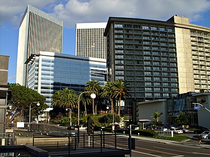
Location: Century City, La, Los Angeles
Attractions near Century City
EUE/Sokolow,2000 Avenue Of The Stars,Craft Los Angeles,Mckinsey & Company,Australian Consulate General,Creative Artists Agency (CAA),BTS Los Angeles,Ray Kurtzman Theater (CAA),Nascar,Hyatt Regency Century Plaza,2029 Century Park East,2040 Century Park East Public Parking,1999 Avenue of the Stars,Jackoway Tyerman Wertheimer Austen Mandelbaum Morris & Klein,Century Plaza Hotel,Fairmont Hotel,Ares Management,Century Plaza Tower I,Italian Consulate General in Los Angeles,Rogan Richard AHow to get to popular attractions in Century City, La with public transit
Hyatt Regency Century Plaza, Century City, La,City of West Hollywood, West Hollywood,Sawtelle / Little Japantown, Sawtelle, La,The Water Garden, Santa Monica,LA Fitness, Santa Clarita,World of Disney, Anaheim,Anaheim GardenWalk, Anaheim,Universal CityWalk Hollywood, Universal City, La,Disneyland, Anaheim,The Hollywood Bowl, Hollywood Hills, La,It's a Small World, Anaheim,Costco Wholesale, Tustin,AMC Promenade 16, Woodland Hills, La,SLS Hotel, a Luxury Collection Hotel, Beverly Hills, Beverly Grove, La,The Boiling Crab, Koreatown, La,Huntington Beach, CA, Huntington Beach,Pomona, CA, Pomona,East Shuttle Area, Anaheim,City of Simi Valley, Simi Valley,Ball Cast Member Parking Lot (BCML), AnaheimGet around Century City, La by public transit!
Traveling around Century City, La has never been so easy. See step by step directions as you travel to any attraction, street or major public transit station. View bus and train schedules, arrival times, service alerts and detailed routes on a map, so you know exactly how to get to anywhere in Century City, La.
When traveling to any destination around Century City, La use Moovit's Live Directions with Get Off Notifications to know exactly where and how far to walk, how long to wait for your line, and how many stops are left. Moovit will alert you when it's time to get off — no need to constantly re-check whether yours is the next stop.
Wondering how to use public transit in Century City, La or how to pay for public transit in Century City, La? Moovit public transit app can help you navigate your way with public transit easily, and at minimum cost. It includes public transit fees, ticket prices, and costs. Looking for a map of Century City, La public transit lines? Moovit public transit app shows all public transit maps in Century City, La with all bus, subway or light rail routes and stops on an interactive map.
Century City, La has 3 transit type(s), including: bus, subway or light rail, operated by several transit agencies, including Metro - Los Angeles, Metro - Los Angeles, Metrolink Trains, METRO, Long Beach Transit, LADOT, OCTA, Foothill Transit, Big Blue Bus, Riverside Transit Agency, LAX FlyAway, Airporter Shuttle, Playa Vista Shuttle, Amtrak and OMNITRANS