Directions to Ceopar (São Francisco) with public transportation
The following transit lines have routes that pass near Ceopar
How to get to Ceopar by bus?
Click on the bus route to see step by step directions with maps, line arrival times and updated time schedules.
From Rua Lodovico Kaminski, Augusta
77 minFrom Estação Tubo Detran, Capão Da Imbúia
33 minFrom Muffato Max Linha Verde, Pinheirinho
58 minFrom Cemitério Vertical, Tarumã
45 minFrom Decathlon, Jardim Botânico
47 minFrom Avenida Winston Churchill, Capão Raso
47 minFrom Terminal Pinhais, Pinhais
44 minFrom Hospital do Idoso Zilda Arns, Pinheirinho
50 minFrom quartel do boqueirao, Boqueirão
48 minFrom UPA 24h - Unidade de Pronto Atendimento Cajuru, Cajuru
50 min
Bus stops near Ceopar in São Francisco
- Av. Manoel Ribas, 66 - Palácio Das Telecomunicações, 1 min walk,VIEW
- R. Solimões, 270, 2 min walk,VIEW
- Av. Manoel Ribas, 200, 3 min walk,VIEW
- Praça da Bandeira, 6 min walk,VIEW
- R. Dom Alberto Gonçalves, 300, 6 min walk,VIEW
- R. Tapajós, 600, 6 min walk,VIEW
- Praça da Bandeira (R. Doutor Roberto Barroso, 1100), 7 min walk,VIEW
- R. Desembargador Benvindo Valente, 285, 9 min walk,VIEW
Bus lines to Ceopar in São Francisco
- 901 SANTA FELICIDADE, SANTA FELICIDADE,VIEW
- 965 SÃO BERNARDO, SÃO BERNARDO,VIEW
- 967 JÚLIO GRAF, JÚLIO GRAF,VIEW
- 972 JARDIM ITÁLIA, JARDIM ITÁLIA,VIEW
- 150 CANAL DA MÚSICA / VISTA ALEGRE, Vista Alegre → Teatro Guaíra,VIEW
- P69 MAD. CAMPO MAGRO / CURITIBA, Curitiba (Fernando Moreira) → Campo Magro,VIEW
- 160 JARDIM MERCÊS / GUANABARA, Guanabara → Jardim Mercês,VIEW
- 168 RAPOSO TAVARES, Raposo Tavares → Travessa Nestor de Castro,VIEW
- 989 MAD. SANTA FELICIDADE, Praça Rui Barbosa ↺ Santa Felicidade (Circular),VIEW
- 022 INTER 2 (HORÁRIO), Campina do Siqueira → Cabral,VIEW
- 011 INTERBAIRROS I (ANTI-HORÁRIO), Estação PUC (Linha Verde) → Prefeitura,VIEW
- 010 INTERBAIRROS I (HORÁRIO), Estação PUC (Linha Verde) → Prefeitura,VIEW
- 164 RAQUEL PRADO / CARLOS GOMES, Marechal Floriano → Raquel Prado,VIEW
- A77 TANGUÁ / GUADALUPE, TANGUÁ / GUADALUPE,VIEW
- A80 TANGUÁ (VILA MARTA) / GUADALUPE, TANGUÁ (VILA MARTA) / GUADALUPE,VIEW
- 166 VILA NORI, VILA NORI,VIEW
- 170 BRACATINGA, BRACATINGA,VIEW
- 171 PRIMAVERA, PRIMAVERA,VIEW
- 175 BOM RETIRO / PUC, BOM RETIRO / PUC,VIEW
- 207 CABRAL / OSÓRIO, CABRAL / OSÓRIO,VIEW
What are the closest stations to Ceopar?
The closest stations to Ceopar are:
- Av. Manoel Ribas, 66 - Palácio Das Telecomunicações is 55 meters away, 1 min walk.
- R. Solimões, 270 is 94 meters away, 2 min walk.
- Av. Manoel Ribas, 200 is 176 meters away, 3 min walk.
- Praça da Bandeira is 435 meters away, 6 min walk.
- R. Dom Alberto Gonçalves, 300 is 439 meters away, 6 min walk.
- R. Tapajós, 600 is 461 meters away, 6 min walk.
- Praça da Bandeira (R. Doutor Roberto Barroso, 1100) is 518 meters away, 7 min walk.
- R. Desembargador Benvindo Valente, 285 is 638 meters away, 9 min walk.
Which bus lines stop near Ceopar?
These bus lines stop near Ceopar: 010 INTERBAIRROS I (HORÁRIO), 150 CANAL DA MÚSICA / VISTA ALEGRE, 160 JARDIM MERCÊS / GUANABARA, 702 CAIUÁ / CACHOEIRA, A77 TANGUÁ / GUADALUPE.
What’s the nearest bus station to Ceopar in São Francisco?
The nearest bus station to Ceopar in São Francisco is Av. Manoel Ribas, 66 - Palácio Das Telecomunicações. It’s a 1 min walk away.
What time is the first bus to Ceopar in São Francisco?
The 989 MAD. SANTA FELICIDADE is the first bus that goes to Ceopar in São Francisco. It stops nearby at 3:31 AM.
What time is the last bus to Ceopar in São Francisco?
The 989 MAD. SANTA FELICIDADE is the last bus that goes to Ceopar in São Francisco. It stops nearby at 3:31 AM.
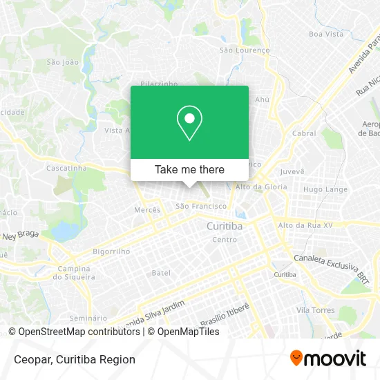
See Ceopar, São Francisco, on the map
Public Transit to Ceopar in São Francisco
Wondering how to get to Ceopar in São Francisco? Moovit helps you find the best way to get to Ceopar with step-by-step directions from the nearest public transit station.
Moovit provides free maps and live directions to help you navigate through your city. View schedules, routes, timetables, and find out how long does it take to get to Ceopar in real time.
Looking for the nearest stop or station to Ceopar? Check out this list of stops closest to your destination: Av. Manoel Ribas; R. Solimões; Av. Manoel Ribas; Praça da Bandeira; R. Dom Alberto Gonçalves; R. Tapajós; Praça da Bandeira (R. Doutor Roberto Barroso; R. Desembargador Benvindo Valente.
Bus: 010 INTERBAIRROS I (HORÁRIO), 150 CANAL DA MÚSICA / VISTA ALEGRE, 160 JARDIM MERCÊS / GUANABARA, 702 CAIUÁ / CACHOEIRA, A77 TANGUÁ / GUADALUPE, 901 SANTA FELICIDADE, 965 SÃO BERNARDO, 967 JÚLIO GRAF, 972 JARDIM ITÁLIA, P69 MAD. CAMPO MAGRO / CURITIBA, 168 RAPOSO TAVARES, 989 MAD. SANTA FELICIDADE, 022 INTER 2 (HORÁRIO), 011 INTERBAIRROS I (ANTI-HORÁRIO).
Want to see if there’s another route that gets you there at an earlier time? Moovit helps you find alternative routes or times. Get directions from and directions to Ceopar easily from the Moovit App or Website.
We make riding to Ceopar easy, which is why over 1.5 million users, including users in São Francisco, trust Moovit as the best app for public transit. You don’t need to download an individual bus app or train app, Moovit is your all-in-one transit app that helps you find the best bus time or train time available.
For information on prices of bus, costs and ride fares to Ceopar, please check the Moovit app.
Use the app to navigate to popular places including to the airport, hospital, stadium, grocery store, mall, coffee shop, school, college, and university.
Ceopar Address: Rua Emílio de Menezes, São Francisco Curitiba-PR 80510-320 street in São Francisco
- Escola Estadual Dona Carola,
- Condominio Conjunto Residencial Millarch,
- V.R Manutencao E Reparacao Automotivo,
- Rua Emílio de Menezes 450,
- Rua Celestino Júnior 522,
- Escola Dona Carola,
- Rua Solimões 290,
- Fernando Avelar,
- Clínica de Estética Huma Beleza e Bem-Estar Em São Francisco,
- Praça da Bandeira,
- Cecatu,
- Ocp Importacao e Exportacao de Manufaturados,
- Rua Tapajós - Mercês / São Francisco,
- Rua Solimões 160,
- SMOP - Secretaria Municipal de Obras Públicas,
- SEPLAD - Secretaria de Planejamento e Administração,
- Espaço De Dança Fernanda Becker,
- Rua Inácio Lustosa 1194,
- Rua Desembargador Vieira Cavalcanti 398,
- Cemitério Municipal de Curitiba - São Francisco de Paula
Places Near Ceopar (São Francisco)
- Campo Largo, Campo,
- Hospital Erasto Gaertner, Jardim Das Américas,
- Hospital do Rocio, Campo,
- Hhhhh, Fazendinha,
- Pontifícia Universidade Católica do Paraná (PUCPR), Prado Velho,
- Hospital de Clínicas (HC - UFPR), Centro,
- Park Shopping Barigüi, Mossunguê,
- Rua General Mário Tourinho, Campina Do Siqueira,
- Shopping Estação, Rebouças,
- Hospital Universitário Evangélico de Curitiba, Bigorrilho,
- Jockey Plaza Shopping Center, Tarumã,
- Parque Barigui, Mercês,
- Hospital Angelina Caron, Campina Grande Do Sul,
- Jardim Botânico de Curitiba PR, Centro,
- Hospital Da Cruz Vermelha, Batel,
- Rua Martim Afonso 558, Mercês,
- Hospital Madalena Sofia, Bairro Alto,
- Hospital Nossa Senhora Das Graças, Mercês,
- Arena Da Baixada - Curitiba,
- Shopping Palladium, Portão
How to get to popular places in Curitiba Region with public transit
Get around São Francisco by public transit!
Traveling around São Francisco has never been so easy. See step by step directions as you travel to any attraction, street or major public transit station. View bus and train schedules, arrival times, service alerts and detailed routes on a map, so you know exactly how to get to anywhere in São Francisco.
When traveling to any destination around São Francisco use Moovit's Live Directions with Get Off Notifications to know exactly where and how far to walk, how long to wait for your line, and how many stops are left. Moovit will alert you when it's time to get off — no need to constantly re-check whether yours is the next stop.
Wondering how to use public transit in São Francisco or how to pay for public transit in São Francisco? Moovit public transit app can help you navigate your way with public transit easily, and at minimum cost. It includes public transit fees, ticket prices, and costs. Looking for a map of São Francisco public transit lines? Moovit public transit app shows all public transit maps in São Francisco with all Bus and Cable Car routes and stops on an interactive map.
Curitiba Region has 2 transit type(s), including: Bus and Cable Car, operated by several transit agencies, including Sistema Integrado de Mobilidade (URBS), Sistema Integrado de Mobilidade (AMEP), URBS (Cartões bancários e Dinheiro), URBS (Cartões bancários / Cartão URBS), AMEP (Cartões bancários / Cartão MetroCard), AMEP (Cartões bancários / Cartão MetroCard / Dinheiro), Viação Colombo (Dinheiro), TRIAR (Cartão TRIAR / Dinheiro), Empresa Curitiba Cerro Azul (Dinheiro), Expresso Nossa Senhora da Penha (Dinheiro), Empresa Campo Alto Tijucas (Dinheiro), Auto Viação São José (Cartão VEM / Dinheiro), BRT S/A (Cartão VEM / Dinheiro), TransPiedade (Cartão Cidadão / Dinheiro) and Oceânica Sul (Cartão Transporte / Dinheiro)