Cermak-Mccormick Place station - Friday schedule
| Line | Direction | Time |
|---|---|---|
| UP-NW | Chicago OTC | 5:12 AM |
| UP-NW | Chicago OTC | 5:27 AM |
| UP-NW | Harvard/McHenry | 5:28 AM |
| UP-NW | Harvard/McHenry | 5:40 AM |
| UP-NW | Chicago OTC | 5:42 AM |
| UP-NW | Harvard/McHenry | 5:50 AM |
| UP-NW | Chicago OTC | 5:57 AM |
| UP-NW | Harvard/McHenry | 6:00 AM |
| UP-NW | Harvard/McHenry | 6:10 AM |
| UP-NW | Chicago OTC | 6:12 AM |
| UP-NW | Harvard/McHenry | 6:20 AM |
| UP-NW | Chicago OTC | 6:24 AM |
| UP-NW | Harvard/McHenry | 6:30 AM |
| UP-NW | Chicago OTC | 6:34 AM |
| UP-NW | Harvard/McHenry | 6:38 AM |
| UP-NW | Chicago OTC | 6:44 AM |
| UP-NW | Harvard/McHenry | 6:47 AM |
| UP-NW | Chicago OTC | 6:54 AM |
| UP-NW | Harvard/McHenry | 6:55 AM |
| UP-NW | Chicago OTC | 7:03 AM |
| UP-NW | Harvard/McHenry | 7:04 AM |
| UP-NW | Harvard/McHenry | 7:12 AM |
| UP-NW | Chicago OTC | 7:13 AM |
| UP-NW | Harvard/McHenry | 7:21 AM |
| UP-NW | Chicago OTC | 7:21 AM |
Directions to Cermak-Mccormick Place station (Chicago) with public transit
The following transit lines have routes that pass near Cermak-Mccormick Place
 Bus: 21, 29, 3, 4, X4.
- Train: BNSF, ME.
- Chicago 'L': GREEN LINE, RED LINE, ORANGE LINE.
How to get to Cermak-Mccormick Place station by bus?
Click on the bus route to see step by step directions with maps, line arrival times and updated time schedules.
How to get to Cermak-Mccormick Place station by train?
Click on the train route to see step by step directions with maps, line arrival times and updated time schedules.
How to get to Cermak-Mccormick Place station by Chicago 'L'?
Click on the Chicago 'L' route to see step by step directions with maps, line arrival times and updated time schedules.
Bus stops near Cermak-Mccormick Place stop in Chicago
- State & Cermak (North), 1 min walk,
- Cermak-Mccormick Place Green Line Station (West), 1 min walk,
- Michigan & Cermak (North), 3 min walk,
Chicago 'L' stations near Cermak-Mccormick Place station in Chicago
- Cermak-Chinatown, 13 min walk,
- Roosevelt, 33 min walk,
Train stations near Cermak-Mccormick Place station in Chicago
- 18th St., 18 min walk,
Bus lines to Cermak-Mccormick Place station in Chicago
- 29, Navy Pier Terminal (North),
- 21, 54th/Cermak Pink Line Station (West),
- 1, Desplaines & Harrison Terminal (South),
- 3, Fairbanks & Huron (South),
- 4, State & Washington (North),
- X4, State & 95th Street (North),
What are the closest stations to Cermak-Mccormick Place?
The closest stations to Cermak-Mccormick Place are:
- State & Cermak (North) stop is 40 yards away, 1 min walk.
- Cermak-Mccormick Place Green Line Station (West) is 56 yards away, 1 min walk.
- Michigan & Cermak (North) stop is 191 yards away, 3 min walk.
- Cermak-Chinatown station is 1048 yards away, 13 min walk.
- 18th St. station is 1550 yards away, 18 min walk.
- Roosevelt station is 2863 yards away, 33 min walk.
Which bus lines stop near Cermak-Mccormick Place?
These bus lines stop near Cermak-Mccormick Place: 21, 29, 3, 4, X4.
Which train lines stop near Cermak-Mccormick Place?
These train lines stop near Cermak-Mccormick Place: BNSF, ME.
Which Chicago 'L' lines stop near Cermak-Mccormick Place?
These Chicago 'L' lines stop near Cermak-Mccormick Place: GREEN LINE, RED LINE.
What’s the nearest Chicago 'L' station to Cermak-Mccormick Place in Chicago?
The nearest Chicago 'L' station to Cermak-Mccormick Place in Chicago is Cermak-Chinatown. It’s a 13 min walk away.
What’s the nearest train station to Cermak-Mccormick Place in Chicago?
The nearest train station to Cermak-Mccormick Place in Chicago is 18th St.. It’s a 18 min walk away.
What’s the nearest bus station to Cermak-Mccormick Place in Chicago?
The nearest bus stations to Cermak-Mccormick Place in Chicago are State & Cermak (North) and Cermak-Mccormick Place Green Line Station (West). The closest one is a 1 min walk away.
What time is the first Chicago 'L' to Cermak-Mccormick Place in Chicago?
The RED LINE is the first Chicago 'L' that goes to Cermak-Mccormick Place in Chicago. It stops nearby at 3:10 AM.
What time is the last Chicago 'L' to Cermak-Mccormick Place in Chicago?
The RED LINE is the last Chicago 'L' that goes to Cermak-Mccormick Place in Chicago. It stops nearby at 3:28 AM.
What time is the first train to Cermak-Mccormick Place in Chicago?
The ME is the first train that goes to Cermak-Mccormick Place in Chicago. It stops nearby at 4:56 AM.
What time is the last train to Cermak-Mccormick Place in Chicago?
The ME is the last train that goes to Cermak-Mccormick Place in Chicago. It stops nearby at 12:59 AM.
What time is the first bus to Cermak-Mccormick Place in Chicago?
The 4 is the first bus that goes to Cermak-Mccormick Place in Chicago. It stops nearby at 3:15 AM.
What time is the last bus to Cermak-Mccormick Place in Chicago?
The 4 is the last bus that goes to Cermak-Mccormick Place in Chicago. It stops nearby at 3:16 AM.
Cermak-Mccormick Place station
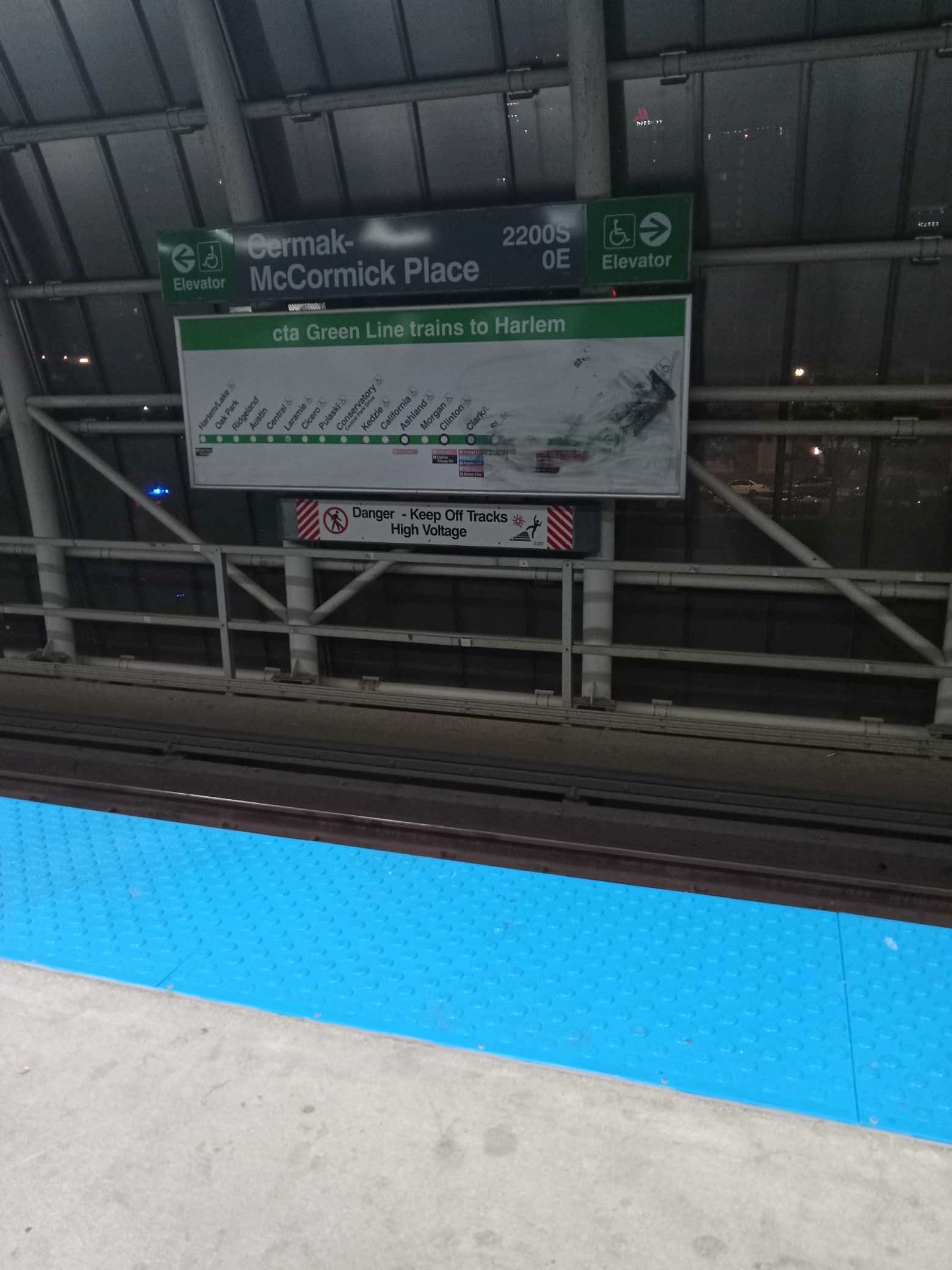 Taken by Yolanda B.
See Cermak-Mccormick Place station, Chicago, on the map
Public transit to Cermak-Mccormick Place station in Chicago
Looking for directions to Cermak-Mccormick Place in Chicago, United States?
Download the Moovit App to find the current schedule and step-by-step directions for Chicago 'L', Bus or Train routes that pass through Cermak-Mccormick Place.
Looking for the nearest stops closest to Cermak-Mccormick Place ? Check out this list of closest stops to your destination: State & Cermak (North); Cermak-Mccormick Place Green Line Station (West); Michigan & Cermak (North); Cermak-Chinatown; 18th St.; Roosevelt.
Bus: 21, 29, 3, 4, X4, 1.Train: BNSF, ME.Chicago 'L': GREEN LINE, RED LINE, ORANGE LINE.
We make riding on public transit to Cermak-Mccormick Place easy, which is why over 1.7 billion users, including users in Chicago trust Moovit as the best app for public transit.
Use the app to navigate to popular places including to the airport, hospital, stadium, grocery store, mall, coffee shop, school, college, and university.
The station has the following entrances: E Cermak Rd, S Wabash Ave and South Wabash Avenue 2248
The first line to this station is UP-NW, at 5:12 AM, and the last line is UP-NW at 1:40 AM.
This station serves Metra’s lines
Popular routes from Cermak-Mccormick Place station, Chicago
- State & Cermak (North),
- Cermak-Mccormick Place Green Line Station (West),
- Michigan & Cermak (North)
Bus stops near Cermak-Mccormick Place stop
- Cermak-Chinatown,
- Roosevelt
Chicago 'L' stations near Cermak-Mccormick Place station
- 18th St.
Train station near Cermak-Mccormick Place station
- 111th St & Central Ave,
- 3000 S River Rd,
- Harlem / Devon,
- Ashland & Lake (Green Line) (North),
- Madison & Damen (East),
- 71st Street & Cottage Grove/S. Chicago (East),
- Irving Park & Oak Park (West),
- Oak Park Ave & South Blvd / Cta Green Line,
- 35th Street & Michigan (West),
- Ridgeland,
- Grand/Cicero,
- Pulaski & Cermak (North),
- Harlem & Diversey (North),
- Oakton St & Wolf Rd,
- Western & Roosevelt (South),
- Solidarity Drive & Aquarium (West),
- 915 E. 60th Street (East),
- Rte 53 & Remington Blvd,
- 106th Street & Ewing (West),
- 47th Street & Lake Park (East)
Popular public transit stations in Chicago
Get around Chicago by public transit!
Traveling around Chicago has never been so easy. See step by step directions as you travel to any attraction, street or major public transit station. View bus and train schedules, arrival times, service alerts and detailed routes on a map, so you know exactly how to get to anywhere in Chicago.
When traveling to any destination around Chicago use Moovit's Live Directions with Get Off Notifications to know exactly where and how far to walk, how long to wait for your line, and how many stops are left. Moovit will alert you when it's time to get off — no need to constantly re-check whether yours is the next stop.
Wondering how to use public transit in Chicago or how to pay for public transit in Chicago? Moovit public transit app can help you navigate your way with public transit easily, and at minimum cost. It includes public transit fees, ticket prices, and costs. Looking for a map of Chicago public transit lines? Moovit public transit app shows all public transit maps in Chicago with all Bus, Train and Chicago 'L' routes and stops on an interactive map.
Chicago has 3 transit type(s), including: Bus, Train and Chicago 'L', operated by several transit agencies, including CTA 'L', Metra, Northern Indiana Commuter Transportation District, CTA, PACE, O'Hare International Airport Shuttle Bus, Gary Public Transit, Amtrak, River Valley Metro, Valpo Transit, DeKalb Public Transit, FlixBus-us, Greyhound-us, Van Galder (Coach USA) and Wisconsin Coach Lines