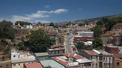
See Cerro Panteón, Provincia De Valparaíso, on the map
Directions to Cerro Panteón (Provincia De Valparaíso) with public transportation
The following transit lines have routes that pass near Cerro Panteón
 Bus:
Bus: - Metro:
- Funicular:
How to get to Cerro Panteón by bus?
Click on the bus route to see step by step directions with maps, line arrival times and updated time schedules.
How to get to Cerro Panteón by metro?
Click on the metro route to see step by step directions with maps, line arrival times and updated time schedules.
Bus stations near Cerro Panteón in Provincia De Valparaíso
- Cumming, 603,3 min walk,
- Ex - Carcel - Parque Cultural Valparaiso,3 min walk,
- Liceo Pedro Montt / Sur,7 min walk,
- San Luis,8 min walk,
- Avenida Alemania, 4546,11 min walk,
Funicular stations near Cerro Panteón in Provincia De Valparaíso
- Prat / Ascensor Concepción,4 min walk,
- Avenida Elias, 102,6 min walk,
- Aldunate, 372,9 min walk,
Bus lines to Cerro Panteón in Provincia De Valparaíso
- 607,Los Almendros - Playa Ancha,
- 515,Nudo Barón,
- 519,Ecuador - Cerro Yungay - Miguel Angel,
- 514,Caleta Portales - La Cantera,
- 516,Plazuela Ecuador,
- 612,Limonares,
What are the closest stations to Cerro Panteón?
The closest stations to Cerro Panteón are:
- Cumming, 603 is 188 meters away, 3 min walk.
- Ex - Carcel - Parque Cultural Valparaiso is 207 meters away, 3 min walk.
- Prat / Ascensor Concepción is 299 meters away, 4 min walk.
- Avenida Elias, 102 is 373 meters away, 6 min walk.
- Liceo Pedro Montt / Sur is 481 meters away, 7 min walk.
- San Luis is 616 meters away, 8 min walk.
- Aldunate, 372 is 657 meters away, 9 min walk.
- Avenida Alemania, 4546 is 785 meters away, 11 min walk.
Which bus lines stop near Cerro Panteón?
These bus lines stop near Cerro Panteón: 515, 607.
Which metro line stops near Cerro Panteón?
L1
What’s the nearest bus stop to Cerro Panteón in Provincia De Valparaíso?
The nearest bus stops to Cerro Panteón in Provincia De Valparaíso are Cumming, 603 and Ex - Carcel - Parque Cultural Valparaiso. The closest one is a 3 min walk away.
What’s the nearest funicular station to Cerro Panteón in Provincia De Valparaíso?
The nearest funicular station to Cerro Panteón in Provincia De Valparaíso is Prat / Ascensor Concepción. It’s a 4 min walk away.
See Cerro Panteón, Provincia De Valparaíso, on the map
Public Transit to Cerro Panteón in Provincia De Valparaíso
Wondering how to get to Cerro Panteón in Provincia De Valparaíso, Chile? Moovit helps you find the best way to get to Cerro Panteón with step-by-step directions from the nearest public transit station.
Moovit provides free maps and live directions to help you navigate through your city. View schedules, routes, timetables, and find out how long does it take to get to Cerro Panteón in real time.
Looking for the nearest stop or station to Cerro Panteón? Check out this list of stops closest to your destination: Cumming; Ex - Carcel - Parque Cultural Valparaiso; Prat / Ascensor Concepción; Avenida Elias; Liceo Pedro Montt / Sur; San Luis; Aldunate; Avenida Alemania.
Bus:Metro:Funicular:
Want to see if there’s another route that gets you there at an earlier time? Moovit helps you find alternative routes or times. Get directions from and directions to Cerro Panteón easily from the Moovit App or Website.
We make riding to Cerro Panteón easy, which is why over 1.5 million users, including users in Provincia De Valparaíso, trust Moovit as the best app for public transit. You don’t need to download an individual bus app or train app, Moovit is your all-in-one transit app that helps you find the best bus time or train time available.
For information on prices of bus and metro, costs and ride fares to Cerro Panteón, please check the Moovit app.
Use the app to navigate to popular places including to the airport, hospital, stadium, grocery store, mall, coffee shop, school, college, and university.
Location: Provincia De Valparaíso, Valparaiso y Vina del Mar
Attractions near Cerro Panteón
Loma,Loma - Café & Restaurante,El Carrito del Buen Gusto y La Buena Masa,Pasiones del Puerto Centro Cultural de Danza y Artes Asociadas,Parque Cultural De Valparaíso,Parque Cultural Ex Cárcel Valparaíso,Cerro Cárcel,Sangucheria Reu,Casona Miraflores,Monumento a Lord Cochrane,Cárcel 620,Atahualpa,Go Penguins,Casa Hostel El Túnel,Ingeniero-Alejandro Javier Becerra,Las Ruinas,Constructoras-Maestro Carlos Guzman,Jardín Infantil Ave Fénix,Cementerio Nº 2,Valpo InkHow to get to popular attractions in Provincia De Valparaíso with public transit
Empanadas Los Roldán, Provincia De Valparaíso,Población Monterrey, Provincia De Valparaíso,Casino de Oficiales de la Armada, Provincia De Valparaíso,Puerto, Provincia De Valparaíso,Reñaca, Provincia De Valparaíso,Quinta Vergara, Provincia De Valparaíso,Cerro Barón, Provincia De Valparaíso,Serviu Región de Valparaíso, Provincia De Valparaíso,Plaza Aníbal Pinto, Provincia De Valparaíso,Pobl. Roque esteban scarpa, Provincia De Marga Marga,Facultad de Farmacia UV, Provincia De Valparaíso,Edificio Aulario Campus Curauma PUCV, Provincia De Valparaíso,Intendencia de Valparaiso, Provincia De Valparaíso,Panaderia Carmencita Reñaca, Provincia De Valparaíso,Edificio Rapa Nui, Provincia De Valparaíso,Plaza José Francisco Vergara, Provincia De Valparaíso,Gobierno Regional de Valparaiso. Division de Planificacion y Desarrollo, Provincia De Valparaíso,Restaurant Don Vittorio, Provincia De Valparaíso,Plaza Sotomayor, Provincia De Valparaíso,Valparaíso Sporting Club, Provincia De ValparaísoGet around Provincia De Valparaíso by public transit!
Traveling around Provincia De Valparaíso has never been so easy. See step by step directions as you travel to any attraction, street or major public transit station. View bus and train schedules, arrival times, service alerts and detailed routes on a map, so you know exactly how to get to anywhere in Provincia De Valparaíso.
When traveling to any destination around Provincia De Valparaíso use Moovit's Live Directions with Get Off Notifications to know exactly where and how far to walk, how long to wait for your line, and how many stops are left. Moovit will alert you when it's time to get off — no need to constantly re-check whether yours is the next stop.
Wondering how to use public transit in Provincia De Valparaíso or how to pay for public transit in Provincia De Valparaíso? Moovit public transit app can help you navigate your way with public transit easily, and at minimum cost. It includes public transit fees, ticket prices, and costs. Looking for a map of Provincia De Valparaíso public transit lines? Moovit public transit app shows all public transit maps in Provincia De Valparaíso with all bus or metro routes and stops on an interactive map.
Provincia De Valparaíso has 2 transit type(s), including: bus or metro, operated by several transit agencies, including EFE Valparaíso, Fenur S.A., Vina Bus S.A., Agdabus, Sol y Mar S.A., Ferrobus, TRANS RURAL VALPARAISO S.A, Buses Del Gran Valparaiso S.A., Top Tur S.A., Trolebuses de Chile S.A. and Ascensores de Valparaiso