See Cesar E Chavez National Monument, Keene, on the map
Directions to Cesar E Chavez National Monument (Keene) with public transportation
The following transit lines have routes that pass near Cesar E Chavez National Monument
 Bus:
Bus:
How to get to Cesar E Chavez National Monument by bus?
Click on the bus route to see step by step directions with maps, line arrival times and updated time schedules.
Bus stations near Cesar E Chavez National Monument in Keene
- Keene,19 min walk,
Bus lines to Cesar E Chavez National Monument in Keene
- 100,Senior Center/Jackman St. (771438),
What are the closest stations to Cesar E Chavez National Monument?
The closest stations to Cesar E Chavez National Monument are:
- Keene is 1604 yards away, 19 min walk.
Which bus line stops near Cesar E Chavez National Monument?
100
What time is the first bus to Cesar E Chavez National Monument in Keene?
The 100 is the first bus that goes to Cesar E Chavez National Monument in Keene. It stops nearby at 4:01 AM.
What time is the last bus to Cesar E Chavez National Monument in Keene?
The 100 is the last bus that goes to Cesar E Chavez National Monument in Keene. It stops nearby at 10:25 PM.
How much is the bus fare to Cesar E Chavez National Monument?
The bus fare to Cesar E Chavez National Monument costs about $2.00 - $3.00.
See Cesar E Chavez National Monument, Keene, on the map
Public Transit to Cesar E Chavez National Monument in Keene
Wondering how to get to Cesar E Chavez National Monument in Keene, United States? Moovit helps you find the best way to get to Cesar E Chavez National Monument with step-by-step directions from the nearest public transit station.
Moovit provides free maps and live directions to help you navigate through your city. View schedules, routes, timetables, and find out how long does it take to get to Cesar E Chavez National Monument in real time.
Looking for the nearest stop or station to Cesar E Chavez National Monument? Check out this list of stops closest to your destination: Keene.
Bus:
Want to see if there’s another route that gets you there at an earlier time? Moovit helps you find alternative routes or times. Get directions from and directions to Cesar E Chavez National Monument easily from the Moovit App or Website.
We make riding to Cesar E Chavez National Monument easy, which is why over 1.5 million users, including users in Keene, trust Moovit as the best app for public transit. You don’t need to download an individual bus app or train app, Moovit is your all-in-one transit app that helps you find the best bus time or train time available.
For information on prices of bus, costs and ride fares to Cesar E Chavez National Monument, please check the Moovit app.
Get to Cesar E Chavez National Monument with public transit and pay for the ride in the Moovit app. In addition to all info you may need for your trip to Cesar E Chavez National Monument, including live directions, real-time arrivals and fare prices, you can also buy public transit passes for your rides. No need for cash or paper tickets to get to Cesar E Chavez National Monument - everything you need is accessible in the app with a click of the button.
Use the app to navigate to popular places including to the airport, hospital, stadium, grocery store, mall, coffee shop, school, college, and university.
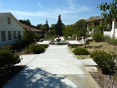
Cesar E Chavez National Monument Address: Keene, CA 93531 street in Keene
Attractions near Cesar E Chavez National Monument
Administration Building,Visitor Center,Villa La Paz Conference & Education Center,Cesar Chavez Foundation,Robert F Kennedy Farmworkers,Halewood St,Avenue E,620x City Dump Rd,Access Real Estate (Terri Ables Real Estate Agent),Capitol Hills Way,Rancho Raviri Almonds & Gifts,This & That Home Decor,Mountain Dog Millworks,Route 58 Auto Worx,Have A Heart Humane Society,All American Tire & Service (All Amer Automotive Service Ctr),New 2 You,Columbia,Tractor Supply Company,Home Depot TehachapiHow to get to popular attractions in Keene with public transit
Tesoro, Ridgecrest,BMO Harris Bank,Fastrip Food Store, Delano,Trust Services of Kern,Maggi Rojas, CMT, Ridgecrest,United States Postal Service-USPS,Quick Fuel,PAL Physicians Automated Lab,Foundation Properties,Vigil Designs,Sno- Fun and Gray's Chili Dogs, Delano,Calypso Barbershop,Mischievouspets, Delano,Credit Union 1,Carol A Helm #,Rick's Home Repairs and Installs, Taft,Magnolia Payday Loans - Bakersfield,Built Right Home Inspection,Easthills Speec H/Language,The North FaceGet around Keene by public transit!
Traveling around Keene has never been so easy. See step by step directions as you travel to any attraction, street or major public transit station. View bus and train schedules, arrival times, service alerts and detailed routes on a map, so you know exactly how to get to anywhere in Keene.
When traveling to any destination around Keene use Moovit's Live Directions with Get Off Notifications to know exactly where and how far to walk, how long to wait for your line, and how many stops are left. Moovit will alert you when it's time to get off — no need to constantly re-check whether yours is the next stop.
Wondering how to use public transit in Keene or how to pay for public transit in Keene? Moovit public transit app can help you navigate your way with public transit easily, and at minimum cost. It includes public transit fees, ticket prices, and costs. Looking for a map of Keene public transit lines? Moovit public transit app shows all public transit maps in Keene with all bus routes and stops on an interactive map.
Keene has 1 transit type(s), including: bus, operated by several transit agencies, including Golden Empire Transit District, Kern Transit, Delano Area Rapid Transit, Arvin Transit, Ridgerunner, Taft - Maricopa Area Transit, Amtrak, Greyhound-us, FlixBus-us and Megabus