How to get to Chandra Chhaya C-17 by bus?
Click on the bus route to see step by step directions with maps, line arrival times and updated time schedules.
From orlem church road, Charkop
44 minFrom Thakur Institute of Management Studies & Research-Entrance 5, Borivali East
42 minFrom Pragati school, gorai, Borivali West
60 minFrom Jimis burger, Malad West
64 minFrom Manori Beach, Borivali West
34 minFrom Aspee House, Malad West
58 minFrom Sky City by Oberoi Realty, Borivali East
36 minFrom Evershine Nagar, Malad West
64 minFrom Nataraj Market, Malad West
44 minFrom Nirmala College, Kandivali East
40 min
How to get to Chandra Chhaya C-17 by train?
Click on the train route to see step by step directions with maps, line arrival times and updated time schedules.
How to get to Chandra Chhaya C-17 by metro?
Click on the metro route to see step by step directions with maps, line arrival times and updated time schedules.
From orlem church road, Charkop
71 minFrom Thakur Institute of Management Studies & Research-Entrance 5, Borivali East
70 minFrom Jimis burger, Malad West
77 minFrom Manori Beach, Borivali West
65 minFrom Aspee House, Malad West
80 minFrom Sky City by Oberoi Realty, Borivali East
59 minFrom Evershine Nagar, Malad West
77 minFrom Nataraj Market, Malad West
79 minFrom Nirmala College, Kandivali East
74 min
Bus stops near Chandra Chhaya C-17 in Mira Bhayandar
Train station near Chandra Chhaya C-17 in Mira Bhayandar
- Mira Road, 7 min walk,VIEW
Metro stations near Chandra Chhaya C-17 in Mira Bhayandar
Bus lines to Chandra Chhaya C-17 in Mira Bhayandar
- 22, Mira Road Station (E),VIEW
- 25, Aaradhya High Park (M.I.C.L),VIEW
- A-703, Samata Nagar Bus Station (Kandivali),VIEW
- 15, Mira Road Station (E) - Rashmi Complex,VIEW
- 16, Mira Road Station (E) - Tiwari College,VIEW
- 17, Mira Road Station (E) - Vinay Nagar,VIEW
- 19, JP North City (Adani Power House) - Mira Road Station (E),VIEW
- 21, Mira Road Station (E) - KD Empire,VIEW
- 24, Mira Road Station (E) - Western Park (Kashi Village),VIEW
- 27, Mira Road Station (E) - M.I.T School,VIEW
- 29, Mira Road Station (E) - Thane Station (E),VIEW
- 29AC, Mira Road Station (E) - Thane Station (E),VIEW
- 29S, Ghodbunder Depot - Mira Road Station (E),VIEW
- 30, Mira Road Station (E) - Unique Garden,VIEW
- 57AC, Thane Station (E) - Mira Road Station (E),VIEW
- 58AC, Thane Station (W) - Mira Road Station (E),VIEW
- 75, Bharat Gears (Mumbra) - Mira Road Station (E),VIEW
- 75AC, Bharat Gears (Mumbra) - Mira Road Station (E),VIEW
- A-701, Mira Road Station (E),VIEW
What are the closest stations to Chandra Chhaya C-17?
The closest stations to Chandra Chhaya C-17 are:
- Ankur Estate Agency is 313 meters away, 5 min walk.
- Shanti Nagar (Sector No.4) is 430 meters away, 6 min walk.
- Adarsh Balwadi is 496 meters away, 7 min walk.
- Mira Road is 539 meters away, 7 min walk.
- Pandurangwadi is 2832 meters away, 36 min walk.
- Anand Nagar is 3808 meters away, 49 min walk.
Which bus lines stop near Chandra Chhaya C-17?
These bus lines stop near Chandra Chhaya C-17: A-701, A-703.
Which train line stops near Chandra Chhaya C-17?
WR (Vasai Road (S))
Which metro line stops near Chandra Chhaya C-17?
LINE 9 (Kashigaon)
What’s the nearest train station to Chandra Chhaya C-17 in Mira Bhayandar?
The nearest train station to Chandra Chhaya C-17 in Mira Bhayandar is Mira Road. It’s a 7 min walk away.
What’s the nearest bus station to Chandra Chhaya C-17 in Mira Bhayandar?
The nearest bus station to Chandra Chhaya C-17 in Mira Bhayandar is Ankur Estate Agency. It’s a 5 min walk away.
What time is the first metro to Chandra Chhaya C-17 in Mira Bhayandar?
The LINE 9 is the first metro that goes to Chandra Chhaya C-17 in Mira Bhayandar. It stops nearby at 5:50 AM.
What time is the last metro to Chandra Chhaya C-17 in Mira Bhayandar?
The LINE 9 is the last metro that goes to Chandra Chhaya C-17 in Mira Bhayandar. It stops nearby at 11:42 PM.
What time is the first train to Chandra Chhaya C-17 in Mira Bhayandar?
The WR is the first train that goes to Chandra Chhaya C-17 in Mira Bhayandar. It stops nearby at 3:54 AM.
What time is the last train to Chandra Chhaya C-17 in Mira Bhayandar?
The WR is the last train that goes to Chandra Chhaya C-17 in Mira Bhayandar. It stops nearby at 2:05 AM.
What time is the first bus to Chandra Chhaya C-17 in Mira Bhayandar?
The 15 is the first bus that goes to Chandra Chhaya C-17 in Mira Bhayandar. It stops nearby at 4:59 AM.
What time is the last bus to Chandra Chhaya C-17 in Mira Bhayandar?
The 15 is the last bus that goes to Chandra Chhaya C-17 in Mira Bhayandar. It stops nearby at 1:36 AM.
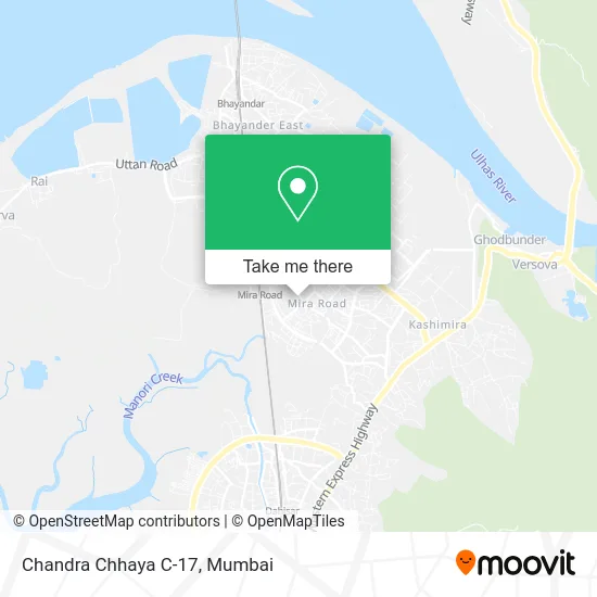
See Chandra Chhaya C-17, Mira Bhayandar, on the map
Public Transit to Chandra Chhaya C-17 in Mira Bhayandar
Wondering how to get to Chandra Chhaya C-17 in Mira Bhayandar? Moovit helps you find the best way to get to Chandra Chhaya C-17 with step-by-step directions from the nearest public transit station.
Moovit provides free maps and live directions to help you navigate through your city. View schedules, routes, timetables, and find out how long does it take to get to Chandra Chhaya C-17 in real time.
Looking for the nearest stop or station to Chandra Chhaya C-17? Check out this list of stops closest to your destination: Ankur Estate Agency; Shanti Nagar (Sector No.4); Adarsh Balwadi; Mira Road; Pandurangwadi; Anand Nagar.
Bus: A-701, A-703, 22, 25, 15, 16, 17, 19, 21.Train: WR, WR-AC, WR-AC, WR-AC, WR-AC.Metro: LINE 9, LINE 2A.
Want to see if there’s another route that gets you there at an earlier time? Moovit helps you find alternative routes or times. Get directions from and directions to Chandra Chhaya C-17 easily from the Moovit App or Website.
We make riding to Chandra Chhaya C-17 easy, which is why over 1.5 million users, including users in Mira Bhayandar, trust Moovit as the best app for public transit. You don’t need to download an individual bus app or train app, Moovit is your all-in-one transit app that helps you find the best bus time or train time available.
For information on prices of bus, train and metro, costs and ride fares to Chandra Chhaya C-17, please check the Moovit app.
Use the app to navigate to popular places including to the airport, hospital, stadium, grocery store, mall, coffee shop, school, college, and university.
Chandra Chhaya C-17 Address: Shrimad Buddhi Sagar Surishwar Marg street in Mira Bhayandar
- RSS Swami Vivekanand Prabhat Shakha,
- Shikhar International High School in Mira Road,
- Mahavir Electric & Hardware Stores in Shanti Nagar-Mira Road,
- Basu Surgical in Mira Road,
- Milan Electric And Light House,
- Riddhi,
- Shanti Nagar B-50,
- Soham Activity Classes in Mira Road,
- Sanjeevani Hospital in Shanti Nagar-Mira Road,
- Baps Swaminarayan Temple in Mira Road,
- Paras Estate in Mira Road,
- Shanti Park,
- Mansarovar C-12,
- Poonam Nagar,
- Pallavi Music Academy (Music Classes),
- Jain Dugdhalaya in Mira Road,
- Mini Party Hall in Mira Road,
- Saraswati Vidya Mandir,
- Badri Vishal Polyclinic,
- Shree Swaminarayan Mandir Mira Road
Places Near Chandra Chhaya C-17 (Mira Bhayandar)
- NESCO, Goregaon,
- Juhu Beach,
- Govardhan Ecovillage, Palghar (St),
- Inorbit Mall, Malad West,
- Mumbai University, Kalina,
- Oberoi Mall, Dindoshi,
- Bombay Exhibition Center, Goregaon,
- Ikea, Worli,
- Worli Sea Face,
- Oberoi Sky City, Borivali East,
- TCS Olympus, Thane,
- Hinduja Hospital, Mahim,
- Dome @ Nsci - Svp Stadium Mumbai, Worli,
- INFINITI Mall (Infinity Mall, andheri), Versova,
- Bhaucha Dhakka,
- Gateway Of India,
- Rani Baug, Byculla,
- R CITY MALL, Ghatkopar East,
- Malabar Hill, Malabar Hill,
- J. J. Hospital, Byculla
How to get to popular places in Mumbai with public transit
Get around Mira Bhayandar by public transit!
Traveling around Mira Bhayandar has never been so easy. See step by step directions as you travel to any attraction, street or major public transit station. View bus and train schedules, arrival times, service alerts and detailed routes on a map, so you know exactly how to get to anywhere in Mira Bhayandar.
When traveling to any destination around Mira Bhayandar use Moovit's Live Directions with Get Off Notifications to know exactly where and how far to walk, how long to wait for your line, and how many stops are left. Moovit will alert you when it's time to get off — no need to constantly re-check whether yours is the next stop.
Wondering how to use public transit in Mira Bhayandar or how to pay for public transit in Mira Bhayandar? Moovit public transit app can help you navigate your way with public transit easily, and at minimum cost. It includes public transit fees, ticket prices, and costs. Looking for a map of Mira Bhayandar public transit lines? Moovit public transit app shows all public transit maps in Mira Bhayandar with all Bus, Train, Metro and Ferry routes and stops on an interactive map.
Mumbai has 4 transit type(s), including: Bus, Train, Metro and Ferry, operated by several transit agencies, including MMMOCL (Maha Mumbai Metro Operation Corporation Ltd.), NMM CIDCO (Navi Mumbai Metro Maha Metro), Reliance Mumbai Metro, MMRCL (Mumbai Metro Rail Corporation Ltd), BEST (Brihanmumbai Electricity Supply & Transport), BEST AC Services, A.C.Trains (Air-Conditioning Trains), W.R. (Western Railways), C.R. (Central Railways), C.R.MEMU (Central Railways Shuttle MEMU Trains), H.R. (Harbour Railways), T.R.(Trans Harbour Railways), U.R.(Uran-Ulwe Railways), I.R.(Indian Railways) and TMT (Thane Municipal Transport)