How to get to Chapelle Cdrs by bus?
Click on the bus route to see step by step directions with maps, line arrival times and updated time schedules.
From Beyer Pierre, Wihr-Au-Val
56 minFrom Gîte de France Réf 68g4904, Sainte-Croix-En-Plaine
39 minFrom Dieudonné Albert, Sundhoffen
52 minFrom Horn Ettwiller Marie Jeanne, Sainte-Croix-En-Plaine
39 minFrom Ds Stars, Wickerschwihr
62 minFrom Gîte de Jeanne, Sundhoffen
54 minFrom Goerg Constant, Horbourg-Wihr
48 min
Bus stops near Chapelle Cdrs in Colmar
What are the closest stations to Chapelle Cdrs?
The closest stations to Chapelle Cdrs are:
- Clos St-Jacques is 6 meters away, 1 min walk.
- Oberharth is 432 meters away, 6 min walk.
- Brant is 584 meters away, 8 min walk.
Which bus line stops near Chapelle Cdrs?
C (Logelbach Ctre Cial)
What’s the nearest bus station to Chapelle Cdrs in Colmar?
The nearest bus station to Chapelle Cdrs in Colmar is Clos St-Jacques. It’s a 1 min walk away.
What time is the first bus to Chapelle Cdrs in Colmar?
The C is the first bus that goes to Chapelle Cdrs in Colmar. It stops nearby at 5:23 AM.
What time is the last bus to Chapelle Cdrs in Colmar?
The F is the last bus that goes to Chapelle Cdrs in Colmar. It stops nearby at 8:56 PM.
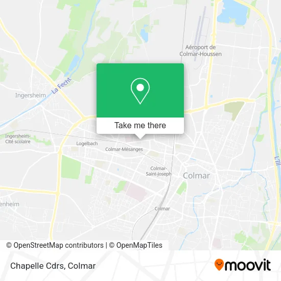
See Chapelle Cdrs, Colmar, on the map
Public Transit to Chapelle Cdrs in Colmar
Wondering how to get to Chapelle Cdrs in Colmar? Moovit helps you find the best way to get to Chapelle Cdrs with step-by-step directions from the nearest public transit station.
Moovit provides free maps and live directions to help you navigate through your city. View schedules, routes, timetables, and find out how long does it take to get to Chapelle Cdrs in real time.
Looking for the nearest stop or station to Chapelle Cdrs? Check out this list of stops closest to your destination: Clos St-Jacques; Oberharth; Brant.
Bus: C, F, E.
Want to see if there’s another route that gets you there at an earlier time? Moovit helps you find alternative routes or times. Get directions from and directions to Chapelle Cdrs easily from the Moovit App or Website.
We make riding to Chapelle Cdrs easy, which is why over 1.5 million users, including users in Colmar, trust Moovit as the best app for public transit. You don’t need to download an individual bus app or train app, Moovit is your all-in-one transit app that helps you find the best bus time or train time available.
For information on prices of bus, costs and ride fares to Chapelle Cdrs, please check the Moovit app.
Use the app to navigate to popular places including to the airport, hospital, stadium, grocery store, mall, coffee shop, school, college, and university.
Chapelle Cdrs Address: Rue du Stauffen street in Colmar
- 40 Rue du Stauffen,
- Aydin Zohra,
- Église Évangélique Le Semeur,
- Dr. Huberschwiller Jean-Louis,
- 1, Rue des Mésanges,
- Hopital Le Parc,
- Cimetière Cdrs,
- La Fournée de Laurent Richon,
- Gare SNCF de Colmar-Mésanges,
- Parking Lycée Blaise Pascal,
- Lycée Blaise Pascal,
- Retro Club de Colmar,
- Auberges De Jeunesse "Mittelharth",
- Olry Caroline,
- Wingert Benjamin,
- Tuna Market,
- Lycée Polyvalent Blaise Pascal,
- Eni,
- Rue de Riquewihr,
- Bel Air Florimont
Places Near Chapelle Cdrs (Colmar)
- Camping de l'Ill - Colmar, Horbourg-Wihr,
- Hôpital Albert Schweitzer, Colmar,
- E. Leclerc, Wintzenheim,
- IUT de Colmar / Campus du Grillenbreit, Colmar,
- Marché de Noël de Colmar, Colmar,
- Decathlon Colmar, Colmar,
- Nauroto, Colmar,
- Lycée Camille Sée, Colmar,
- Hôpital Pasteur, Colmar,
- Riquewihr,
- Arrêt Flixbus, Colmar,
- Lycée Blaise Pascal, Colmar,
- Centre Commercial E. Leclerc, Colmar,
- Liebherr, Colmar,
- Centre Commercial Colmar CORA Houssen, Houssen,
- Hopital Schweitzer, Colmar,
- Hyper U, Colmar,
- E. Leclerc, Colmar,
- Parc des Expositions Colmar, Colmar,
- Base Nautique Colmar-Houssen, Colmar
How to get to popular places in Colmar with public transit
Get around Colmar by public transit!
Traveling around Colmar has never been so easy. See step by step directions as you travel to any attraction, street or major public transit station. View bus and train schedules, arrival times, service alerts and detailed routes on a map, so you know exactly how to get to anywhere in Colmar.
When traveling to any destination around Colmar use Moovit's Live Directions with Get Off Notifications to know exactly where and how far to walk, how long to wait for your line, and how many stops are left. Moovit will alert you when it's time to get off — no need to constantly re-check whether yours is the next stop.
Wondering how to use public transit in Colmar or how to pay for public transit in Colmar? Moovit public transit app can help you navigate your way with public transit easily, and at minimum cost. It includes public transit fees, ticket prices, and costs. Looking for a map of Colmar public transit lines? Moovit public transit app shows all public transit maps in Colmar with all bus routes and stops on an interactive map.
Colmar has 1 transit type(s), including: bus, operated by several transit agencies, including TRACE