How to get to ChargePoint by bus?
Click on the bus route to see step by step directions with maps, line arrival times and updated time schedules.
From La Milesse, La Milesse
82 minFrom Lycée des Métiers Cfa CFP Sainte Catherine - Site Officiel, Le Mans
62 minFrom Camp du 2e RIMa, Champagné
67 minFrom Hotellerie de L Océane, Saint-Saturnin
80 minFrom Malees Factory, Sargé-Lès-Le-Mans
80 minFrom Haubert Guillaume, Le Mans
81 minFrom Centre Culturel Du Val De Vray, Saint-Saturnin
79 minFrom Avenue Georges Duhamel, Le Mans
65 minFrom Rue de la Paille 48, La Chapelle-Saint-Aubin
74 minFrom Saint-Saturnin, Saint-Saturnin
82 min
Bus stops near ChargePoint in Le Mans
Light Rail stations near ChargePoint in Le Mans
- Leclerc-Fleurus, 14 min walk,VIEW
Bus lines to ChargePoint in Le Mans
- 4, St-Georges / St-Joseph – Bellevue-Hauts de C.,VIEW
- 7, Éperon par Auchan,VIEW
- 11, Le Cadran / St-Aubin - Closerie,VIEW
- 14, Parc Manceau - St-Martin,VIEW
- 16, Lafayette - Californie,VIEW
- 17, Gallière - Eperon,VIEW
- 20, Éperon - Aigné,VIEW
- T1, Antarès-Stade Marie Marvingt - Université,VIEW
- 10B, David D'Angers,VIEW
- 10A, David D'Angers,VIEW
What are the closest stations to ChargePoint?
The closest stations to ChargePoint are:
- Lafayette is 936 meters away, 13 min walk.
- Leclerc-Fleurus is 1041 meters away, 14 min walk.
- Collectivité is 1192 meters away, 16 min walk.
- Courard is 1224 meters away, 16 min walk.
Which bus lines stop near ChargePoint?
These bus lines stop near ChargePoint: 10B, 14, 16, 5.
Which light rail lines stop near ChargePoint?
These light rail lines stop near ChargePoint: T1, T2.
What’s the nearest light rail station to ChargePoint in Le Mans?
The nearest light rail station to ChargePoint in Le Mans is Leclerc-Fleurus. It’s a 14 min walk away.
What’s the nearest bus station to ChargePoint in Le Mans?
The nearest bus station to ChargePoint in Le Mans is Lafayette. It’s a 13 min walk away.
What time is the first light rail to ChargePoint in Le Mans?
The T2 is the first light rail that goes to ChargePoint in Le Mans. It stops nearby at 5:10 AM.
What time is the last light rail to ChargePoint in Le Mans?
The T1 is the last light rail that goes to ChargePoint in Le Mans. It stops nearby at 1:12 AM.
What time is the first bus to ChargePoint in Le Mans?
The 16 is the first bus that goes to ChargePoint in Le Mans. It stops nearby at 6:30 AM.
What time is the last bus to ChargePoint in Le Mans?
The 10B is the last bus that goes to ChargePoint in Le Mans. It stops nearby at 8:31 PM.
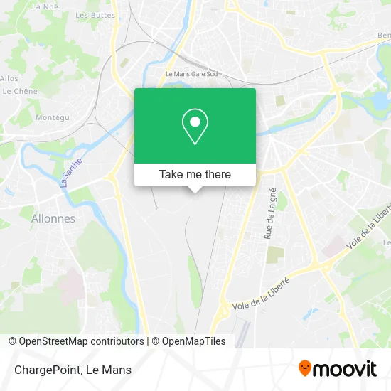
See ChargePoint, Le Mans, on the map
Public Transit to ChargePoint in Le Mans
Wondering how to get to ChargePoint in Le Mans? Moovit helps you find the best way to get to ChargePoint with step-by-step directions from the nearest public transit station.
Moovit provides free maps and live directions to help you navigate through your city. View schedules, routes, timetables, and find out how long does it take to get to ChargePoint in real time.
Looking for the nearest stop or station to ChargePoint? Check out this list of stops closest to your destination: Lafayette; Leclerc-Fleurus; Collectivité; Courard.
Bus: 10B, 14, 16, 5, 4, 7, 11, 10A.Light Rail: T1, T2.
Want to see if there’s another route that gets you there at an earlier time? Moovit helps you find alternative routes or times. Get directions from and directions to ChargePoint easily from the Moovit App or Website.
We make riding to ChargePoint easy, which is why over 1.5 million users, including users in Le Mans, trust Moovit as the best app for public transit. You don’t need to download an individual bus app or train app, Moovit is your all-in-one transit app that helps you find the best bus time or train time available.
For information on prices of bus and light rail, costs and ride fares to ChargePoint, please check the Moovit app.
Use the app to navigate to popular places including to the airport, hospital, stadium, grocery store, mall, coffee shop, school, college, and university.
ChargePoint Address: 81 Rue de la Foucaudière 72100 Le Mans street in Le Mans
- Age d'Or Services le Mans,
- Rue de la Foucaudière,
- Technicentre SNCF Pays de la Loire — Le Mans,
- Cse Claas Tractor,
- Rue Pierre Pavoine 128,
- Boulevard René Cassin 8,
- METRO,
- De la Cartoucherie,
- Api Restauration,
- Premium,
- Ekonsilio,
- Ô Palais du Brunch - Jdd'Events,
- Les Amazones,
- Chope et Compagnie le Mans Sud,
- Linconyl,
- La Lune Lake Bed & Breakfast,
- Maison De Quartier Robert Manceau,
- Collège Pierre Gilles De Gennes,
- École Maternelle Jules Ferry,
- Bar Tabac le Chérubin Loto
Places Near ChargePoint (Le Mans)
- Maison D'Arrêt Le Mans - Les Croisettes, Coulaines,
- Saint-Saturnin, Saint-Saturnin,
- Auchan le Mans, La Chapelle-Saint-Aubin,
- Hôpital, Le Mans,
- Université, Le Mans,
- Changé, Changé,
- Clinique Du Pré, Le Mans,
- Avenue Bollée, Le Mans,
- La Chapelle-Saint-Aubin, La Chapelle-Saint-Aubin,
- Parc Des Expositions, Le Mans,
- Camp du 2e RIMa, Champagné,
- Family Village, Ruaudin,
- Pôle Santé Sud-Elsan, Le Mans,
- Gare SNCF du Mans, Le Mans,
- Circuit des 24 Heures du Mans, Le Mans,
- Place des Jacobins (le Mans), Le Mans,
- E.Leclerc, Le Mans,
- Clinique Pôle Santé Sud, Le Mans,
- Coulaines, Coulaines,
- Centre Hospitalier Du Mans, Le Mans
How to get to popular places in Le Mans with public transit
Get around Le Mans by public transit!
Traveling around Le Mans has never been so easy. See step by step directions as you travel to any attraction, street or major public transit station. View bus and train schedules, arrival times, service alerts and detailed routes on a map, so you know exactly how to get to anywhere in Le Mans.
When traveling to any destination around Le Mans use Moovit's Live Directions with Get Off Notifications to know exactly where and how far to walk, how long to wait for your line, and how many stops are left. Moovit will alert you when it's time to get off — no need to constantly re-check whether yours is the next stop.
Wondering how to use public transit in Le Mans or how to pay for public transit in Le Mans? Moovit public transit app can help you navigate your way with public transit easily, and at minimum cost. It includes public transit fees, ticket prices, and costs. Looking for a map of Le Mans public transit lines? Moovit public transit app shows all public transit maps in Le Mans with all Bus and Light Rail routes and stops on an interactive map.
Le Mans has 2 transit type(s), including: Bus and Light Rail, operated by several transit agencies, including SETRAM