How to get to ChargePoint by bus?
Click on the bus route to see step by step directions with maps, line arrival times and updated time schedules.
From K-rejser Beausejour camp, Le Mans
119 minFrom Rue Prémartine 208, Le Mans
54 minFrom Rue Georges Bizet 10, Allonnes
70 minFrom Arnage, Arnage
113 minFrom Lycée Saint-Charles Sainte-Croix, Le Mans
60 minFrom Pôle Européen du Cheval, Yvré-L'Évêque
92 minFrom La Pincenardière, Mulsanne
138 minFrom Parc Des Trois Vallées, Coulaines
64 minFrom place Luigi Chinetti 9, Le Mans
94 min
Bus stops near ChargePoint in Rouillon
Bus lines to ChargePoint in Rouillon
- 28, La Chapelle-St-Aubin,VIEW
- 33, Universite,VIEW
- 4, St-Georges / St-Joseph – Bellevue-Hauts de C.,VIEW
- 7, Éperon par Auchan,VIEW
- 11, Le Cadran / St-Aubin - Closerie,VIEW
- 14, Parc Manceau - St-Martin,VIEW
- 16, Lafayette - Californie,VIEW
- 17, Gallière - Eperon,VIEW
- 20, Éperon - Aigné,VIEW
- T1, Antarès-Stade Marie Marvingt - Université,VIEW
- 160, Collège Épine,VIEW
- 161, Foresterie,VIEW
- 141, Tourellerie,VIEW
- 142, Aller,VIEW
What are the closest stations to ChargePoint?
The closest stations to ChargePoint are:
- Scotto is 347 meters away, 5 min walk.
- Belle Chasse is 583 meters away, 8 min walk.
- Lafayette is 806 meters away, 11 min walk.
- Martial Vivet is 896 meters away, 12 min walk.
- Primevère is 1284 meters away, 17 min walk.
Which bus lines stop near ChargePoint?
These bus lines stop near ChargePoint: 12, 28.
Which light rail line stops near ChargePoint?
T1 (Universite)
What’s the nearest bus station to ChargePoint in Rouillon?
The nearest bus station to ChargePoint in Rouillon is Scotto. It’s a 5 min walk away.
What time is the first light rail to ChargePoint in Rouillon?
The T1 is the first light rail that goes to ChargePoint in Rouillon. It stops nearby at 5:24 AM.
What time is the last light rail to ChargePoint in Rouillon?
The T1 is the last light rail that goes to ChargePoint in Rouillon. It stops nearby at 1:03 AM.
What time is the first bus to ChargePoint in Rouillon?
The 16 is the first bus that goes to ChargePoint in Rouillon. It stops nearby at 6:30 AM.
What time is the last bus to ChargePoint in Rouillon?
The 16 is the last bus that goes to ChargePoint in Rouillon. It stops nearby at 8:26 PM.
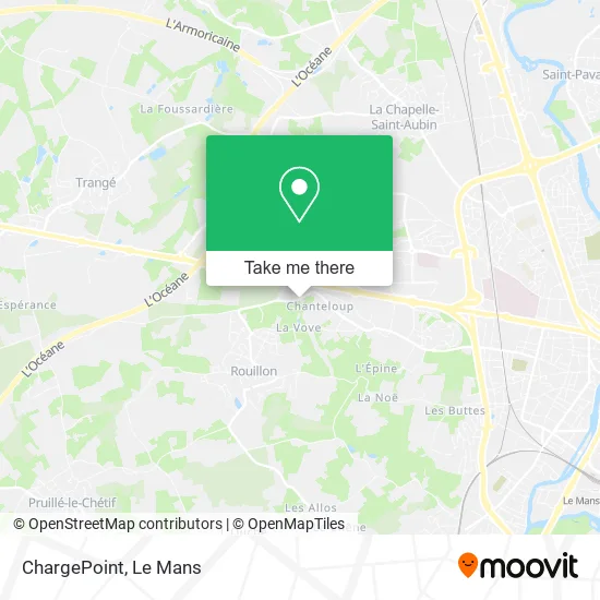
See ChargePoint, Rouillon, on the map
Public Transit to ChargePoint in Rouillon
Wondering how to get to ChargePoint in Rouillon? Moovit helps you find the best way to get to ChargePoint with step-by-step directions from the nearest public transit station.
Moovit provides free maps and live directions to help you navigate through your city. View schedules, routes, timetables, and find out how long does it take to get to ChargePoint in real time.
Looking for the nearest stop or station to ChargePoint? Check out this list of stops closest to your destination: Scotto; Belle Chasse; Lafayette; Martial Vivet; Primevère.
Bus: 12, 28, 33, 4, 7, 11, 14, 16, 160, 161, 141, 142.Light Rail: T1.
Want to see if there’s another route that gets you there at an earlier time? Moovit helps you find alternative routes or times. Get directions from and directions to ChargePoint easily from the Moovit App or Website.
We make riding to ChargePoint easy, which is why over 1.5 million users, including users in Rouillon, trust Moovit as the best app for public transit. You don’t need to download an individual bus app or train app, Moovit is your all-in-one transit app that helps you find the best bus time or train time available.
For information on prices of bus and light rail, costs and ride fares to ChargePoint, please check the Moovit app.
Use the app to navigate to popular places including to the airport, hospital, stadium, grocery store, mall, coffee shop, school, college, and university.
ChargePoint Address: 250 Rue de Beaugé 72700 Rouillon street in Rouillon
- Parc de l'Oseraie,
- Sante Mailiz,
- Financ G et L Charonnet - Financ Glc,
- Access,
- Foresterie,
- Restaurant a l'Intinct Bar a Bières,
- Chemin de la Foresterie,
- Cerfrance,
- Parc de l'Oseraie,
- Gymnase Robert Jarry Le Mans SCM,
- Rue Louis de Broglie 34,
- Ecoclean Connect,
- Cmd Carrelage Monceaux Drouet,
- Marinero Nile et Forat,
- Escape Game Apero le Mans 72,
- 194 Rue de Beaugé,
- Arrêt OUIBUS,
- 22 Bd Louis le Prince Ringuet,
- Boulevard Louis le Prince Ringuet 5,
- Samourai 2000
Places Near ChargePoint (Rouillon)
- Pôle Santé Sud-Elsan, Le Mans,
- E.Leclerc, Le Mans,
- Family Village, Ruaudin,
- Hôpital, Le Mans,
- Place des Jacobins (le Mans), Le Mans,
- Avenue Bollée, Le Mans,
- Circuit des 24 Heures du Mans, Le Mans,
- Saint-Saturnin, Saint-Saturnin,
- Camp du 2e RIMa, Champagné,
- Changé, Changé,
- Clinique Du Pré, Le Mans,
- Coulaines, Coulaines,
- Auchan le Mans, La Chapelle-Saint-Aubin,
- La Chapelle-Saint-Aubin, La Chapelle-Saint-Aubin,
- Clinique Pôle Santé Sud, Le Mans,
- Université, Le Mans,
- Maison D'Arrêt Le Mans - Les Croisettes, Coulaines,
- Gare SNCF du Mans, Le Mans,
- Centre Hospitalier Du Mans, Le Mans,
- Parc Des Expositions, Le Mans
How to get to popular places in Le Mans with public transit
Get around Rouillon by public transit!
Traveling around Rouillon has never been so easy. See step by step directions as you travel to any attraction, street or major public transit station. View bus and train schedules, arrival times, service alerts and detailed routes on a map, so you know exactly how to get to anywhere in Rouillon.
When traveling to any destination around Rouillon use Moovit's Live Directions with Get Off Notifications to know exactly where and how far to walk, how long to wait for your line, and how many stops are left. Moovit will alert you when it's time to get off — no need to constantly re-check whether yours is the next stop.
Wondering how to use public transit in Rouillon or how to pay for public transit in Rouillon? Moovit public transit app can help you navigate your way with public transit easily, and at minimum cost. It includes public transit fees, ticket prices, and costs. Looking for a map of Rouillon public transit lines? Moovit public transit app shows all public transit maps in Rouillon with all Bus and Light Rail routes and stops on an interactive map.
Le Mans has 2 transit type(s), including: Bus and Light Rail, operated by several transit agencies, including SETRAM