How to get to ChargePoint by bus?
Click on the bus route to see step by step directions with maps, line arrival times and updated time schedules.
From Mercy Hospital, Miami
108 minFrom Ponce De Leon Boulevard & Southwest 37th Avenue, Miami
89 minFrom Sedano's (Sedanos Supermarket), Miami
70 minFrom mercy hospital trolley stop, Miami
107 minFrom Mt Sinai Medical Center, Miami
98 minFrom Village of Merrick Park, Miami
97 minFrom The Law Office of Alexis Gonzalez, P.A., Miami
61 minFrom City Of Doral Trolly, Miami
80 minFrom 37th Ave & West Flagler St, Miami
71 minFrom Miccosukee Casino, Kendall-Palmetto Bay
51 min
How to get to ChargePoint by train?
Click on the train route to see step by step directions with maps, line arrival times and updated time schedules.
Bus stops near ChargePoint in Miami
Train station near ChargePoint in Miami
- Dadeland North, 54 min walk,VIEW
Bus lines to ChargePoint in Miami
- 272, 272 - West Kendall Park & Ride,VIEW
- 204, 204 - West Kendall Park & Ride,VIEW
- 73, 73 - Dadeland North Station,VIEW
- 87, 87 - Dadeland North Station,VIEW
- 88, 88 - West Kendall Park & Ride,VIEW
- 104, 104a - Dadeland North Station Via Hammocks Blvd,VIEW
- 400, 400 - Downtown Miami,VIEW
- 288, 288 - Dadeland North Station,VIEW
What are the closest stations to ChargePoint?
The closest stations to ChargePoint are:
- Dadeland North Bay 4 is 798 yards away, 11 min walk.
- Dadeland North Bay 3 is 798 yards away, 11 min walk.
- Sw 67 Av & Sw 80 St is 861 yards away, 11 min walk.
- Sw 88 St @ Sw 72 Ct is 934 yards away, 11 min walk.
- S Dixie Hwy & Sw 68 Ct (N/n) is 1053 yards away, 13 min walk.
- Dadeland North Bay 1 is 1100 yards away, 13 min walk.
- Dadeland North is 4605 yards away, 54 min walk.
Which bus lines stop near ChargePoint?
These bus lines stop near ChargePoint: 204, 37, 73, 87.
Which train lines stop near ChargePoint?
These train lines stop near ChargePoint: GREEN, ORANGE.
What’s the nearest bus station to ChargePoint in Miami?
The nearest bus stations to ChargePoint in Miami are Dadeland North Bay 4, Dadeland North Bay 3, Sw 67 Av & Sw 80 St and Sw 88 St @ Sw 72 Ct. The closest one is a 11 min walk away.
What time is the first train to ChargePoint in Miami?
The GREEN is the first train that goes to ChargePoint in Miami. It stops nearby at 5:00 AM.
What time is the last train to ChargePoint in Miami?
The GREEN is the last train that goes to ChargePoint in Miami. It stops nearby at 1:04 AM.
What time is the first bus to ChargePoint in Miami?
The 400 is the first bus that goes to ChargePoint in Miami. It stops nearby at 3:28 AM.
What time is the last bus to ChargePoint in Miami?
The 400 is the last bus that goes to ChargePoint in Miami. It stops nearby at 2:32 AM.
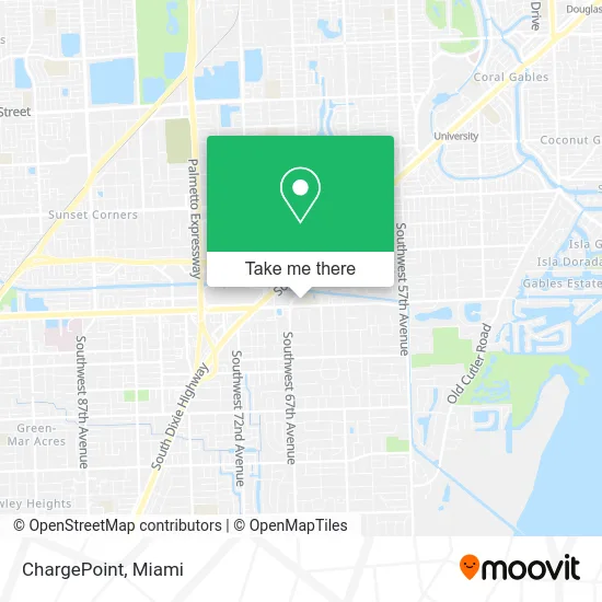
See ChargePoint, Miami, on the map
Public Transit to ChargePoint in Miami
Wondering how to get to ChargePoint in Miami? Moovit helps you find the best way to get to ChargePoint with step-by-step directions from the nearest public transit station.
Moovit provides free maps and live directions to help you navigate through your city. View schedules, routes, timetables, and find out how long does it take to get to ChargePoint in real time.
Looking for the nearest stop or station to ChargePoint? Check out this list of stops closest to your destination: Dadeland North Bay 4; Dadeland North Bay 3; Sw 67 Av & Sw 80 St; Sw 88 St @ Sw 72 Ct; S Dixie Hwy & Sw 68 Ct (N/n); Dadeland North Bay 1; Dadeland North.
Bus: 204, 37, 73, 87, 272, 88, 104, 400.Train: GREEN, ORANGE.
Want to see if there’s another route that gets you there at an earlier time? Moovit helps you find alternative routes or times. Get directions from and directions to ChargePoint easily from the Moovit App or Website.
We make riding to ChargePoint easy, which is why over 1.5 million users, including users in Miami, trust Moovit as the best app for public transit. You don’t need to download an individual bus app or train app, Moovit is your all-in-one transit app that helps you find the best bus time or train time available.
For information on prices of bus and train, costs and ride fares to ChargePoint, please check the Moovit app.
Use the app to navigate to popular places including to the airport, hospital, stadium, grocery store, mall, coffee shop, school, college, and university.
ChargePoint Address: 6605 N Kendall Dr Miami, FL 33156 street in Miami
- Gulliver Preparatory School,
- Gulliver Preparatory School (Gulliver Prep - Upper School Campus),
- Gulliver Prep,
- Bomnin CHEVROLET Dadeland,
- El Trailer,
- Best Buy-Dadeland,
- DSW Designer Shoe Warehouse,
- Ideal Dental,
- Dadeland North Metrorail Station,
- Burlington,
- Ross Dress for Less,
- Target (Target Store Dadeland),
- Dadeland Station,
- Target,
- Michaels,
- Best Buy,
- SW 81 St Miami Fl,
- Hampton Inn (Hampton by Hilton-Miami),
- Hampton Inn Miami Dadeland South Miami,
- SW 80th St / US-1
Places Near ChargePoint (Miami)
- Hard Rock Stadium, Miami Gardens,
- Little Havana, Miami,
- Miami VA Hospital, Miami,
- Wynwood, Miami,
- Port of Miami Cruise Terminal, Miami,
- Aventura Mall, Miami,
- Brickell City Centre, Miami,
- Keiser University Flagship Campus, West Palm Beach,
- Marlins Park, Miami,
- Dolphin Mall Bus, Miami,
- Aventura Mall, Miami Beach,
- Miami Freedom Park, Miami,
- Sawgrass mall ( FL ), Miami Beach,
- Bayside Marketplace, Miami,
- Miami-Dade County Courthouse, Miami,
- Richard E. Gerstein Justice Building, Miami,
- Sawgrass Mall, Miami,
- Dolphin Mall, Miami,
- Zoo Miami, Miami,
- Miami Design District, Miami
How to get to popular places in Miami with public transit
Get around Miami by public transit!
Traveling around Miami has never been so easy. See step by step directions as you travel to any attraction, street or major public transit station. View bus and train schedules, arrival times, service alerts and detailed routes on a map, so you know exactly how to get to anywhere in Miami.
When traveling to any destination around Miami use Moovit's Live Directions with Get Off Notifications to know exactly where and how far to walk, how long to wait for your line, and how many stops are left. Moovit will alert you when it's time to get off — no need to constantly re-check whether yours is the next stop.
Wondering how to use public transit in Miami or how to pay for public transit in Miami? Moovit public transit app can help you navigate your way with public transit easily, and at minimum cost. It includes public transit fees, ticket prices, and costs. Looking for a map of Miami public transit lines? Moovit public transit app shows all public transit maps in Miami with all Bus, Train, Light Rail and Ferry routes and stops on an interactive map.
Miami has 4 transit type(s), including: Bus, Train, Light Rail and Ferry, operated by several transit agencies, including Broward County Transit, Miami-Dade Transit, Metrorail, Palm Tran, Tri-Rail, Brightline, MARTY, City of Homestead Trolley, Key West Transit, Treasure Coast Connector, GoLine IRT, Amtrak, Greyhound-us, FlixBus-us and Aventura Express Shuttle Bus