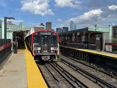
See Charles/Mgh Station, Boston, on the map
Directions to Charles/Mgh Station (Boston) with public transportation
The following transit lines have routes that pass near Charles/Mgh Station
 Bus:
Bus: - Train:
- Subway:
How to get to Charles/Mgh Station by bus?
Click on the bus route to see step by step directions with maps, line arrival times and updated time schedules.
How to get to Charles/Mgh Station by train?
Click on the train route to see step by step directions with maps, line arrival times and updated time schedules.
How to get to Charles/Mgh Station by subway?
Click on the subway route to see step by step directions with maps, line arrival times and updated time schedules.
Bus stations near Charles/Mgh Station in Boston
- Charles/Mgh - 325 Cambridge St,2 min walk,
- Charles St @ Beacon St,6 min walk,
- Science Park/West End - Martha Rd @ Amy Ct,10 min walk,
- Government Center - Cambridge St @ Sudbury St,12 min walk,
- North Station - Nashua St @ Red Auerbach Way,13 min walk,
- Portland St @ Causeway St,14 min walk,
- North Station,15 min walk,
- Tremont St Opp Temple Pl,16 min walk,
- Park Street - Tremont St Opp Hamilton Pl,16 min walk,
Subway stations near Charles/Mgh Station in Boston
- Bowdoin,10 min walk,
- Park Street,15 min walk,
Train stations near Charles/Mgh Station in Boston
- North Station,19 min walk,
Bus lines to Charles/Mgh Station in Boston
- RED LINE SHUTTLE,Kendall/MIT - Broadway via Pearl Street,
- RED LINE SHUTTLE,Alewife - Park Street,
- RED LINE SHUTTLE,Harvard - JFK/UMass via Congress Street,
- RED LINE SHUTTLE,Harvard - Broadway,
- RED LINE SHUTTLE,Kendall/MIT - JFK/UMass,
- RED LINE SHUTTLE,Kendall/MIT - Broadway via Downtown Crossing,
- RED LINE SHUTTLE,Harvard - South Station,
- RED LINE SHUTTLE,Kendall/MIT - Park Street,
- RED LINE SHUTTLE,Harvard - JFK/UMass via State Street,
- RED LINE SHUTTLE,Harvard - Park Street,
- 43,Park St & Tremont St,
- GREEN LINE E SHUTTLE,Medford/Tufts - North Station,
- GREEN LINE SHUTTLE,Union Square - North Station,
- GREEN LINE SHUTTLE,Medford/Tufts - Government Center via Union Square,
- GREEN LINE SHUTTLE,Lechmere - North Station,
- GREEN LINE SHUTTLE,Union Square - Government Center,
- BLUE LINE SHUTTLE,Government Center (Local Shuttle),
- BLUE LINE SHUTTLE,Government Center Via Maverick (Shuttle),
- BLUE LINE SHUTTLE,Airport Via Maverick (Shuttle),
- ORANGE LINE SHUTTLE,North Station (Shuttle),
What are the closest stations to Charles/Mgh Station?
The closest stations to Charles/Mgh Station are:
- Charles/Mgh - 325 Cambridge St is 101 yards away, 2 min walk.
- Charles St @ Beacon St is 471 yards away, 6 min walk.
- Bowdoin is 815 yards away, 10 min walk.
- Science Park/West End - Martha Rd @ Amy Ct is 836 yards away, 10 min walk.
- Government Center - Cambridge St @ Sudbury St is 941 yards away, 12 min walk.
- North Station - Nashua St @ Red Auerbach Way is 1062 yards away, 13 min walk.
- Portland St @ Causeway St is 1114 yards away, 14 min walk.
- North Station is 1184 yards away, 15 min walk.
- Park Street is 1216 yards away, 15 min walk.
- Tremont St Opp Temple Pl is 1282 yards away, 16 min walk.
- Park Street - Tremont St Opp Hamilton Pl is 1356 yards away, 16 min walk.
Which bus lines stop near Charles/Mgh Station?
These bus lines stop near Charles/Mgh Station: 426, 43, 450, 504, 64, 87.
Which train lines stop near Charles/Mgh Station?
These train lines stop near Charles/Mgh Station: FITCHBURG, FRAMINGHAM/WORCESTER.
Which subway lines stop near Charles/Mgh Station?
These subway lines stop near Charles/Mgh Station: BLUE LINE, RED LINE.
What’s the nearest subway station to Charles/Mgh Station in Boston?
The nearest subway station to Charles/Mgh Station in Boston is Bowdoin. It’s a 10 min walk away.
What’s the nearest train station to Charles/Mgh Station in Boston?
The nearest train station to Charles/Mgh Station in Boston is North Station. It’s a 19 min walk away.
What’s the nearest bus stop to Charles/Mgh Station in Boston?
The nearest bus stop to Charles/Mgh Station in Boston is Charles/Mgh - 325 Cambridge St. It’s a 2 min walk away.
What time is the first train to Charles/Mgh Station in Boston?
The LOWELL is the first train that goes to Charles/Mgh Station in Boston. It stops nearby at 5:25 AM.
What time is the last train to Charles/Mgh Station in Boston?
The FITCHBURG is the last train that goes to Charles/Mgh Station in Boston. It stops nearby at 12:31 AM.
What time is the first bus to Charles/Mgh Station in Boston?
The EZRIDE is the first bus that goes to Charles/Mgh Station in Boston. It stops nearby at 6:20 AM.
What time is the last bus to Charles/Mgh Station in Boston?
The EZRIDE is the last bus that goes to Charles/Mgh Station in Boston. It stops nearby at 8:00 PM.
See Charles/Mgh Station, Boston, on the map
Public Transit to Charles/Mgh Station in Boston
Wondering how to get to Charles/Mgh Station in Boston, United States? Moovit helps you find the best way to get to Charles/Mgh Station with step-by-step directions from the nearest public transit station.
Moovit provides free maps and live directions to help you navigate through your city. View schedules, routes, timetables, and find out how long does it take to get to Charles/Mgh Station in real time.
Looking for the nearest stop or station to Charles/Mgh Station? Check out this list of stops closest to your destination: Charles/Mgh - 325 Cambridge St; Charles St @ Beacon St; Bowdoin; Science Park/West End - Martha Rd @ Amy Ct; Government Center - Cambridge St @ Sudbury St; North Station - Nashua St @ Red Auerbach Way; Portland St @ Causeway St; North Station; Park Street; Tremont St Opp Temple Pl; Park Street - Tremont St Opp Hamilton Pl.
Bus:Train:Subway:
Want to see if there’s another route that gets you there at an earlier time? Moovit helps you find alternative routes or times. Get directions from and directions to Charles/Mgh Station easily from the Moovit App or Website.
We make riding to Charles/Mgh Station easy, which is why over 1.5 million users, including users in Boston, trust Moovit as the best app for public transit. You don’t need to download an individual bus app or train app, Moovit is your all-in-one transit app that helps you find the best bus time or train time available.
For information on prices of subway, bus and train, costs and ride fares to Charles/Mgh Station, please check the Moovit app.
Use the app to navigate to popular places including to the airport, hospital, stadium, grocery store, mall, coffee shop, school, college, and university.
Charles/Mgh Station Address: Charles Street street in Boston
Attractions near Charles/Mgh Station
Charles Street,Charles Circle,The Whitney Hotel,Liberty Hotel Taxi Stand,Mass Ear Eye Infirmary,The Liberty Hotel,Whitney Hotel Boston,Scampo,Charles/MGH T Stop,2hotnsexy Boston Escorts,Suffolk County Jail,Mgh Yawkey Center,Yawkey Center for Outpatient Care,2 North Grove Street,Massachusetts General Hospital ER,Mass Eye And Ear ER,Andrew Oseran MD,David Forcione,Massachusetts Infectious Disss Soc (Kuter David John MD - Massachusetts General Hospital),Mass Eye and Ear InfirmaryHow to get to popular attractions in Boston with public transit
Brown University,Worcester, MA, Worcester,Ruggles Station, Boston,Redbones Barbecue, Somerville,Wilmington, MA, Wilmington,Stephanie's On Newbury, Boston,McGreevy's, Boston,BJ's Wholesale Club, Haverhill,Bridgewater, MA, Bridgewater,South Bay Mall, Boston,Target,MBTA Cleveland Circle Station, Boston,The Lenox Hotel, Boston,La Famiglia Giorgio's, Boston,Hyatt Boston Harbor, Boston,Star Market, Waltham,Newport, RI,Cranston, RI,Downtown Providence,FiRE + iCE Boston, BostonGet around Boston by public transit!
Traveling around Boston has never been so easy. See step by step directions as you travel to any attraction, street or major public transit station. View bus and train schedules, arrival times, service alerts and detailed routes on a map, so you know exactly how to get to anywhere in Boston.
When traveling to any destination around Boston use Moovit's Live Directions with Get Off Notifications to know exactly where and how far to walk, how long to wait for your line, and how many stops are left. Moovit will alert you when it's time to get off — no need to constantly re-check whether yours is the next stop.
Wondering how to use public transit in Boston or how to pay for public transit in Boston? Moovit public transit app can help you navigate your way with public transit easily, and at minimum cost. It includes public transit fees, ticket prices, and costs. Looking for a map of Boston public transit lines? Moovit public transit app shows all public transit maps in Boston with all subway, bus or train routes and stops on an interactive map.
Boston has 3 transit type(s), including: subway, bus or train, operated by several transit agencies, including MBTA, MBTA, MBTA, Southeastern Regional Transit Authority, MetroWest Regional Transit Authority, Rhode Island Public Transit Authority, WRTA, Lowell Regional Transit Authority, Merrimack Valley Transit, Montachusett Regional Transit Authority, Cape Cod Regional Transit Authority, Brockton Area Transit Authority, Cape Cod Regional Transit Authority, Martha's Vineyard Transit Authority and the WAVE - Nantucket Regional Transit Authority