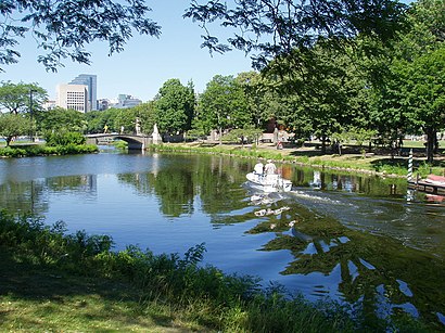
Directions to Charles River Reservation (Boston) with public transportation
The following transit lines have routes that pass near Charles River Reservation
How to get to Charles River Reservation by bus?
Click on the bus route to see step by step directions with maps, line arrival times and updated time schedules.
How to get to Charles River Reservation by train?
Click on the train route to see step by step directions with maps, line arrival times and updated time schedules.
How to get to Charles River Reservation by subway?
Click on the subway route to see step by step directions with maps, line arrival times and updated time schedules.
Bus stations near Charles River Reservation in Boston
- Western Ave Opp Riverdale St, 3 min walk,
- N Harvard St @ Western Ave, 4 min walk,
Subway stations near Charles River Reservation in Boston
- Allston Street, 25 min walk,
- Harvard Square, 26 min walk,
Bus lines to Charles River Reservation in Boston
- 70, Cedarwood,
- 86, Reservoir,
- 66, Harvard Via Allston,
What are the closest stations to Charles River Reservation?
The closest stations to Charles River Reservation are:
- Western Ave Opp Riverdale St is 115 yards away, 3 min walk.
- N Harvard St @ Western Ave is 223 yards away, 4 min walk.
- Allston Street is 2030 yards away, 25 min walk.
- Harvard Square is 2135 yards away, 26 min walk.
Which bus lines stop near Charles River Reservation?
These bus lines stop near Charles River Reservation: 66, 70, 86.
Which train line stops near Charles River Reservation?
FRAMINGHAM/WORCESTER
Which subway lines stop near Charles River Reservation?
These subway lines stop near Charles River Reservation: GREEN LINE B, RED LINE.
What’s the nearest subway station to Charles River Reservation in Boston?
The nearest subway station to Charles River Reservation in Boston is Allston Street. It’s a 25 min walk away.
What’s the nearest bus stop to Charles River Reservation in Boston?
The nearest bus stop to Charles River Reservation in Boston is Western Ave Opp Riverdale St. It’s a 3 min walk away.
What time is the first subway to Charles River Reservation in Boston?
The GREEN LINE B is the first subway that goes to Charles River Reservation in Boston. It stops nearby at 5:12 AM.
What time is the last subway to Charles River Reservation in Boston?
The GREEN LINE B is the last subway that goes to Charles River Reservation in Boston. It stops nearby at 1:25 AM.
What time is the first bus to Charles River Reservation in Boston?
The 70 is the first bus that goes to Charles River Reservation in Boston. It stops nearby at 4:32 AM.
What time is the last bus to Charles River Reservation in Boston?
The 66 is the last bus that goes to Charles River Reservation in Boston. It stops nearby at 1:21 AM.
How much is the bus fare to Charles River Reservation?
The bus fare to Charles River Reservation costs about $1.70.
How much is the subway fare to Charles River Reservation?
The subway fare to Charles River Reservation costs about $2.40.
See Charles River Reservation, Boston, on the map
Public Transit to Charles River Reservation in Boston
Wondering how to get to Charles River Reservation in Boston, United States? Moovit helps you find the best way to get to Charles River Reservation with step-by-step directions from the nearest public transit station.
Moovit provides free maps and live directions to help you navigate through your city. View schedules, routes, timetables, and find out how long does it take to get to Charles River Reservation in real time.
Looking for the nearest stop or station to Charles River Reservation? Check out this list of stops closest to your destination: Western Ave Opp Riverdale St; N Harvard St @ Western Ave; Allston Street; Harvard Square.
Bus: 66, 70, 86.Train: FRAMINGHAM/WORCESTER.Subway: GREEN LINE B, RED LINE.
Want to see if there’s another route that gets you there at an earlier time? Moovit helps you find alternative routes or times. Get directions from and directions to Charles River Reservation easily from the Moovit App or Website.
We make riding to Charles River Reservation easy, which is why over 1.5 million users, including users in Boston, trust Moovit as the best app for public transit. You don’t need to download an individual bus app or train app, Moovit is your all-in-one transit app that helps you find the best bus time or train time available.
For information on prices of bus, subway and train, costs and ride fares to Charles River Reservation, please check the Moovit app.
Use the app to navigate to popular places including to the airport, hospital, stadium, grocery store, mall, coffee shop, school, college, and university.
Charles River Reservation Address: Ivy Lane street in Boston
Attractions near Charles River Reservation
William E. Smith Playground,Smith Park Pumptrack,Teele Hall (Harvard Business School),Trader Joe's,Planet Aid,Allston Gulf,Harvard Ed Portal,MBTA Bus Stop | N Harvard St & Western Ave,King Ceramics Program,Harvard Student Art Show,First Choice Rehabilitation Center,William Luzier,Wbz,Wbz Heliport,The Breakfast Club,1170 Soldiers Field Road,Gordon Indoor Track- Harvard University,WBZ-TV ( CBS ),On the Point Fitness,AtmHow to get to popular attractions in Boston with public transit
185 Pilgrim Road, Boston,Doubletree by Hilton Hotel Boston - Downtown, Boston,Google, Cambridge,Allston, Boston,Sconset Bluff Walk, Siasconset,Boston Harbor Hotel, Boston,Bebop, Boston,AC Hotel Boston Cambridge, Cambridge,Massachusetts College Of Pharmacy And Health Science, Boston,230 Lee Burbank Hwy, Revere,Holliston,Harvard University, Cambridge,Mike's Pastry, Boston,Astrazeneca Bos / Garage#1, Waltham,Umass Dartmouth, New Bedford,The Mall At Chestnut Hill, Newton,Franklin St (franklin federal), Boston,North Easton,Dorchester, Boston,Worcester, MA, WorcesterGet around Boston by public transit!
Traveling around Boston has never been so easy. See step by step directions as you travel to any attraction, street or major public transit station. View bus and train schedules, arrival times, service alerts and detailed routes on a map, so you know exactly how to get to anywhere in Boston.
When traveling to any destination around Boston use Moovit's Live Directions with Get Off Notifications to know exactly where and how far to walk, how long to wait for your line, and how many stops are left. Moovit will alert you when it's time to get off — no need to constantly re-check whether yours is the next stop.
Wondering how to use public transit in Boston or how to pay for public transit in Boston? Moovit public transit app can help you navigate your way with public transit easily, and at minimum cost. It includes public transit fees, ticket prices, and costs. Looking for a map of Boston public transit lines? Moovit public transit app shows all public transit maps in Boston with all Bus, Train, Subway and Ferry routes and stops on an interactive map.
Boston has 4 transit type(s), including: Bus, Train, Subway and Ferry, operated by several transit agencies, including MBTA, Southeastern Regional Transit Authority, MetroWest Regional Transit Authority, Rhode Island Public Transit Authority, WRTA, Lowell Regional Transit Authority, Merrimack Valley Transit, Montachusett Regional Transit Authority, Cape Cod Regional Transit Authority, Brockton Area Transit Authority, Martha's Vineyard Transit Authority, the WAVE - Nantucket Regional Transit Authority, GATRA, Cape Ann Transportation Authority, Massport