Directions to Chase Atm (Quincy) with public transportation
The following transit lines have routes that pass near Chase Atm
 Bus: 210, 217, 211.
- Train: FALL RIVER/NEW BEDFORD, GREENBUSH.
- Subway: RED LINE, MATTAPAN LINE.
- Ferry: QUINCY FERRY, WINTHROP/QUINCY FERRY.
How to get to Chase Atm by bus?
Click on the bus route to see step by step directions with maps, line arrival times and updated time schedules.
From Haymarket Station, Boston
85 minFrom Carmelina's, Boston
86 minFrom Old South Church, Boston
96 minFrom John Hancock Tower (200 Clarendon), Boston
96 minFrom Little Italy, Boston
86 minFrom PwC, Boston
94 minFrom Paul Revere House, Boston
87 minFrom Boston Harborwalk, Boston
96 minFrom ICA, Boston
96 min
How to get to Chase Atm by train?
Click on the train route to see step by step directions with maps, line arrival times and updated time schedules.
From Haymarket Station, Boston
80 minFrom Carmelina's, Boston
82 minFrom Old South Church, Boston
82 minFrom John Hancock Tower (200 Clarendon), Boston
80 minFrom Little Italy, Boston
81 minFrom PwC, Boston
78 minFrom Paul Revere House, Boston
82 minFrom Boston Harborwalk, Boston
80 minFrom ICA, Boston
80 min
How to get to Chase Atm by subway?
Click on the subway route to see step by step directions with maps, line arrival times and updated time schedules.
From Haymarket Station, Boston
27 minFrom Carmelina's, Boston
30 minFrom Old South Church, Boston
33 minFrom John Hancock Tower (200 Clarendon), Boston
30 minFrom Little Italy, Boston
29 minFrom PwC, Boston
32 minFrom Paul Revere House, Boston
31 minFrom Boston Harborwalk, Boston
32 minFrom ICA, Boston
34 min
Bus stops near Chase Atm in Quincy
Ferry station near Chase Atm in Quincy
- Quincy, 10 min walk,VIEW
Bus lines to Chase Atm in Quincy
- 217, Bryant Ave & Upton St,VIEW
- 211, Squantum,VIEW
- 210, Fields Corner,VIEW
- RED LINE SHUTTLE, North Quincy (Shuttle),VIEW
- RED LINE SHUTTLE, Braintree (Shuttle),VIEW
- 215, Ashmont - Quincy Center,VIEW
- RED LINE SHUTTLE, Ashmont - Braintree,VIEW
- RED LINE SHUTTLE, North Quincy - JFK/UMass,VIEW
- RED LINE SHUTTLE, Braintree - Broadway,VIEW
- RED LINE SHUTTLE, Braintree - JFK/UMass (Shuttle),VIEW
- RED LINE SHUTTLE, Quincy Center - Broadway (Shuttle),VIEW
What are the closest stations to Chase Atm?
The closest stations to Chase Atm are:
- Holmes St @ Billings Rd is 456 yards away, 6 min walk.
- Atlantic Middle School is 480 yards away, 6 min walk.
- Hancock St @ Billings Rd is 553 yards away, 7 min walk.
- North Quincy - Hancock Street Garage is 677 yards away, 9 min walk.
- Quincy is 773 yards away, 10 min walk.
- North Quincy is 1158 yards away, 14 min walk.
- Cedar Grove is 2223 yards away, 27 min walk.
- Wollaston is 3363 yards away, 40 min walk.
Which bus line stops near Chase Atm?
210 (Fields Corner)
Which train lines stop near Chase Atm?
These train lines stop near Chase Atm: FALL RIVER/NEW BEDFORD, GREENBUSH.
Which subway line stops near Chase Atm?
RED LINE (Alewife)
What’s the nearest subway station to Chase Atm in Quincy?
The nearest subway station to Chase Atm in Quincy is Cedar Grove. It’s a 27 min walk away.
What’s the nearest bus station to Chase Atm in Quincy?
The nearest bus stations to Chase Atm in Quincy are Holmes St @ Billings Rd and Atlantic Middle School. The closest one is a 6 min walk away.
What’s the nearest ferry station to Chase Atm in Quincy?
The nearest ferry station to Chase Atm in Quincy is Quincy. It’s a 10 min walk away.
What time is the first subway to Chase Atm in Quincy?
The MATTAPAN LINE is the first subway that goes to Chase Atm in Quincy. It stops nearby at 5:07 AM.
What time is the last subway to Chase Atm in Quincy?
The MATTAPAN LINE is the last subway that goes to Chase Atm in Quincy. It stops nearby at 2:34 AM.
What time is the first bus to Chase Atm in Quincy?
The 210 is the first bus that goes to Chase Atm in Quincy. It stops nearby at 5:06 AM.
What time is the last bus to Chase Atm in Quincy?
The 210 is the last bus that goes to Chase Atm in Quincy. It stops nearby at 1:11 AM.
What time is the first ferry to Chase Atm in Quincy?
The QUINCY FERRY is the first ferry that goes to Chase Atm in Quincy. It stops nearby at 6:15 AM.
What time is the last ferry to Chase Atm in Quincy?
The QUINCY FERRY is the last ferry that goes to Chase Atm in Quincy. It stops nearby at 8:55 PM.
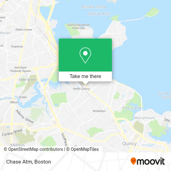
See Chase Atm, Quincy, on the map
Public Transit to Chase Atm in Quincy
Wondering how to get to Chase Atm in Quincy? Moovit helps you find the best way to get to Chase Atm with step-by-step directions from the nearest public transit station.
Moovit provides free maps and live directions to help you navigate through your city. View schedules, routes, timetables, and find out how long does it take to get to Chase Atm in real time.
Looking for the nearest stop or station to Chase Atm? Check out this list of stops closest to your destination: Holmes St @ Billings Rd; Atlantic Middle School; Hancock St @ Billings Rd; North Quincy - Hancock Street Garage; Quincy; North Quincy; Cedar Grove; Wollaston.
Bus: 210, 217, 211.Train: FALL RIVER/NEW BEDFORD, GREENBUSH.Subway: RED LINE, MATTAPAN LINE.Ferry: QUINCY FERRY, WINTHROP/QUINCY FERRY.
Want to see if there’s another route that gets you there at an earlier time? Moovit helps you find alternative routes or times. Get directions from and directions to Chase Atm easily from the Moovit App or Website.
We make riding to Chase Atm easy, which is why over 1.7 million users, including users in Quincy, trust Moovit as the best app for public transit. You don’t need to download an individual bus app or train app, Moovit is your all-in-one transit app that helps you find the best bus time or train time available.
For information on prices of subway, bus and train, costs and ride fares to Chase Atm, please check the Moovit app.
Use the app to navigate to popular places including to the airport, hospital, stadium, grocery store, mall, coffee shop, school, college, and university.
Chase Atm Address: 315 Hancock St street in Quincy
- Evelina Fitzgerald - TD Wealth Financial Advisor,
- North Quincy Station,
- Cash World Tour,
- Aylward Sharon R Attorney,
- Aylward Francis Attorney,
- Target,
- Courtney Sanders Knapik, DMD,
- 2go Bus,
- Touched by Tina,
- STARBUCKS,
- bcu,
- James Wu Hvac and Plumbing,
- Eastern Hair Studio,
- Amazon Locker-Swing,
- bcu,
- North Quincy High Guidance,
- North Quincy High,
- Sean Obrien,
- MBTA-North Quincy (N Quincy Station @ Red Line),
- Fifteen Minute Locksmith
Places Near Chase Atm (Quincy)
- Prudential Center, Boston,
- Castle Island, Boston,
- Quincy Market, Boston,
- Cheers, Boston,
- Leader Bank Pavilion (Leader Bank Pavillion), Boston,
- Faneuil Hall, Boston,
- Isabella Stewart Gardner Museum, Boston,
- North End, Boston,
- Boston Children's Hospital, Boston,
- Seaport District, Boston,
- Museum Of Science, Boston,
- Wang Theater, Boston,
- Boston Convention & Exhibition Center, Boston,
- Boston Common, Boston,
- Wilbur Theatre, Boston,
- Boston Medical Center, Boston,
- Mgm Music Hall, Boston,
- Massachusetts General Hospital, Boston,
- House Of Blues, Boston,
- Td Garden, Boston
How to get to popular places in Boston with public transit
Get around Quincy by public transit!
Traveling around Quincy has never been so easy. See step by step directions as you travel to any attraction, street or major public transit station. View bus and train schedules, arrival times, service alerts and detailed routes on a map, so you know exactly how to get to anywhere in Quincy.
When traveling to any destination around Quincy use Moovit's Live Directions with Get Off Notifications to know exactly where and how far to walk, how long to wait for your line, and how many stops are left. Moovit will alert you when it's time to get off — no need to constantly re-check whether yours is the next stop.
Wondering how to use public transit in Quincy or how to pay for public transit in Quincy? Moovit public transit app can help you navigate your way with public transit easily, and at minimum cost. It includes public transit fees, ticket prices, and costs. Looking for a map of Quincy public transit lines? Moovit public transit app shows all public transit maps in Quincy with all Bus, Train, Subway and Ferry routes and stops on an interactive map.
Boston has 4 transit type(s), including: Bus, Train, Subway and Ferry, operated by several transit agencies, including MBTA, Southeastern Regional Transit Authority, MetroWest Regional Transit Authority, Rhode Island Public Transit Authority, WRTA, Lowell Regional Transit Authority, Merrimack Valley Transit, Montachusett Regional Transit Authority, Cape Cod Regional Transit Authority, Brockton Area Transit Authority, Martha's Vineyard Transit Authority, the WAVE - Nantucket Regional Transit Authority, GATRA, Cape Ann Transportation Authority and Massport