How to get to Chatarrera Gomez by bus?
Click on the bus route to see step by step directions with maps, line arrival times and updated time schedules.
From Misa Dominical Rancho Santa Monica, Aguascalientes
56 minFrom Cantia, Aguascalientes
53 minFrom Calle Aquiles Elorduy, Aguascalientes
53 minFrom Explanada San Marcos, Aguascalientes
43 minFrom Jardines de las Palmas Bjx, Aguascalientes
63 minFrom Bodega Aurrera, Aguascalientes
56 minFrom Fracc. Misión de Santa Lucía, Aguascalientes
37 minFrom Balcones de oriente, Aguascalientes
79 minFrom Dispensario Medico del Templo del Señor de los Rayos, Aguascalientes
49 minFrom Benjamín de La Mora, Aguascalientes
44 min
Bus stops near Chatarrera Gomez in Aguascalientes
Bus lines to Chatarrera Gomez in Aguascalientes
What are the closest stations to Chatarrera Gomez?
The closest stations to Chatarrera Gomez are:
- López Mateos, 103 is 257 meters away, 4 min walk.
- Los Pedroza, 121 is 920 meters away, 12 min walk.
- Avenida Ferrocarril, 541 is 1290 meters away, 17 min walk.
Which bus line stops near Chatarrera Gomez?
RUTA 43 (San Antonio)
What’s the nearest bus station to Chatarrera Gomez in Aguascalientes?
The nearest bus station to Chatarrera Gomez in Aguascalientes is López Mateos, 103. It’s a 4 min walk away.
What time is the first bus to Chatarrera Gomez in Aguascalientes?
The RUTA 37 is the first bus that goes to Chatarrera Gomez in Aguascalientes. It stops nearby at 5:45 AM.
What time is the last bus to Chatarrera Gomez in Aguascalientes?
The RUTA 43 is the last bus that goes to Chatarrera Gomez in Aguascalientes. It stops nearby at 10:45 PM.
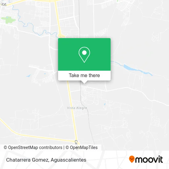
See Chatarrera Gomez, Aguascalientes, on the map
Public Transit to Chatarrera Gomez in Aguascalientes
Wondering how to get to Chatarrera Gomez in Aguascalientes? Moovit helps you find the best way to get to Chatarrera Gomez with step-by-step directions from the nearest public transit station.
Moovit provides free maps and live directions to help you navigate through your city. View schedules, routes, timetables, and find out how long does it take to get to Chatarrera Gomez in real time.
Looking for the nearest stop or station to Chatarrera Gomez? Check out this list of stops closest to your destination: López Mateos; Los Pedroza; Avenida Ferrocarril.
Bus: RUTA 43, RUTA 37, RUTA 47.
Want to see if there’s another route that gets you there at an earlier time? Moovit helps you find alternative routes or times. Get directions from and directions to Chatarrera Gomez easily from the Moovit App or Website.
We make riding to Chatarrera Gomez easy, which is why over 1.5 million users, including users in Aguascalientes, trust Moovit as the best app for public transit. You don’t need to download an individual bus app or train app, Moovit is your all-in-one transit app that helps you find the best bus time or train time available.
For information on prices of bus, costs and ride fares to Chatarrera Gomez, please check the Moovit app.
Use the app to navigate to popular places including to the airport, hospital, stadium, grocery store, mall, coffee shop, school, college, and university.
Chatarrera Gomez Address: Chatarrera Gomez, Calle Francisco I. Madero, Ejido Arellano, 20340 Aguascalientes, Aguascalientes street in Aguascalientes
- Ejido Arellano,
- Maratón Guadalupano,
- La Casa del Pez,
- Hamburguesas Mary,
- Cristóbal Colon,
- Venta de Productos de Limpieza,
- Aeropuerto de Aguascalientes S.A. de C.V.,
- Etv, 49, Francisco Villa,
- Emiliano Zapata,
- Hamburguesas Blanquita,
- Taqueria Ruiz,
- Abarrotes El Chino,
- Aranzazu Plaza Kristal Aguascalientes,
- Caja Gonzalo Vega Scl,
- Templo Cristiano,
- Papeleria Jose,
- Quimicos Hidrogema,
- Centro de Negocios Sheló Nabel Aguascalientes,
- Telebachillerato Comunitario Arellano,
- Seguros Aguascalientes
Places Near Chatarrera Gomez (Aguascalientes)
- Centro Comercial Altaria, Aguascalientes,
- ESPACIOS, Aguascalientes,
- Parque Las Tres Centurias, Aguascalientes,
- Central De Autobuses, Aguascalientes,
- La Isla San Marcos, Aguascalientes,
- Villasuncion, Aguascalientes,
- Imss Clinica 1, Aguascalientes,
- Aeropuerto de Aguascalientes S.A. de C.V., Aguascalientes,
- clinica 3 uaa, Aguascalientes,
- Universidad Autónoma de Aguascalientes, Aguascalientes,
- Agropecuario, Aguascalientes,
- Jesús María, Aguascalientes,
- Blvd. Luis Donaldo Colosio, Aguascalientes,
- Isla San Marcos, Aguascalientes,
- Centro, Aguascalientes,
- Nuevo Hospital Hidalgo, Aguascalientes,
- Ciudad industrial, Aguascalientes,
- Terminal De Combis, Aguascalientes,
- Hospital Imss No. 3, Aguascalientes,
- Villas de Nuestra Señora de la Asunción, Aguascalientes
How to get to popular places in Aguascalientes with public transit
Get around Aguascalientes by public transit!
Traveling around Aguascalientes has never been so easy. See step by step directions as you travel to any attraction, street or major public transit station. View bus and train schedules, arrival times, service alerts and detailed routes on a map, so you know exactly how to get to anywhere in Aguascalientes.
When traveling to any destination around Aguascalientes use Moovit's Live Directions with Get Off Notifications to know exactly where and how far to walk, how long to wait for your line, and how many stops are left. Moovit will alert you when it's time to get off — no need to constantly re-check whether yours is the next stop.
Wondering how to use public transit in Aguascalientes or how to pay for public transit in Aguascalientes? Moovit public transit app can help you navigate your way with public transit easily, and at minimum cost. It includes public transit fees, ticket prices, and costs. Looking for a map of Aguascalientes public transit lines? Moovit public transit app shows all public transit maps in Aguascalientes with all bus routes and stops on an interactive map.
Aguascalientes has 1 transit type(s), including: bus, operated by several transit agencies, including Coordinación General de Movilidad