How to get to Seguros Aguascalientes by bus?
Click on the bus route to see step by step directions with maps, line arrival times and updated time schedules.
From Coto San Nicolás
52 minFrom Blvd. Juan Pablo II
58 minFrom Haciendas de Aguascalientes
74 minFrom Calle Benjamín de la Mora
39 minFrom Walmart
31 minFrom Fraccionamiento Fundadores
49 minFrom Cinemas Kristal
51 minFrom Crit Teleton Ags
50 minFrom Clínica & Maternidad Asunción
37 minFrom Bodega Aurrera Haciendas
73 min
Bus stops near Seguros Aguascalientes
Bus lines to Seguros Aguascalientes
What are the closest stations to Seguros Aguascalientes?
The closest stations to Seguros Aguascalientes are:
- López Mateos, 103 is 43 meters away, 1 min walk.
- Los Pedroza, 121 is 853 meters away, 11 min walk.
- Alfredo De Lara, 101 is 1479 meters away, 19 min walk.
Which bus line stops near Seguros Aguascalientes?
RUTA 43 (San Antonio)
What’s the nearest bus station to Seguros Aguascalientes?
The nearest bus station to Seguros Aguascalientes is López Mateos, 103. It’s a 1 min walk away.
What time is the first bus to Seguros Aguascalientes?
The RUTA 37 is the first bus that goes to Seguros Aguascalientes. It stops nearby at 5:45 AM.
What time is the last bus to Seguros Aguascalientes?
The RUTA 43 is the last bus that goes to Seguros Aguascalientes. It stops nearby at 10:47 PM.
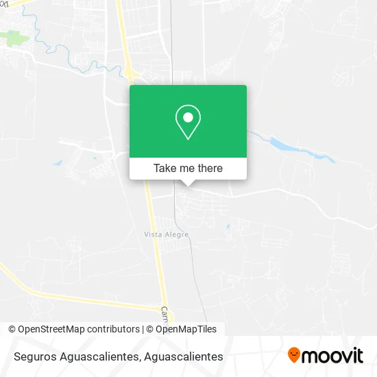
See Seguros Aguascalientes on the map
Public Transportation to Seguros Aguascalientes
Wondering how to get to Seguros Aguascalientes? Moovit helps you find the best way to get to Seguros Aguascalientes with step-by-step directions from the nearest public transit station.
Moovit provides free maps and live directions to help you navigate through your city. View schedules, routes, timetables, and find out how long does it take to get to Seguros Aguascalientes in real time.
Looking for the nearest stop or station to Seguros Aguascalientes? Check out this list of stops closest to your destination: López Mateos; Los Pedroza; Alfredo De Lara.
Bus: RUTA 43, RUTA 37, RUTA 47.
Want to see if there’s another route that gets you there at an earlier time? Moovit helps you find alternative routes or times. Get directions from and directions to Seguros Aguascalientes easily from the Moovit App or Website.
We make riding to Seguros Aguascalientes easy, which is why over 1.5 million users, including users in Aguascalientes, trust Moovit as the best app for public transit. You don’t need to download an individual bus app or train app, Moovit is your all-in-one transit app that helps you find the best bus time or train time available.
For information on prices of bus, costs and ride fares to Seguros Aguascalientes, please check the Moovit app.
Use the app to navigate to popular places including to the airport, hospital, stadium, grocery store, mall, coffee shop, school, college, and university.
Seguros Aguascalientes Address: Avenida Adolfo López Mateos, Fraccionamiento Lotes de Arellano, 20298 Aguascalientes, Aguascaliente street in Aguascalientes
- Centro de Negocios Sheló Nabel Aguascalientes,
- Abarrotes El Chino,
- Hoverboard Aguascalientes,
- Edificio Medico Okabe,
- Templo Cristiano,
- Emiliano Zapata,
- Hamburguesas Blanquita,
- Cristóbal Colon,
- Papeleria Jose,
- Venta de Productos de Limpieza,
- Telebachillerato Comunitario Arellano,
- Etv, 49, Francisco Villa,
- Maratón Guadalupano,
- Ejido Arellano,
- La Casa del Pez,
- Chatarrera Gomez,
- Taqueria Ruiz,
- Hamburguesas Mary,
- Aranzazu Plaza Kristal Aguascalientes,
- Aeropuerto de Aguascalientes S.A. de C.V.
Places Near Seguros Aguascalientes
- Jesús María, Aguascalientes,
- clinica 3 uaa, Aguascalientes,
- Nuevo Hospital Hidalgo, Aguascalientes,
- La Isla San Marcos, Aguascalientes,
- ESPACIOS, Aguascalientes,
- Hospital Imss No. 3, Aguascalientes,
- Imss Clinica 1, Aguascalientes,
- Universidad Autónoma de Aguascalientes, Aguascalientes,
- Agropecuario, Aguascalientes,
- Parque Las Tres Centurias, Aguascalientes,
- Ciudad industrial, Aguascalientes,
- Villas de Nuestra Señora de la Asunción, Aguascalientes,
- Centro, Aguascalientes,
- Isla San Marcos, Aguascalientes,
- Blvd. Luis Donaldo Colosio, Aguascalientes,
- Central De Autobuses, Aguascalientes,
- Terminal De Combis, Aguascalientes,
- Centro Comercial Altaria, Aguascalientes,
- Villasuncion, Aguascalientes,
- Aeropuerto de Aguascalientes S.A. de C.V., Aguascalientes
How to get to popular places in Aguascalientes with public transit
Get around Aguascalientes by public transit!
Traveling around Aguascalientes has never been so easy. See step by step directions as you travel to any attraction, street or major public transit station. View bus and train schedules, arrival times, service alerts and detailed routes on a map, so you know exactly how to get to anywhere in Aguascalientes.
When traveling to any destination around Aguascalientes use Moovit's Live Directions with Get Off Notifications to know exactly where and how far to walk, how long to wait for your line, and how many stops are left. Moovit will alert you when it's time to get off — no need to constantly re-check whether yours is the next stop.
Wondering how to use public transit in Aguascalientes or how to pay for public transit in Aguascalientes? Moovit public transit app can help you navigate your way with public transit easily, and at minimum cost. It includes public transit fees, ticket prices, and costs. Looking for a map of Aguascalientes public transit lines? Moovit public transit app shows all public transit maps in Aguascalientes with all bus routes and stops on an interactive map.
Aguascalientes has 1 transit type(s), including: bus, operated by several transit agencies, including Coordinación General de Movilidad