Directions to Cherry Brook Park (Boston) with public transportation
The following transit lines have routes that pass near Cherry Brook Park
 Train: FITCHBURG.
Train station near Cherry Brook Park in Boston
- Lincoln, 2 min walk,VIEW
- Wellesleyweston Magazine,
- Eyad Haidar,
- Weston,
- Weston MA USA,
- Amana Certified Appliance Repair,
- Waltham Woods Conference Center,
- Biohub Boston,
- Weston, Massachusetts,
- Saint Peters Episcopal Church,
- Astrazeneca Bos / Garage#1,
- 860 Winter Street,
- Master Plumber,
- Lincoln Removal Services,
- 880 Winter St,
- Boston Appearl Marketing,
- Stepping Stones Global Ministries,
- Verizon LTE Innovation Center,
- Alkermes,
- The American Dental Association,
- Stack Garage Doors
Places Near Cherry Brook Park (Boston)
- Cheers, Boston,
- Boston Children's Hospital, Boston,
- Boston Medical Center, Boston,
- Prudential Center, Boston,
- Boston Convention & Exhibition Center, Boston,
- Wilbur Theatre, Boston,
- Quincy Market, Boston,
- Castle Island, Boston,
- Mgm Music Hall, Boston,
- House Of Blues, Boston,
- Isabella Stewart Gardner Museum, Boston,
- Td Garden, Boston,
- Seaport District, Boston,
- North End, Boston,
- Museum Of Science, Boston,
- Massachusetts General Hospital, Boston,
- Leader Bank Pavilion (Leader Bank Pavillion), Boston,
- Boston Common, Boston,
- Wang Theater, Boston,
- Faneuil Hall, Boston
How to get to popular places in Boston with public transit
What are the closest stations to Cherry Brook Park?
The closest stations to Cherry Brook Park are:
- Lincoln is 151 yards away, 2 min walk.
Which train line stops near Cherry Brook Park?
FITCHBURG (#409 | Wachusett)
What’s the nearest train station to Cherry Brook Park in Boston?
The nearest train station to Cherry Brook Park in Boston is Lincoln. It’s a 2 min walk away.
What time is the first train to Cherry Brook Park in Boston?
The FITCHBURG is the first train that goes to Cherry Brook Park in Boston. It stops nearby at 5:27 AM.
What time is the last train to Cherry Brook Park in Boston?
The FITCHBURG is the last train that goes to Cherry Brook Park in Boston. It stops nearby at 12:24 AM.
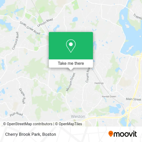
See Cherry Brook Park, Boston, on the map
Public Transit to Cherry Brook Park in Boston
Wondering how to get to Cherry Brook Park in Boston? Moovit helps you find the best way to get to Cherry Brook Park with step-by-step directions from the nearest public transit station.
Moovit provides free maps and live directions to help you navigate through your city. View schedules, routes, timetables, and find out how long does it take to get to Cherry Brook Park in real time.
Looking for the nearest stop or station to Cherry Brook Park? Check out this list of stops closest to your destination: Lincoln.
Train: FITCHBURG.
Want to see if there’s another route that gets you there at an earlier time? Moovit helps you find alternative routes or times. Get directions from and directions to Cherry Brook Park easily from the Moovit App or Website.
We make riding to Cherry Brook Park easy, which is why over 1.7 million users, including users in Boston, trust Moovit as the best app for public transit. You don’t need to download an individual bus app or train app, Moovit is your all-in-one transit app that helps you find the best bus time or train time available.
For information on prices of bus, train and subway, costs and ride fares to Cherry Brook Park, please check the Moovit app.
Use the app to navigate to popular places including to the airport, hospital, stadium, grocery store, mall, coffee shop, school, college, and university.
Cherry Brook Park Address: 7 Cherry Brook Rd street in Boston
Get around Boston by public transit!
Traveling around Boston has never been so easy. See step by step directions as you travel to any attraction, street or major public transit station. View bus and train schedules, arrival times, service alerts and detailed routes on a map, so you know exactly how to get to anywhere in Boston.
When traveling to any destination around Boston use Moovit's Live Directions with Get Off Notifications to know exactly where and how far to walk, how long to wait for your line, and how many stops are left. Moovit will alert you when it's time to get off — no need to constantly re-check whether yours is the next stop.
Wondering how to use public transit in Boston or how to pay for public transit in Boston? Moovit public transit app can help you navigate your way with public transit easily, and at minimum cost. It includes public transit fees, ticket prices, and costs. Looking for a map of Boston public transit lines? Moovit public transit app shows all public transit maps in Boston with all Bus, Train, Subway and Ferry routes and stops on an interactive map.
Boston has 4 transit type(s), including: Bus, Train, Subway and Ferry, operated by several transit agencies, including MBTA, Southeastern Regional Transit Authority, MetroWest Regional Transit Authority, Rhode Island Public Transit Authority, WRTA, Lowell Regional Transit Authority, Merrimack Valley Transit, Montachusett Regional Transit Authority, Cape Cod Regional Transit Authority, Brockton Area Transit Authority, Martha's Vineyard Transit Authority, the WAVE - Nantucket Regional Transit Authority, GATRA, Cape Ann Transportation Authority and Massport