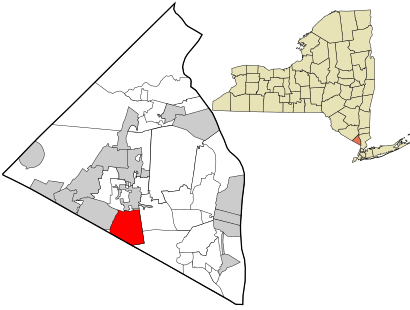
See Chestnut Ridge, New York, Chestnut Ridge, Ny, on the map
Directions to Chestnut Ridge, New York (Chestnut Ridge, Ny) with public transportation
The following transit lines have routes that pass near Chestnut Ridge, New York
 Bus:
Bus: - Train:
How to get to Chestnut Ridge, New York by bus?
Click on the bus route to see step by step directions with maps, line arrival times and updated time schedules.
How to get to Chestnut Ridge, New York by train?
Click on the train route to see step by step directions with maps, line arrival times and updated time schedules.
Bus stations near Chestnut Ridge, New York in Chestnut Ridge, Ny
- Kennedy Dr & Old Nyack Turnpike,11 min walk,
Train stations near Chestnut Ridge, New York in Chestnut Ridge, Ny
- Spring Valley,48 min walk,
Bus lines to Chestnut Ridge, New York in Chestnut Ridge, Ny
- LOOP 3,Suffern- Westbound,
What are the closest stations to Chestnut Ridge, New York?
The closest stations to Chestnut Ridge, New York are:
- Kennedy Dr & Old Nyack Turnpike is 845 yards away, 11 min walk.
- Spring Valley is 4039 yards away, 48 min walk.
Which bus lines stop near Chestnut Ridge, New York?
These bus lines stop near Chestnut Ridge, New York: 59, 92, H03.
Which train line stops near Chestnut Ridge, New York?
PVL
What’s the nearest bus stop to Chestnut Ridge, New York in Chestnut Ridge, Ny?
The nearest bus stop to Chestnut Ridge, New York in Chestnut Ridge, Ny is Kennedy Dr & Old Nyack Turnpike. It’s a 11 min walk away.
What time is the first train to Chestnut Ridge, New York in Chestnut Ridge, Ny?
The PVL is the first train that goes to Chestnut Ridge, New York in Chestnut Ridge, Ny. It stops nearby at 5:10 AM.
What time is the last train to Chestnut Ridge, New York in Chestnut Ridge, Ny?
The PVL is the last train that goes to Chestnut Ridge, New York in Chestnut Ridge, Ny. It stops nearby at 12:22 AM.
What time is the first bus to Chestnut Ridge, New York in Chestnut Ridge, Ny?
The LOOP 3 is the first bus that goes to Chestnut Ridge, New York in Chestnut Ridge, Ny. It stops nearby at 6:48 AM.
What time is the last bus to Chestnut Ridge, New York in Chestnut Ridge, Ny?
The LOOP 3 is the last bus that goes to Chestnut Ridge, New York in Chestnut Ridge, Ny. It stops nearby at 9:34 PM.
How much is the train fare to Chestnut Ridge, New York?
The train fare to Chestnut Ridge, New York costs about $2.25 - $20.75.
How much is the bus fare to Chestnut Ridge, New York?
The bus fare to Chestnut Ridge, New York costs about $2.00 - $2.90.
See Chestnut Ridge, New York, Chestnut Ridge, Ny, on the map
Public Transit to Chestnut Ridge, New York in Chestnut Ridge, Ny
Wondering how to get to Chestnut Ridge, New York in Chestnut Ridge, Ny, United States? Moovit helps you find the best way to get to Chestnut Ridge, New York with step-by-step directions from the nearest public transit station.
Moovit provides free maps and live directions to help you navigate through your city. View schedules, routes, timetables, and find out how long does it take to get to Chestnut Ridge, New York in real time.
Looking for the nearest stop or station to Chestnut Ridge, New York? Check out this list of stops closest to your destination: Kennedy Dr & Old Nyack Turnpike; Spring Valley.
Bus:Train:
Want to see if there’s another route that gets you there at an earlier time? Moovit helps you find alternative routes or times. Get directions from and directions to Chestnut Ridge, New York easily from the Moovit App or Website.
We make riding to Chestnut Ridge, New York easy, which is why over 1.5 million users, including users in Chestnut Ridge, Ny, trust Moovit as the best app for public transit. You don’t need to download an individual bus app or train app, Moovit is your all-in-one transit app that helps you find the best bus time or train time available.
For information on prices of bus and train, costs and ride fares to Chestnut Ridge, New York, please check the Moovit app.
Use the app to navigate to popular places including to the airport, hospital, stadium, grocery store, mall, coffee shop, school, college, and university.
Chestnut Ridge, New York Address: Rockland, NY street in Chestnut Ridge, Ny
Attractions near Chestnut Ridge, New York
Chestnut Rd RT-45,256 Old Nyack Turnpike,SBV Workforce Management,500 Chestnut Ridge Rd,Rockland Mobile Care (Rockland Paramedics),Kakiat Junior High School,Garden St Old Nyack Tpke,S Cole Ave Old Nyack Tpke,Nyack S Cole Ave,Ave Nyack,123 S Cole Ave ,Garden St Gilman,6 Sima Lane,Replace Acetone,F & F Deli Grocery,Sukkah Bros,La Placita Restaurant,Jawonio Apartments,Jon's Paper & Plastic Distributors,MonseyHow to get to popular attractions in Chestnut Ridge, Ny with public transit
Ace Hotel Lobby Bar, Manhattan,Hill Country Chicken, Manhattan,Secaucus, NJ, Secaucus, Nj,Burger Joint, Manhattan,Shake Shack, Manhattan,Lombardi's Coal Oven Pizza, Manhattan,Fette Sau,Peter Luger Steak House,The Meatball Shop,Tom & Jerry's, Manhattan,Clinton St. Baking Co. & Restaurant, Manhattan,Barrage, Manhattan,Hotel Chantelle, Manhattan,Gregory's Coffee, Manhattan,Cookshop, Manhattan,Gyu-Kaku Japanese BBQ, Manhattan,Rattle N Hum, Manhattan,The Park, Manhattan,J.G. Melon, Manhattan,Woorijip, ManhattanGet around Chestnut Ridge, Ny by public transit!
Traveling around Chestnut Ridge, Ny has never been so easy. See step by step directions as you travel to any attraction, street or major public transit station. View bus and train schedules, arrival times, service alerts and detailed routes on a map, so you know exactly how to get to anywhere in Chestnut Ridge, Ny.
When traveling to any destination around Chestnut Ridge, Ny use Moovit's Live Directions with Get Off Notifications to know exactly where and how far to walk, how long to wait for your line, and how many stops are left. Moovit will alert you when it's time to get off — no need to constantly re-check whether yours is the next stop.
Wondering how to use public transit in Chestnut Ridge, Ny or how to pay for public transit in Chestnut Ridge, Ny? Moovit public transit app can help you navigate your way with public transit easily, and at minimum cost. It includes public transit fees, ticket prices, and costs. Looking for a map of Chestnut Ridge, Ny public transit lines? Moovit public transit app shows all public transit maps in Chestnut Ridge, Ny with all bus or train routes and stops on an interactive map.
Chestnut Ridge, Ny has 2 transit type(s), including: bus or train, operated by several transit agencies, including MTA Subway, Metro-North Railroad, LIRR, PATH, Shore Line East, MTA Bus Company, MTA New York City Transit - Express routes, MTA Bus, NJ Transit, NYC Ferry, NICE bus, Bee-Line Bus, NJ Transit Rail, NJ Transit Rail and Norwalk Transit District