Directions to Chica Project (Quincy) with public transportation
The following transit lines have routes that pass near Chica Project
 Bus: 215, 238.
- Train: FALL RIVER/NEW BEDFORD, GREENBUSH.
- Subway: RED LINE.
How to get to Chica Project by bus?
Click on the bus route to see step by step directions with maps, line arrival times and updated time schedules.
From Holiday Inn Express Boston Hotel Boston, Boston
55 minFrom Washington St, Boston
24 minFrom Haymarket, Boston, Boston
58 minFrom The Banshee Bar, Boston
48 minFrom Randolph, MA, Randolph
35 minFrom Sam Adams Boston Brewery Tour, Boston
50 minFrom Samuel Adams Brewery, Boston
50 minFrom Home2 Suites-Boston South Bay, Boston
53 minFrom South Boston, Boston
62 minFrom Arnold Arboretum, Boston
48 min
How to get to Chica Project by train?
Click on the train route to see step by step directions with maps, line arrival times and updated time schedules.
From Holiday Inn Express Boston Hotel Boston, Boston
97 minFrom Washington St, Boston
119 minFrom Haymarket, Boston, Boston
102 minFrom The Banshee Bar, Boston
78 minFrom Randolph, MA, Randolph
73 minFrom Sam Adams Boston Brewery Tour, Boston
97 minFrom Samuel Adams Brewery, Boston
97 minFrom Home2 Suites-Boston South Bay, Boston
94 minFrom South Boston, Boston
94 minFrom Arnold Arboretum, Boston
82 min
How to get to Chica Project by subway?
Click on the subway route to see step by step directions with maps, line arrival times and updated time schedules.
From Holiday Inn Express Boston Hotel Boston, Boston
56 minFrom Washington St, Boston
65 minFrom Haymarket, Boston, Boston
53 minFrom The Banshee Bar, Boston
49 minFrom Sam Adams Boston Brewery Tour, Boston
74 minFrom Samuel Adams Brewery, Boston
74 minFrom Home2 Suites-Boston South Bay, Boston
56 minFrom South Boston, Boston
58 minFrom Arnold Arboretum, Boston
82 min
Bus stops near Chica Project in Quincy
Subway station near Chica Project in Quincy
- Wollaston, 26 min walk,VIEW
What are the closest stations to Chica Project?
The closest stations to Chica Project are:
- Copeland St @ Buckley St is 74 yards away, 2 min walk.
- West St @ Centre St is 389 yards away, 5 min walk.
- Wollaston is 2175 yards away, 26 min walk.
Which bus lines stop near Chica Project?
These bus lines stop near Chica Project: 215, 238.
Which train lines stop near Chica Project?
These train lines stop near Chica Project: FALL RIVER/NEW BEDFORD, GREENBUSH.
Which subway line stops near Chica Project?
RED LINE (Ashmont/Braintree)
What’s the nearest subway station to Chica Project in Quincy?
The nearest subway station to Chica Project in Quincy is Wollaston. It’s a 26 min walk away.
What’s the nearest bus station to Chica Project in Quincy?
The nearest bus station to Chica Project in Quincy is Copeland St @ Buckley St. It’s a 2 min walk away.
What time is the first subway to Chica Project in Quincy?
The RED LINE is the first subway that goes to Chica Project in Quincy. It stops nearby at 5:18 AM.
What time is the last subway to Chica Project in Quincy?
The RED LINE is the last subway that goes to Chica Project in Quincy. It stops nearby at 1:49 AM.
What time is the first bus to Chica Project in Quincy?
The 215 is the first bus that goes to Chica Project in Quincy. It stops nearby at 5:11 AM.
What time is the last bus to Chica Project in Quincy?
The 215 is the last bus that goes to Chica Project in Quincy. It stops nearby at 1:12 AM.
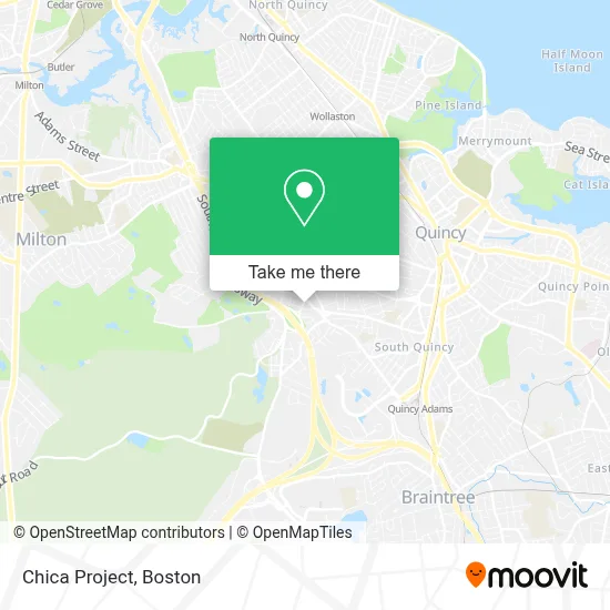
See Chica Project, Quincy, on the map
Public Transit to Chica Project in Quincy
Wondering how to get to Chica Project in Quincy? Moovit helps you find the best way to get to Chica Project with step-by-step directions from the nearest public transit station.
Moovit provides free maps and live directions to help you navigate through your city. View schedules, routes, timetables, and find out how long does it take to get to Chica Project in real time.
Looking for the nearest stop or station to Chica Project? Check out this list of stops closest to your destination: Copeland St @ Buckley St; West St @ Centre St; Wollaston.
Bus: 215, 238.Train: FALL RIVER/NEW BEDFORD, GREENBUSH.Subway: RED LINE.
Want to see if there’s another route that gets you there at an earlier time? Moovit helps you find alternative routes or times. Get directions from and directions to Chica Project easily from the Moovit App or Website.
We make riding to Chica Project easy, which is why over 1.7 million users, including users in Quincy, trust Moovit as the best app for public transit. You don’t need to download an individual bus app or train app, Moovit is your all-in-one transit app that helps you find the best bus time or train time available.
For information on prices of bus, subway and train, costs and ride fares to Chica Project, please check the Moovit app.
Use the app to navigate to popular places including to the airport, hospital, stadium, grocery store, mall, coffee shop, school, college, and university.
Chica Project Address: 1266 Furnace Brook Pkwy street in Quincy
- Sharpturn Mortgage,
- Peacefield Financial,
- Perruzzi Law Offices,
- Ready Kiernan & McNally,
- Beaton Donna Licsw,
- Stepping Stones Group,
- Stronghand Massage Therapy,
- Foot Specialists of New England,
- Quincy Fire Department Engine 5 West Quincy,
- D-Target,
- District Court,
- Prime Behavioral Health,
- Laila Maalouf Law Offices,
- Peter Dewire MD,
- Trust 1 Services,
- Boston Marine in S,
- One Two Locksmith,
- Charbel Automotive,
- Sovereign Sol Well,
- ATM
Places Near Chica Project (Quincy)
- Boston Medical Center, Boston,
- North End, Boston,
- Seaport District, Boston,
- House Of Blues, Boston,
- Cheers, Boston,
- Castle Island, Boston,
- Wang Theater, Boston,
- Isabella Stewart Gardner Museum, Boston,
- Quincy Market, Boston,
- Wilbur Theatre, Boston,
- Massachusetts General Hospital, Boston,
- Td Garden, Boston,
- Boston Children's Hospital, Boston,
- Leader Bank Pavilion (Leader Bank Pavillion), Boston,
- Faneuil Hall, Boston,
- Museum Of Science, Boston,
- Boston Convention & Exhibition Center, Boston,
- Boston Common, Boston,
- Prudential Center, Boston,
- Mgm Music Hall, Boston
How to get to popular places in Boston with public transit
Get around Quincy by public transit!
Traveling around Quincy has never been so easy. See step by step directions as you travel to any attraction, street or major public transit station. View bus and train schedules, arrival times, service alerts and detailed routes on a map, so you know exactly how to get to anywhere in Quincy.
When traveling to any destination around Quincy use Moovit's Live Directions with Get Off Notifications to know exactly where and how far to walk, how long to wait for your line, and how many stops are left. Moovit will alert you when it's time to get off — no need to constantly re-check whether yours is the next stop.
Wondering how to use public transit in Quincy or how to pay for public transit in Quincy? Moovit public transit app can help you navigate your way with public transit easily, and at minimum cost. It includes public transit fees, ticket prices, and costs. Looking for a map of Quincy public transit lines? Moovit public transit app shows all public transit maps in Quincy with all Bus, Train, Subway and Ferry routes and stops on an interactive map.
Boston has 4 transit type(s), including: Bus, Train, Subway and Ferry, operated by several transit agencies, including MBTA, Southeastern Regional Transit Authority, MetroWest Regional Transit Authority, Rhode Island Public Transit Authority, WRTA, Lowell Regional Transit Authority, Merrimack Valley Transit, Montachusett Regional Transit Authority, Cape Cod Regional Transit Authority, Brockton Area Transit Authority, Martha's Vineyard Transit Authority, the WAVE - Nantucket Regional Transit Authority, GATRA, Cape Ann Transportation Authority and Massport