Directions to Chicago Cultural Center with public transportation
The following transit lines have routes that pass near Chicago Cultural Center
 Bus: 143, 147, 148, 2, 6.
- Train: ME, UP-N, LAKESHORE, MONON.
- Chicago 'L': BLUE LINE, GREEN LINE, PINK LINE, PURPLE LINE, RED LINE.
How to get to Chicago Cultural Center by bus?
Click on the bus route to see step by step directions with maps, line arrival times and updated time schedules.
How to get to Chicago Cultural Center by train?
Click on the train route to see step by step directions with maps, line arrival times and updated time schedules.
How to get to Chicago Cultural Center by Chicago 'L'?
Click on the Chicago 'L' route to see step by step directions with maps, line arrival times and updated time schedules.
Bus stops near Chicago Cultural Center
- Michigan & Washington (South), 2 min walk,
- AM Michigan & Randolph (Chicago), 2 min walk,
- Michigan Ave & Randolph St (Pick Up Only), 2 min walk,
- Michigan & Randolph (North), 2 min walk,
- Washington & Wabash (East), 3 min walk,
- State & Randolph (North), 4 min walk,
Chicago 'L' stations near Chicago Cultural Center
- Washington-Blue, 5 min walk,
- Monroe-Red, 7 min walk,
- Washington/Wabash, 11 min walk,
Train station near Chicago Cultural Center
- Millennium Station, 17 min walk,
Bus lines to Chicago Cultural Center
- 3, King Drive,
- 4, Cottage Grove,
- X4, Cottage Grove Express,
- 20, Madison,
- 26, South Shore Express,
- 60, Blue Island/26th,
- 66, Chicago,
- 124, Navy Pier,
- 143, Stockton/Michigan Express,
- 147, Outer DuSable Lake Shore Express,
- 148, Clarendon/Michigan Express,
- 151, Sheridan,
- 157, Streeterville/Taylor,
- CHICAGO DASH, Chicago,
- 850, North Bolingbrook – East Loop Express,
- 851, South Bolingbrook – East Loop Express,
- 855, Plainfield-East Loop Express,
- 6, 79th Street & Lake Shore Drive (West),
- J14, Madison & Jefferson (West),
- 56, Washington & Wabash (East),
What are the closest stations to Chicago Cultural Center?
The closest stations to Chicago Cultural Center are:
- Michigan & Washington (South) stop is 68 yards away, 2 min walk.
- AM Michigan & Randolph (Chicago) stop is 94 yards away, 2 min walk.
- Michigan Ave & Randolph St (Pick Up Only) stop is 135 yards away, 2 min walk.
- Michigan & Randolph (North) stop is 137 yards away, 2 min walk.
- Washington & Wabash (East) stop is 162 yards away, 3 min walk.
- State & Randolph (North) stop is 293 yards away, 4 min walk.
- Washington-Blue station is 366 yards away, 5 min walk.
- Monroe-Red station is 507 yards away, 7 min walk.
- Washington/Wabash station is 914 yards away, 11 min walk.
- Millennium Station is 1397 yards away, 17 min walk.
Which bus lines stop near Chicago Cultural Center?
These bus lines stop near Chicago Cultural Center: 143, 147, 148, 2, 6, 60, J14, X4.
Which train lines stop near Chicago Cultural Center?
These train lines stop near Chicago Cultural Center: ME, UP-N.
Which Chicago 'L' lines stop near Chicago Cultural Center?
These Chicago 'L' lines stop near Chicago Cultural Center: BLUE LINE, GREEN LINE, PINK LINE, PURPLE LINE, RED LINE.
What’s the nearest Chicago 'L' station to Chicago Cultural Center?
The nearest Chicago 'L' station to Chicago Cultural Center is Washington-Blue. It’s a 5 min walk away.
What’s the nearest train station to Chicago Cultural Center?
The nearest train station to Chicago Cultural Center is Millennium Station. It’s a 17 min walk away.
What’s the nearest bus station to Chicago Cultural Center?
The nearest bus stations to Chicago Cultural Center are Michigan & Washington (South), AM Michigan & Randolph (Chicago), Michigan Ave & Randolph St (Pick Up Only) and Michigan & Randolph (North). The closest one is a 2 min walk away.
What time is the first Chicago 'L' to Chicago Cultural Center?
The RED LINE is the first Chicago 'L' that goes to Chicago Cultural Center. It stops nearby at 3:00 AM.
What time is the last Chicago 'L' to Chicago Cultural Center?
The BLUE LINE is the last Chicago 'L' that goes to Chicago Cultural Center. It stops nearby at 3:30 AM.
What time is the first train to Chicago Cultural Center?
The ME is the first train that goes to Chicago Cultural Center. It stops nearby at 4:50 AM.
What time is the last train to Chicago Cultural Center?
The ME is the last train that goes to Chicago Cultural Center. It stops nearby at 12:58 AM.
What time is the first bus to Chicago Cultural Center?
The 66 is the first bus that goes to Chicago Cultural Center. It stops nearby at 3:00 AM.
What time is the last bus to Chicago Cultural Center?
The 60 is the last bus that goes to Chicago Cultural Center. It stops nearby at 3:36 AM.
See Chicago Cultural Center on the map
Public Transportation to Chicago Cultural Center
Wondering how to get to Chicago Cultural Center? Moovit helps you find the best way to get to Chicago Cultural Center with step-by-step directions from the nearest public transit station.
Moovit provides free maps and live directions to help you navigate through your city. View schedules, routes, timetables, and find out how long does it take to get to Chicago Cultural Center in real time.
Looking for the nearest stop or station to Chicago Cultural Center? Check out this list of stops closest to your destination: Michigan & Washington (South); AM Michigan & Randolph (Chicago); Michigan Ave & Randolph St (Pick Up Only); Michigan & Randolph (North); Washington & Wabash (East); State & Randolph (North); Washington-Blue; Monroe-Red; Washington/Wabash; Millennium Station.
Bus: 143, 147, 148, 2, 6, 60, J14, X4, 3, 4, 20, 26, CHICAGO DASH.Train: ME, UP-N, LAKESHORE, MONON.Chicago 'L': BLUE LINE, GREEN LINE, PINK LINE, PURPLE LINE, RED LINE, BROWN LINE, ORANGE LINE.
Want to see if there’s another route that gets you there at an earlier time? Moovit helps you find alternative routes or times. Get directions from and directions to Chicago Cultural Center easily from the Moovit App or Website.
We make riding to Chicago Cultural Center easy, which is why over 1.7 billion users, including users in Chicago, trust Moovit as the best app for public transit. You don’t need to download an individual bus app or train app, Moovit is your all-in-one transit app that helps you find the best bus time or train time available.
For information on prices of bus, Chicago 'L' and train, costs and ride fares to Chicago Cultural Center, please check the Moovit app.
Use the app to navigate to popular places including to the airport, hospital, stadium, grocery store, mall, coffee shop, school, college, and university.
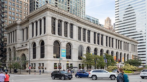
Chicago Cultural Center Address: North Michigan Avenue street in Chicago
- Chicago Cultural Center (Department of Cultural Affairs and Special Events),
- Michigan Ave & Washington St,
- Millennium Park,
- N Michigan Ave / E Randolph St,
- Rush University Medical Center,
- Insight Eapllc,
- LA Fitness,
- 150 N Michigan Building,
- John Hancock,
- Great Lakes,
- Randolph Wabash Station,
- Chicago Behavioral Health,
- Remington's,
- Philippine Consulate General,
- Starbucks,
- Arlo Chicago,
- Ross Dress for Less,
- northwestern memorial hospital icu,
- CTA - Washington/Wabash,
- Kraff Eye Institute
Places Near Chicago Cultural Center
- Grant Park, Chicago,
- Lincoln Park Zoo, Chicago,
- Museum Of Science And Industry, Chicago,
- Field Museum, Chicago,
- United Center, Chicago,
- Chinatown, Chicago,
- Navy Pier, Chicago,
- Wrigley Field, Chicago,
- Soldier Field, Chicago,
- Shedd Aquarium, Chicago,
- Horseshoe Casino Shuttle, Chicago,
- Willis Tower, Chicago,
- Brookfield Zoo, Brookfield,
- Daley Center (Richard J Daley Center), Chicago,
- Ogilvie Transportation Center, Chicago,
- Northwestern Memorial Hospital, Chicago,
- Art Institute Of Chicago, Chicago,
- Salt Shed, Chicago,
- O'Block, Chicago,
- The Bean, Chicago
How to get to popular places in Chicago with public transit
Get around Chicago by public transit!
Traveling around Chicago has never been so easy. See step by step directions as you travel to any attraction, street or major public transit station. View bus and train schedules, arrival times, service alerts and detailed routes on a map, so you know exactly how to get to anywhere in Chicago.
When traveling to any destination around Chicago use Moovit's Live Directions with Get Off Notifications to know exactly where and how far to walk, how long to wait for your line, and how many stops are left. Moovit will alert you when it's time to get off — no need to constantly re-check whether yours is the next stop.
Wondering how to use public transit in Chicago or how to pay for public transit in Chicago? Moovit public transit app can help you navigate your way with public transit easily, and at minimum cost. It includes public transit fees, ticket prices, and costs. Looking for a map of Chicago public transit lines? Moovit public transit app shows all public transit maps in Chicago with all Bus, Train and Chicago 'L' routes and stops on an interactive map.
Chicago has 3 transit type(s), including: Bus, Train and Chicago 'L', operated by several transit agencies, including CTA 'L', Metra, Northern Indiana Commuter Transportation District, CTA, PACE, O'Hare International Airport Shuttle Bus, Gary Public Transit, Amtrak, River Valley Metro, Valpo Transit, DeKalb Public Transit, FlixBus-us, Greyhound-us, Van Galder (Coach USA) and Wisconsin Coach Lines