See Children's Hospital Boston on the map
Directions to Children's Hospital Boston with public transportation
The following transit lines have routes that pass near Children's Hospital Boston
 Bus:
Bus: - Train:
- Subway:
How to get to Children's Hospital Boston by bus?
Click on the bus route to see step by step directions with maps, line arrival times and updated time schedules.
How to get to Children's Hospital Boston by train?
Click on the train route to see step by step directions with maps, line arrival times and updated time schedules.
How to get to Children's Hospital Boston by subway?
Click on the subway route to see step by step directions with maps, line arrival times and updated time schedules.
Bus stations near Children's Hospital Boston
- Brookline Ave @ Park Dr,2 min walk,
- Park Dr @ Fenway Station NB,3 min walk,
- Kilmarnock St @ Peterborough St,6 min walk,
- Brookline Ave Opp Short St,7 min walk,
Subway stations near Children's Hospital Boston
- Longwood,5 min walk,
- Saint Marys Street,11 min walk,
Bus lines to Children's Hospital Boston
- 8,Kenmore via South Bay Center - Harbor Point via South Bay Center,
- 19,Kenmore - Fields Corner,
- 60,Kenmore - Chestnut Hill Mall,
- 65,Kenmore - Brighton Center,
- GREEN LINE D SHUTTLE,Reservoir - Fenway,
- GREEN LINE D SHUTTLE,Riverside - Fenway,
- GREEN LINE D SHUTTLE,Fenway - Kenmore,
- GREEN LINE D SHUTTLE,Newton Highlands - Kenmore,
- GREEN LINE D SHUTTLE,Newton Highlands - Fenway,
- GREEN LINE D SHUTTLE,Reservoir - Kenmore,
- GREEN LINE D SHUTTLE,Brookline Hills - Kenmore,
- GREEN LINE D SHUTTLE,Newton Highlands - Kenmore via Saint Mary's Street,
- GREEN LINE D SHUTTLE,Riverside - Kenmore,
- GREEN LINE D SHUTTLE,Riverside - Kenmore via Saint Mary's Street,
- CT2,Ruggles (Limited Stops) - Sullivan (Limited Stops),
- 47,Broadway - Central Square,
- 55,West Fenway,
- CT3,Beth Israel (Limited Stops),
What are the closest stations to Children's Hospital Boston?
The closest stations to Children's Hospital Boston are:
- Brookline Ave @ Park Dr is 114 yards away, 2 min walk.
- Park Dr @ Fenway Station NB is 175 yards away, 3 min walk.
- Longwood is 371 yards away, 5 min walk.
- Kilmarnock St @ Peterborough St is 429 yards away, 6 min walk.
- Brookline Ave Opp Short St is 530 yards away, 7 min walk.
- Saint Marys Street is 886 yards away, 11 min walk.
Which bus lines stop near Children's Hospital Boston?
These bus lines stop near Children's Hospital Boston: 39, 47, 60, 66.
Which train line stops near Children's Hospital Boston?
FRAMINGHAM/WORCESTER
Which subway line stops near Children's Hospital Boston?
GREEN LINE D
What’s the nearest subway station to Children's Hospital Boston?
The nearest subway station to Children's Hospital Boston is Longwood. It’s a 5 min walk away.
What’s the nearest bus stop to Children's Hospital Boston?
The nearest bus stop to Children's Hospital Boston is Brookline Ave @ Park Dr. It’s a 2 min walk away.
What time is the first subway to Children's Hospital Boston?
The GREEN LINE C is the first subway that goes to Children's Hospital Boston. It stops nearby at 5:03 AM.
What time is the last subway to Children's Hospital Boston?
The GREEN LINE C is the last subway that goes to Children's Hospital Boston. It stops nearby at 1:10 AM.
What time is the first train to Children's Hospital Boston?
The FRAMINGHAM/WORCESTER is the first train that goes to Children's Hospital Boston. It stops nearby at 4:56 AM.
What time is the last train to Children's Hospital Boston?
The FRAMINGHAM/WORCESTER is the last train that goes to Children's Hospital Boston. It stops nearby at 12:04 AM.
What time is the first bus to Children's Hospital Boston?
The 47 is the first bus that goes to Children's Hospital Boston. It stops nearby at 5:17 AM.
What time is the last bus to Children's Hospital Boston?
The NITE is the last bus that goes to Children's Hospital Boston. It stops nearby at 1:57 AM.
How much is the subway fare to Children's Hospital Boston?
The subway fare to Children's Hospital Boston costs about $2.40.
See Children's Hospital Boston on the map
Public Transportation to Children's Hospital Boston
Wondering how to get to Children's Hospital Boston, United States? Moovit helps you find the best way to get to Children's Hospital Boston with step-by-step directions from the nearest public transit station.
Moovit provides free maps and live directions to help you navigate through your city. View schedules, routes, timetables, and find out how long does it take to get to Children's Hospital Boston in real time.
Looking for the nearest stop or station to Children's Hospital Boston? Check out this list of stops closest to your destination: Brookline Ave @ Park Dr; Park Dr @ Fenway Station NB; Longwood; Kilmarnock St @ Peterborough St; Brookline Ave Opp Short St; Saint Marys Street.
Bus:Train:Subway:
Want to see if there’s another route that gets you there at an earlier time? Moovit helps you find alternative routes or times. Get directions from and directions to Children's Hospital Boston easily from the Moovit App or Website.
We make riding to Children's Hospital Boston easy, which is why over 1.5 million users, including users in Boston, trust Moovit as the best app for public transit. You don’t need to download an individual bus app or train app, Moovit is your all-in-one transit app that helps you find the best bus time or train time available.
For information on prices of bus, subway and train, costs and ride fares to Children's Hospital Boston, please check the Moovit app.
Use the app to navigate to popular places including to the airport, hospital, stadium, grocery store, mall, coffee shop, school, college, and university.
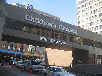
Children's Hospital Boston Address: 401 Park Dr Boston, MA 02215 street in Boston
Attractions near Children's Hospital Boston
Fitness Forward,Union Square Donuts,Pulse,Harvard,Third Party Delivery Integrations,Bright Horizons,401 Park,Regal Cinemas,Bisq,Adam Curtis Dame Agt,Institute for Health & GLBL Environment,MS Clucks Deluxe,Whoop,Trillium Fenway,Saltie Girl,Trillium Brewing Company,MBTA-Fenway (Park Dr @ Fenway Station),BED BATH & BEYOND - Fenway Park,The Green,401 Park Dr / P1-2How to get to popular attractions in Boston with public transit
Cityside Restaurant & Bar, Boston,McGreevy's, Boston,Grafton Street Pub, Cambridge,Ruggles Station, Boston,BJ's Wholesale Club, Haverhill,Dillon's, Boston,Stella, Boston,Planet Fitness, Malden,WaterFire Providence - Waterplace Park,Union Station (WOR), Worcester,Golds Gym,Newport, RI,Mike's Food and Spirits, Somerville,Downtown Providence,Charlestown, Boston,The Phoenix Landing, Cambridge,Neptune Oyster, Boston,Worcester Polytechnic Institute (WPI), Worcester,MBTA Commuter Rail South Attleboro, Attleboro,Portsmouth, RIGet around Boston by public transit!
Traveling around Boston has never been so easy. See step by step directions as you travel to any attraction, street or major public transit station. View bus and train schedules, arrival times, service alerts and detailed routes on a map, so you know exactly how to get to anywhere in Boston.
When traveling to any destination around Boston use Moovit's Live Directions with Get Off Notifications to know exactly where and how far to walk, how long to wait for your line, and how many stops are left. Moovit will alert you when it's time to get off — no need to constantly re-check whether yours is the next stop.
Wondering how to use public transit in Boston or how to pay for public transit in Boston? Moovit public transit app can help you navigate your way with public transit easily, and at minimum cost. It includes public transit fees, ticket prices, and costs. Looking for a map of Boston public transit lines? Moovit public transit app shows all public transit maps in Boston with all bus, subway or train routes and stops on an interactive map.
Boston has 3 transit type(s), including: bus, subway or train, operated by several transit agencies, including MBTA, MBTA, MBTA, Southeastern Regional Transit Authority, MetroWest Regional Transit Authority, Rhode Island Public Transit Authority, WRTA, Lowell Regional Transit Authority, Merrimack Valley Transit, Montachusett Regional Transit Authority, Cape Cod Regional Transit Authority, Brockton Area Transit Authority, Cape Cod Regional Transit Authority, Martha's Vineyard Transit Authority and the WAVE - Nantucket Regional Transit Authority