See Chizuk Amuno Synagogue, Baltimore, on the map
Directions to Chizuk Amuno Synagogue (Baltimore) with public transportation
The following transit lines have routes that pass near Chizuk Amuno Synagogue
 Bus:
Bus: - Metro:
How to get to Chizuk Amuno Synagogue by bus?
Click on the bus route to see step by step directions with maps, line arrival times and updated time schedules.
How to get to Chizuk Amuno Synagogue by metro?
Click on the metro route to see step by step directions with maps, line arrival times and updated time schedules.
Bus stations near Chizuk Amuno Synagogue in Baltimore
- Lombard St & Albemarle St,4 min walk,
- Caroline St & Fayette St Sb,9 min walk,
- Fleet & Exeter,10 min walk,
Bus lines to Chizuk Amuno Synagogue in Baltimore
- CITYLINK BROWN,Um Medical Center,
- 65,Dundalk Marine Terminal,
- ORANGE ROUTE,Jewish Museum Of Maryland (Wb),
- 704,Canton/Fells Point- Students Only,
- CITYLINK LIME,Harbor East,
- 150,Downtown/Harbor East,
- GREEN ROUTE,Madison St. (Eb),
What are the closest stations to Chizuk Amuno Synagogue?
The closest stations to Chizuk Amuno Synagogue are:
- Lombard St & Albemarle St is 287 yards away, 4 min walk.
- Caroline St & Fayette St Sb is 699 yards away, 9 min walk.
- Fleet & Exeter is 793 yards away, 10 min walk.
Which bus lines stop near Chizuk Amuno Synagogue?
These bus lines stop near Chizuk Amuno Synagogue: CITYLINK BLUE, CITYLINK BROWN, CITYLINK PURPLE, COMMERCE STREET - COMMERCE STREET.
Which metro line stops near Chizuk Amuno Synagogue?
METRO
What’s the nearest bus stop to Chizuk Amuno Synagogue in Baltimore?
The nearest bus stop to Chizuk Amuno Synagogue in Baltimore is Lombard St & Albemarle St. It’s a 4 min walk away.
See Chizuk Amuno Synagogue, Baltimore, on the map
Public Transit to Chizuk Amuno Synagogue in Baltimore
Wondering how to get to Chizuk Amuno Synagogue in Baltimore, United States? Moovit helps you find the best way to get to Chizuk Amuno Synagogue with step-by-step directions from the nearest public transit station.
Moovit provides free maps and live directions to help you navigate through your city. View schedules, routes, timetables, and find out how long does it take to get to Chizuk Amuno Synagogue in real time.
Looking for the nearest stop or station to Chizuk Amuno Synagogue? Check out this list of stops closest to your destination: Lombard St & Albemarle St; Caroline St & Fayette St Sb; Fleet & Exeter.
Bus:Metro:
Want to see if there’s another route that gets you there at an earlier time? Moovit helps you find alternative routes or times. Get directions from and directions to Chizuk Amuno Synagogue easily from the Moovit App or Website.
We make riding to Chizuk Amuno Synagogue easy, which is why over 1.5 million users, including users in Baltimore, trust Moovit as the best app for public transit. You don’t need to download an individual bus app or train app, Moovit is your all-in-one transit app that helps you find the best bus time or train time available.
For information on prices of bus, metro and light rail, costs and ride fares to Chizuk Amuno Synagogue, please check the Moovit app.
Use the app to navigate to popular places including to the airport, hospital, stadium, grocery store, mall, coffee shop, school, college, and university.
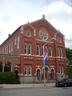
Chizuk Amuno Synagogue Address: Lloyd Street street in Baltimore
Attractions near Chizuk Amuno Synagogue
Jewish Museum of Maryland,Lombard Lloyd,Lombard at Samuel Attman's Way,Jewish Museum of Maryland ,Lloyd Street Synagogue,Lombard and Horseradish,Lombard Horseradish Ln,KoldKiss,Bal St N Aisquith St,Baltimore Aisquith St,Lloyd Granby St,Helping Up Mission,Economic International Salon & Spa,Helping Up Mission (Helping Up Missions),Baltimore Rekey My Lock Locksmith,Just Temps,Lombard St S Exeter St,Central & Lombard St,Central & Lomb St,Beazer HomesHow to get to popular attractions in Baltimore with public transit
Hard Rock Cafe Washington DC, Washington,Agora, Washington,Estadio, Washington,AMC Owings Mills 17, Baltimore County,Costco Wholesale, Howard County,Glen Burnie, MD, Anne Arundel County,Urbana, Washington,Matchbox Vintage Pizza Bistro, Washington,Centreville, VA, Fairfax County,White Flint Metro Station, Montgomery County,Lyon Hall, Arlington County,Columbia, MD, Howard County,Earth Treks Climbing Center, Montgomery County,Nordstrom Tysons Corner Center, Fairfax County,The Hippodrome Theatre at the France-Merrick Performing Arts Center, Baltimore,Bar Louie, Washington,Towson, MD, Baltimore County,Shaw's Tavern, Washington,District Chophouse & Brewery, Washington,Perry Hall, Maryland, Baltimore CountyGet around Baltimore by public transit!
Traveling around Baltimore has never been so easy. See step by step directions as you travel to any attraction, street or major public transit station. View bus and train schedules, arrival times, service alerts and detailed routes on a map, so you know exactly how to get to anywhere in Baltimore.
When traveling to any destination around Baltimore use Moovit's Live Directions with Get Off Notifications to know exactly where and how far to walk, how long to wait for your line, and how many stops are left. Moovit will alert you when it's time to get off — no need to constantly re-check whether yours is the next stop.
Wondering how to use public transit in Baltimore or how to pay for public transit in Baltimore? Moovit public transit app can help you navigate your way with public transit easily, and at minimum cost. It includes public transit fees, ticket prices, and costs. Looking for a map of Baltimore public transit lines? Moovit public transit app shows all public transit maps in Baltimore with all bus, metro or light rail routes and stops on an interactive map.
Baltimore has 3 transit type(s), including: bus, metro or light rail, operated by several transit agencies, including WMATA, WMATA, Montgomery County Ride On, Fairfax Connector, TheBus, DC Circulator, MDOT MTA, Marc, MDOT MTA, MDOT MTA, Virginia Railway Express (VRE), PRTC, DASH - Alexandria, Arlington Transit (ART) and DC Streetcar