See Church & 29th St, Noe Valley, Sf, on the map
Directions to Church & 29th St (Noe Valley, Sf) with public transportation
The following transit lines have routes that pass near Church & 29th St
 Bus:
Bus: - BART:
- Light Rail:
How to get to Church & 29th St by bus?
Click on the bus route to see step by step directions with maps, line arrival times and updated time schedules.
How to get to Church & 29th St by BART?
Click on the BART route to see step by step directions with maps, line arrival times and updated time schedules.
Light Rail stations near Church & 29th St in Noe Valley, Sf
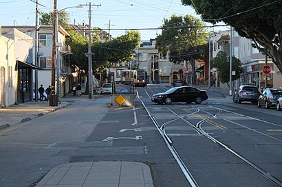
- Church St & 29th St,1 min walk,
Bus stations near Church & 29th St in Noe Valley, Sf
- 30th St & Church St,3 min walk,
Bus lines to Church & 29th St in Noe Valley, Sf
- 24,Jackson + Fillmore,
What are the closest stations to Church & 29th St?
The closest stations to Church & 29th St are:
- Church St & 29th St is 26 yards away, 1 min walk.
- 30th St & Church St is 168 yards away, 3 min walk.
Which bus lines stop near Church & 29th St?
These bus lines stop near Church & 29th St: 14R, 24, 49.
Which BART lines stop near Church & 29th St?
These BART lines stop near Church & 29th St: ANTIOCH - SFIA/MILLBRAE, RICHMOND - DALY CITY/MILLBRAE, WARM SPRINGS/SOUTH FREMONT - DALY CITY.
Which light rail line stops near Church & 29th St?
KJ
What’s the nearest light rail station to Church & 29th St in Noe Valley, Sf?
The nearest light rail station to Church & 29th St in Noe Valley, Sf is Church St & 29th St. It’s a 1 min walk away.
What’s the nearest bus stop to Church & 29th St in Noe Valley, Sf?
The nearest bus stop to Church & 29th St in Noe Valley, Sf is 30th St & Church St. It’s a 3 min walk away.
See Church & 29th St, Noe Valley, Sf, on the map
Public Transit to Church & 29th St in Noe Valley, Sf
Wondering how to get to Church & 29th St in Noe Valley, Sf, United States? Moovit helps you find the best way to get to Church & 29th St with step-by-step directions from the nearest public transit station.
Moovit provides free maps and live directions to help you navigate through your city. View schedules, routes, timetables, and find out how long does it take to get to Church & 29th St in real time.
Looking for the nearest stop or station to Church & 29th St? Check out this list of stops closest to your destination: Church St & 29th St; 30th St & Church St.
Bus:BART:Light Rail:
Want to see if there’s another route that gets you there at an earlier time? Moovit helps you find alternative routes or times. Get directions from and directions to Church & 29th St easily from the Moovit App or Website.
We make riding to Church & 29th St easy, which is why over 1.5 million users, including users in Noe Valley, Sf, trust Moovit as the best app for public transit. You don’t need to download an individual bus app or train app, Moovit is your all-in-one transit app that helps you find the best bus time or train time available.
For information on prices of bus, light rail, BART and cable car, costs and ride fares to Church & 29th St, please check the Moovit app.
Use the app to navigate to popular places including to the airport, hospital, stadium, grocery store, mall, coffee shop, school, college, and university.
Church & 29th St Address: Church Street street in Noe Valley, Sf
Attractions near Church & 29th St
Counseling Centers Of Ciis,Henry's Hunan,Wash And Dry,Pacific Heights Handyman,Coin Wash & Dry,Drewes Brothers Meats,Dr. E. F. Savio, Dr. C. I. Skelley, Dr. Ted Savio, Dentistry,Henry's Hunan Restaurant,Savio Tad DDS,Deep Sushi,Baron's Quality Meats,Barons Meats,Pacific Family Practice Medical Group,Wash & Dry,K-9 Wash Club,Tataki Sushi & Sake Bar,Getzwell Pediatrics,Muni J Stop #13999,Tataki South,Regent ThaiHow to get to popular attractions in Noe Valley, Sf with public transit
Regal Cinemas Hacienda Crossings 21 & IMAX, Dublin,The Home Depot, Concord,Safeway, Hayward,Charles M. Schulz - Sonoma County Airport (STS),Googleplex,AMC Saratoga 14, San Jose,Japantown, Western Addition, Sf,Safeway, Rohnert Park,Boudin Bakery Café SFO, Sfo,Costco Wholesale, Antioch,Costco Wholesale, Santa Clara,California's Great America, Santa Clara,Best Western Plus Grosvenor Airport Hotel, South San Francisco,City of Cupertino, Cupertino,Genentech Inc, South San Francisco,Serramonte Center, Daly City,Nordstrom Valley Fair, San Jose,I-680 / US-101 / I-280 Interchange, San Jose,Renaissance ClubSport Walnut Creek Hotel, Contra Costa Centre,Union City BART Station, Union CityGet around Noe Valley, Sf by public transit!
Traveling around Noe Valley, Sf has never been so easy. See step by step directions as you travel to any attraction, street or major public transit station. View bus and train schedules, arrival times, service alerts and detailed routes on a map, so you know exactly how to get to anywhere in Noe Valley, Sf.
When traveling to any destination around Noe Valley, Sf use Moovit's Live Directions with Get Off Notifications to know exactly where and how far to walk, how long to wait for your line, and how many stops are left. Moovit will alert you when it's time to get off — no need to constantly re-check whether yours is the next stop.
Wondering how to use public transit in Noe Valley, Sf or how to pay for public transit in Noe Valley, Sf? Moovit public transit app can help you navigate your way with public transit easily, and at minimum cost. It includes public transit fees, ticket prices, and costs. Looking for a map of Noe Valley, Sf public transit lines? Moovit public transit app shows all public transit maps in Noe Valley, Sf with all bus, light rail, BART or cable car routes and stops on an interactive map.
Noe Valley, Sf has 4 transit type(s), including: bus, light rail, BART or cable car, operated by several transit agencies, including BART, Bay Area Rapid Transit, Muni Metro, Caltrain, VTA, Capitol Corridor, Sonoma Marin Area Rail Transit, MUNI, VTA, SF Cable Car, AC Transit, Dumbarton Express, Golden Gate Transit, County Connection and SamTrans