Directions to Church Of The Guardian Angel (Manhattan) with public transportation
The following transit lines have routes that pass near Church Of The Guardian Angel
How to get to Church Of The Guardian Angel by bus?
Click on the bus route to see step by step directions with maps, line arrival times and updated time schedules.
How to get to Church Of The Guardian Angel by train?
Click on the train route to see step by step directions with maps, line arrival times and updated time schedules.
How to get to Church Of The Guardian Angel by subway?
Click on the subway route to see step by step directions with maps, line arrival times and updated time schedules.
Bus stations near Church Of The Guardian Angel in Manhattan
- 10 Av/W 19 St,2 min walk,
- W 23 St/10 Av,2 min walk,
Bus lines to Church Of The Guardian Angel in Manhattan
- M11,Riverbank 145 St Via 10 Av,
- M23-SBS,Select Bus East Side Avenue C Crosstown,
What are the closest stations to Church Of The Guardian Angel?
The closest stations to Church Of The Guardian Angel are:
- 10 Av/W 19 St is 126 yards away, 2 min walk.
- W 23 St/10 Av is 161 yards away, 2 min walk.
Which bus lines stop near Church Of The Guardian Angel?
These bus lines stop near Church Of The Guardian Angel: M11, M14A, M23-SBS.
Which train lines stop near Church Of The Guardian Angel?
These train lines stop near Church Of The Guardian Angel: PATH, PORT JEFFERSON.
Which subway lines stop near Church Of The Guardian Angel?
These subway lines stop near Church Of The Guardian Angel: C, L.
What’s the nearest bus stop to Church Of The Guardian Angel in Manhattan?
The nearest bus stops to Church Of The Guardian Angel in Manhattan are 10 Av/W 19 St and W 23 St/10 Av. The closest one is a 2 min walk away.
See Church Of The Guardian Angel, Manhattan, on the map
Public Transit to Church Of The Guardian Angel in Manhattan
Wondering how to get to Church Of The Guardian Angel in Manhattan, United States? Moovit helps you find the best way to get to Church Of The Guardian Angel with step-by-step directions from the nearest public transit station.
Moovit provides free maps and live directions to help you navigate through your city. View schedules, routes, timetables, and find out how long does it take to get to Church Of The Guardian Angel in real time.
Looking for the nearest stop or station to Church Of The Guardian Angel? Check out this list of stops closest to your destination: 10 Av/W 19 St; W 23 St/10 Av.
Bus:M11M14AM23-SBSTrain:PATHPORT JEFFERSONSubway:CL
Want to see if there’s another route that gets you there at an earlier time? Moovit helps you find alternative routes or times. Get directions from and directions to Church Of The Guardian Angel easily from the Moovit App or Website.
We make riding to Church Of The Guardian Angel easy, which is why over 1.5 million users, including users in Manhattan, trust Moovit as the best app for public transit. You don’t need to download an individual bus app or train app, Moovit is your all-in-one transit app that helps you find the best bus time or train time available.
For information on prices of bus, subway and train, costs and ride fares to Church Of The Guardian Angel, please check the Moovit app.
Use the app to navigate to popular places including to the airport, hospital, stadium, grocery store, mall, coffee shop, school, college, and university.
Church Of The Guardian Angel Address: 10th Avenue street in Manhattan
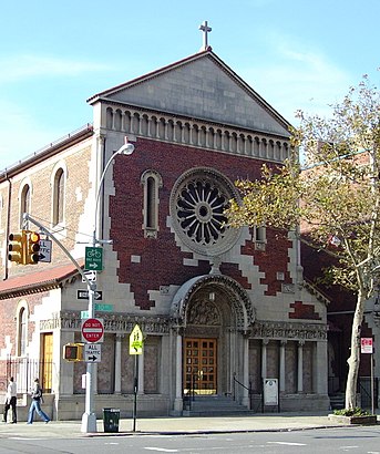
The Church of the Guardian Angel is a Roman Catholic church in the Roman Catholic Archdiocese of New York, located at 193 Tenth Avenue, Chelsea, Manhattan, New York City, New York.Wiki
Attractions near Church Of The Guardian Angel
Chapel of the Guardian Angel,High Line,Guardian Angel Church,500 W21 St Condominium,Nohra Haime Gallery,Lorenzo Lopez Interiors,Edison ParkFast,Guardian Angel School,Pagoto Organic Ice Cream,Printed Matter Inc,W 21st St (21st 10th),W 21st St (10th 21st street),W 21st St (21st street and 10th Ave),W 21st St ,W 21st St (21st street intersection 10th),W 21st St (W 21st St & 10th avenue),W 21st St (west 21st street 10th),W 21st St ,W 21st St,W 21st St (10th 21st)How to get to popular attractions in Manhattan with public transit
The 13th Step, Manhattan,The Standard Grill, Manhattan,Veselka, Manhattan,Peter Luger Steak House,Central Park SummerStage, Manhattan,Avenue, Manhattan,Ace Hotel Lobby Bar, Manhattan,The Grey Dog, Manhattan,Virgin America Ticket Counter, Elizabeth, Nj,MTA Subway - 42nd St / Bryant Park (B / D/F / M/7), Manhattan,Rubirosa Ristorante, Manhattan,NJT - New Brunswick Station (NEC), New Brunswick, Nj,Upper West Side, Manhattan,Great Lawn, Manhattan,Shake Shack, Manhattan,Jackson Heights, NY, Queens,Secaucus, NJ, Secaucus, Nj,Ferrara Bakery, Manhattan,The Dead Rabbit, Manhattan,The Kunjip, ManhattanGet around Manhattan by public transit!
Traveling around Manhattan has never been so easy. See step by step directions as you travel to any attraction, street or major public transit station. View bus and train schedules, arrival times, service alerts and detailed routes on a map, so you know exactly how to get to anywhere in Manhattan.
When traveling to any destination around Manhattan use Moovit's Live Directions with Get Off Notifications to know exactly where and how far to walk, how long to wait for your line, and how many stops are left. Moovit will alert you when it's time to get off — no need to constantly re-check whether yours is the next stop.
Wondering how to use public transit in Manhattan or how to pay for public transit in Manhattan? Moovit public transit app can help you navigate your way with public transit easily, and at minimum cost. It includes public transit fees, ticket prices, and costs. Looking for a map of Manhattan public transit lines? Moovit public transit app shows all public transit maps in Manhattan with all bus, subway or train routes and stops on an interactive map.
Manhattan has 3 transit type(s), including: bus, subway or train, operated by several transit agencies, including MTA Subway, Metro-North Railroad, LIRR, PATH, Shore Line East, MTA Bus Company, MTA New York City Transit - Express routes, MTA Bus, NJ Transit, NYC Ferry, NICE bus, Bee-Line Bus, NJ Transit Rail, NJ Transit Rail and Norwalk Transit District