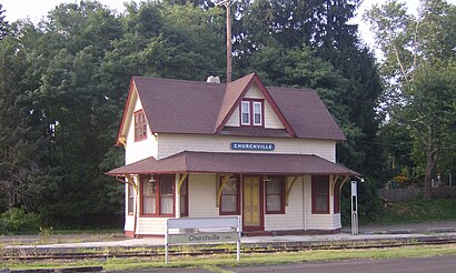
See Churchville Station, Northampton, on the map
Directions to Churchville Station (Northampton) with public transportation
The following transit lines have routes that pass near Churchville Station
 Bus:
Bus:
How to get to Churchville Station by bus?
Click on the bus route to see step by step directions with maps, line arrival times and updated time schedules.
Bus stations near Churchville Station in Northampton
- Street Rd & Knowles Av,36 min walk,
- Bridgetown Pk & Milton St,52 min walk,
Bus lines to Churchville Station in Northampton
- 24,Southampton,
- 58,Neshaminy Mall,
What are the closest stations to Churchville Station?
The closest stations to Churchville Station are:
- Street Rd & Knowles Av is 3060 yards away, 36 min walk.
- Bridgetown Pk & Milton St is 4421 yards away, 52 min walk.
Which bus line stops near Churchville Station?
58
See Churchville Station, Northampton, on the map
Public Transit to Churchville Station in Northampton
Wondering how to get to Churchville Station in Northampton, United States? Moovit helps you find the best way to get to Churchville Station with step-by-step directions from the nearest public transit station.
Moovit provides free maps and live directions to help you navigate through your city. View schedules, routes, timetables, and find out how long does it take to get to Churchville Station in real time.
Looking for the nearest stop or station to Churchville Station? Check out this list of stops closest to your destination: Street Rd & Knowles Av; Bridgetown Pk & Milton St.
Bus:
Want to see if there’s another route that gets you there at an earlier time? Moovit helps you find alternative routes or times. Get directions from and directions to Churchville Station easily from the Moovit App or Website.
We make riding to Churchville Station easy, which is why over 1.5 million users, including users in Northampton, trust Moovit as the best app for public transit. You don’t need to download an individual bus app or train app, Moovit is your all-in-one transit app that helps you find the best bus time or train time available.
For information on prices of bus and train, costs and ride fares to Churchville Station, please check the Moovit app.
Use the app to navigate to popular places including to the airport, hospital, stadium, grocery store, mall, coffee shop, school, college, and university.
Location: Northampton, Philadelphia
Attractions near Churchville Station
125 Bustleton Pike,County Wide Inspections, Inc,Churchville,Art In The Pod,William Way,Wave of the Future,# 3,5 Bustleton Pike,Southampton North,Childtowne Montessori School,183 William Way,Bristol Rd,1380 Bristol Road,22 Green Dr,Ken's Entertainment Group,Churchville Cemetery,1,Bustleton Pike,1500 Bustleton Pike,Churchville InnHow to get to popular attractions in Northampton with public transit
McCarter Theatre, Princeton,Butcher and Singer, Philadelphia,Williamstown, NJ, Williamstown,Fogo De Chão, Philadelphia,Target,Chickie's & Pete's, Philadelphia,Lawrenceville, NJ,Costco Wholesale, Limerick,Amtrak / SEPTA: Exton Station (EXT), West Whiteland,Wegmans,Pottstown, PA, Pottstown,Gloucester City, NJ, Gloucester City,King Of Prussia Mall, King Of Prussia,Our Lady of Lourdes Hospital, Camden,University Medical Center of Princeton at Plainsboro,Havertown, PA, Haverford,SEPTA Conshohocken Station, Conshohocken,Morimoto, Philadelphia,Sonesta Philadelphia Rittenhouse Square, Philadelphia,Three Monkeys Café, PhiladelphiaGet around Northampton by public transit!
Traveling around Northampton has never been so easy. See step by step directions as you travel to any attraction, street or major public transit station. View bus and train schedules, arrival times, service alerts and detailed routes on a map, so you know exactly how to get to anywhere in Northampton.
When traveling to any destination around Northampton use Moovit's Live Directions with Get Off Notifications to know exactly where and how far to walk, how long to wait for your line, and how many stops are left. Moovit will alert you when it's time to get off — no need to constantly re-check whether yours is the next stop.
Wondering how to use public transit in Northampton or how to pay for public transit in Northampton? Moovit public transit app can help you navigate your way with public transit easily, and at minimum cost. It includes public transit fees, ticket prices, and costs. Looking for a map of Northampton public transit lines? Moovit public transit app shows all public transit maps in Northampton with all bus or train routes and stops on an interactive map.
Northampton has 2 transit type(s), including: bus or train, operated by several transit agencies, including SEPTA Subway, SEPTA Trolley, SEPTA Rail, SEPTA, SEPTA, NJ TRANSIT RAIL-Rail, NJ TRANSIT RAIL-Tram, NJ TRANSIT BUS, Port Authority Transit Corporation, Navy Yard, Penn Transit, Drexel University, Pottstown Area Rapid Transit (PART), Fullington Tours and Chescobus