Directions to Cimetière Juif De Bayonne with public transportation
The following transit lines have routes that pass near Cimetière Juif De Bayonne
How to get to Cimetière Juif De Bayonne by bus?
Click on the bus route to see step by step directions with maps, line arrival times and updated time schedules.
Bus stations near Cimetière Juif De Bayonne
- Matràs,7 min walk,
Ferry stations near Cimetière Juif De Bayonne
- Cale De Boucau,43 min walk,
Bus lines to Cimetière Juif De Bayonne
- 30,Square Mora,
- T2,Marrac,
What are the closest stations to Cimetière Juif De Bayonne?
The closest stations to Cimetière Juif De Bayonne are:
- Matràs is 465 meters away, 7 min walk.
- Cale De Boucau is 3362 meters away, 43 min walk.
Which bus lines stop near Cimetière Juif De Bayonne?
These bus lines stop near Cimetière Juif De Bayonne: 30, T2.
What’s the nearest bus stop to Cimetière Juif De Bayonne?
The nearest bus stop to Cimetière Juif De Bayonne is Matràs. It’s a 7 min walk away.
What time is the first bus to Cimetière Juif De Bayonne?
The T2 is the first bus that goes to Cimetière Juif De Bayonne. It stops nearby at 3:08 AM.
What time is the last bus to Cimetière Juif De Bayonne?
The T2 is the last bus that goes to Cimetière Juif De Bayonne. It stops nearby at 2:57 AM.
What time is the first ferry to Cimetière Juif De Bayonne?
The ADOUR 1 is the first ferry that goes to Cimetière Juif De Bayonne. It stops nearby at 7:21 AM.
What time is the last ferry to Cimetière Juif De Bayonne?
The ADOUR 1 is the last ferry that goes to Cimetière Juif De Bayonne. It stops nearby at 7:38 PM.
See Cimetière Juif De Bayonne on the map
Public Transportation to Cimetière Juif De Bayonne
Wondering how to get to Cimetière Juif De Bayonne, France? Moovit helps you find the best way to get to Cimetière Juif De Bayonne with step-by-step directions from the nearest public transit station.
Moovit provides free maps and live directions to help you navigate through your city. View schedules, routes, timetables, and find out how long does it take to get to Cimetière Juif De Bayonne in real time.
Looking for the nearest stop or station to Cimetière Juif De Bayonne? Check out this list of stops closest to your destination: Matràs; Cale De Boucau.
Bus:30T2Ferry:ADOUR 1
Want to see if there’s another route that gets you there at an earlier time? Moovit helps you find alternative routes or times. Get directions from and directions to Cimetière Juif De Bayonne easily from the Moovit App or Website.
We make riding to Cimetière Juif De Bayonne easy, which is why over 1.5 million users, including users in Bayonne, trust Moovit as the best app for public transit. You don’t need to download an individual bus app or train app, Moovit is your all-in-one transit app that helps you find the best bus time or train time available.
For information on prices of bus, costs and ride fares to Cimetière Juif De Bayonne, please check the Moovit app.
Use the app to navigate to popular places including to the airport, hospital, stadium, grocery store, mall, coffee shop, school, college, and university.
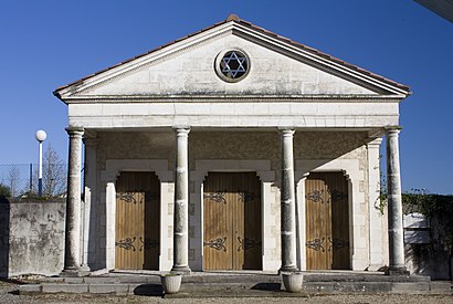
Cimetière Juif De Bayonne Address: Rue du Grand Hargous street in Bayonne
Attractions near Cimetière Juif De Bayonne
Les Délices de Bayonne,Amazon Locker-Elisabeth,Ô Chalet d'Lm,Wash,Phone Company,Mvc Saint-Etienne,Église Saint-Étienne,Cimetière Talouchet,Association Nationale Pour la Formation Professionnelle des Adultes,afpa,25 Chemin de Laharie,Les Douceurs D,Résidence Saute-Ruisseau,Couvreur Charpentier Bayonne,Sud Evenements Sonorisation,45 Avenue Louis de Foix,La Maison des Travaux,Maison De Retraite Oihana,Point.P,64100How to get to popular attractions in Bayonne with public transit
Village Iraty Biarritz, Biarritz,Etcheverry Laurent, Arcangues,Aiha, Tarnos,Ets Uhart, Biarritz,Accoh Mathieu, Biarritz,La Croix des Champs, Biarritz,Irish Pub Biarritz, Biarritz,La Cabana, Ondres,Biarritz Hyper Centre Halles et Cote des Basques, Biarritz,Hondarra, Anglet,Asian 64, Bayonne,Maison Damestoy, Boucau,Lesca Pascal, Biarritz,Louviot Julien, Bassussarry,Le Chinois Gourmand, Anglet,Morgado-Teixido Danielle, Guéthary,Sarl Jacops, Anglet,Bernos Zoé, Guéthary,E. Leclerc, Anglet,Joana Sasco, GuétharyGet around Bayonne by public transit!
Traveling around Bayonne has never been so easy. See step by step directions as you travel to any attraction, street or major public transit station. View bus and train schedules, arrival times, service alerts and detailed routes on a map, so you know exactly how to get to anywhere in Bayonne.
When traveling to any destination around Bayonne use Moovit's Live Directions with Get Off Notifications to know exactly where and how far to walk, how long to wait for your line, and how many stops are left. Moovit will alert you when it's time to get off — no need to constantly re-check whether yours is the next stop.
Wondering how to use public transit in Bayonne or how to pay for public transit in Bayonne? Moovit public transit app can help you navigate your way with public transit easily, and at minimum cost. It includes public transit fees, ticket prices, and costs. Looking for a map of Bayonne public transit lines? Moovit public transit app shows all public transit maps in Bayonne with all bus routes and stops on an interactive map.
Bayonne has 1 transit type(s), including: bus, operated by several transit agencies, including Txik Txak, Txik Txak ❙ Lignes Complémentaires, Txik Txak ❙ Navette Fluviale, Txik Txak ❙ Navettes gratuites de Bayonne, Txik Txak ❙ Lignes Structurantes, Txik Txak ❙ Lignes Tram’Bus, Txik Txak ❙ Cars Express and Txik Txak ❙ Navettes gratuites de Biarritz