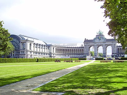
Directions to Cinquantenaire (Brussel) with public transportation
The following transit lines have routes that pass near Cinquantenaire
How to get to Cinquantenaire by bus?
Click on the bus route to see step by step directions with maps, line arrival times and updated time schedules.
How to get to Cinquantenaire by train?
Click on the train route to see step by step directions with maps, line arrival times and updated time schedules.
Bus stations near Cinquantenaire in Brussel
- Gaulois / Galliërs,7 min walk,
- Chevalerie / Ridderschap,7 min walk,
- Merode,8 min walk,
- Nerviens / Nerviërs,9 min walk,
Light Rail stations near Cinquantenaire in Brussel
- Merode,7 min walk,
Train stations near Cinquantenaire in Brussel
- Mérode,8 min walk,
Subway stations near Cinquantenaire in Brussel
- Merode,9 min walk,
Bus lines to Cinquantenaire in Brussel
- 27,Luxembourg,
- N06,Gare Centrale,
- 80,Haren,
- 61,Montgomery,
- M1,Stockel,
- 36,Schuman/Maelbeek,
- 543,Auderghem Herrmann-Debroux,
What are the closest stations to Cinquantenaire?
The closest stations to Cinquantenaire are:
- Gaulois / Galliërs is 466 meters away, 7 min walk.
- Chevalerie / Ridderschap is 478 meters away, 7 min walk.
- Merode is 501 meters away, 7 min walk.
- Mérode is 565 meters away, 8 min walk.
- Nerviens / Nerviërs is 640 meters away, 9 min walk.
Which bus lines stop near Cinquantenaire?
These bus lines stop near Cinquantenaire: 12, 60, 61, 79, 80.
Which train lines stop near Cinquantenaire?
These train lines stop near Cinquantenaire: IC, S4, S8, S9.
Which subway lines stop near Cinquantenaire?
These subway lines stop near Cinquantenaire: 1, 5.
What’s the nearest light rail station to Cinquantenaire in Brussel?
The nearest light rail station to Cinquantenaire in Brussel is Merode. It’s a 7 min walk away.
What’s the nearest subway station to Cinquantenaire in Brussel?
The nearest subway station to Cinquantenaire in Brussel is Merode. It’s a 9 min walk away.
What’s the nearest train station to Cinquantenaire in Brussel?
The nearest train station to Cinquantenaire in Brussel is Mérode. It’s a 8 min walk away.
What’s the nearest bus stop to Cinquantenaire in Brussel?
The nearest bus stops to Cinquantenaire in Brussel are Gaulois / Galliërs and Chevalerie / Ridderschap. The closest one is a 7 min walk away.
What time is the first light rail to Cinquantenaire in Brussel?
The 81 is the first light rail that goes to Cinquantenaire in Brussel. It stops nearby at 4:43 AM.
What time is the last light rail to Cinquantenaire in Brussel?
The 81 is the last light rail that goes to Cinquantenaire in Brussel. It stops nearby at 1:30 AM.
What time is the first subway to Cinquantenaire in Brussel?
The 5 is the first subway that goes to Cinquantenaire in Brussel. It stops nearby at 5:12 AM.
What time is the last subway to Cinquantenaire in Brussel?
The 5 is the last subway that goes to Cinquantenaire in Brussel. It stops nearby at 12:54 AM.
What time is the first train to Cinquantenaire in Brussel?
The S4 is the first train that goes to Cinquantenaire in Brussel. It stops nearby at 6:20 AM.
What time is the last train to Cinquantenaire in Brussel?
The S4 is the last train that goes to Cinquantenaire in Brussel. It stops nearby at 8:41 PM.
What time is the first bus to Cinquantenaire in Brussel?
The 27 is the first bus that goes to Cinquantenaire in Brussel. It stops nearby at 5:15 AM.
What time is the last bus to Cinquantenaire in Brussel?
The M1 is the last bus that goes to Cinquantenaire in Brussel. It stops nearby at 12:52 AM.
See Cinquantenaire, Brussel, on the map
Public Transit to Cinquantenaire in Brussel
Wondering how to get to Cinquantenaire in Brussel, Belgium? Moovit helps you find the best way to get to Cinquantenaire with step-by-step directions from the nearest public transit station.
Moovit provides free maps and live directions to help you navigate through your city. View schedules, routes, timetables, and find out how long does it take to get to Cinquantenaire in real time.
Looking for the nearest stop or station to Cinquantenaire? Check out this list of stops closest to your destination: Gaulois / Galliërs; Chevalerie / Ridderschap; Merode; Mérode; Nerviens / Nerviërs.
Bus:126061798027N06M1Train:ICS4S8S9S7Subway:15
Want to see if there’s another route that gets you there at an earlier time? Moovit helps you find alternative routes or times. Get directions from and directions to Cinquantenaire easily from the Moovit App or Website.
We make riding to Cinquantenaire easy, which is why over 1.5 million users, including users in Brussel, trust Moovit as the best app for public transit. You don’t need to download an individual bus app or train app, Moovit is your all-in-one transit app that helps you find the best bus time or train time available.
For information on prices of bus, train and subway, costs and ride fares to Cinquantenaire, please check the Moovit app.
Use the app to navigate to popular places including to the airport, hospital, stadium, grocery store, mall, coffee shop, school, college, and university.
Location: Brussel, Belgium
Attractions near Cinquantenaire
Parc du Cinquantenaire - Jubelpark,Parc Cinquantenaire Brussels,Arcades du Cinquantenaire - Triomfboog Van Het Jubelpark,Royal Museum Of the Armed Forces And Military - History Documentation Centre,Parc du Cinquantenaire,Jubelpark,Royal Museum of the Armed Forces and Military History ,Musée Art & Histoire - Museum Kunst & Geschiedenis,Koninklijk Legermuseum Brussel,Parc du Cinquantenaire 10,Autoworld,Autoworld Museum,Jubelpark 1,Kmkg,Renaissancelaan,Metro 5 Erasmus > Herrmann-Debroux,Acea,Karel de Grotelaan,Digit,Galliërs / Gaulois (MIVB / STIB)How to get to popular attractions in Brussel with public transit
Station Luttre (Gare de Luttre), Pont-À-Celles,Delhaize, Aalst,Bocadero, Antwerpen,De Ardennen, Tenneville,DreamLand, Oostende,Gits, Hooglede,Machelen-aan-de-Leie, Zulte,Station Gavere-Asper, Gavere,WZC Ten Anker, Nieuwpoort,VTI Spijker, Hoogstraten,Geluwe, Wervik,SBAT Examencentrum, Gent,Dassenveld Faze 4 (Colruyt), Halle,Jachthaven VVW Nieuwpoort, Nieuwpoort,Nike Factory Store, Aartselaar,Sunparks, De Haan,Heist, Knokke-Heist,Stade Gaston Reiff, Braine-L'Alleud,BZIO Oostende, Oostende,Dienstverleningscentrum Maria ter Engelen Klerken, HouthulstGet around Brussel by public transit!
Traveling around Brussel has never been so easy. See step by step directions as you travel to any attraction, street or major public transit station. View bus and train schedules, arrival times, service alerts and detailed routes on a map, so you know exactly how to get to anywhere in Brussel.
When traveling to any destination around Brussel use Moovit's Live Directions with Get Off Notifications to know exactly where and how far to walk, how long to wait for your line, and how many stops are left. Moovit will alert you when it's time to get off — no need to constantly re-check whether yours is the next stop.
Wondering how to use public transit in Brussel or how to pay for public transit in Brussel? Moovit public transit app can help you navigate your way with public transit easily, and at minimum cost. It includes public transit fees, ticket prices, and costs. Looking for a map of Brussel public transit lines? Moovit public transit app shows all public transit maps in Brussel with all bus, train or subway routes and stops on an interactive map.
Brussel has 3 transit type(s), including: bus, train or subway, operated by several transit agencies, including STIB, STIB, STIB, Brussels City Shuttle, NMBS/SNCB, NMBS/SNCB, De Lijn, De Lijn, TEC Liège - Verviers, TEC Charleroi, TEC Charleroi, TEC Namur - Luxembourg, TEC Brabant Wallon, TEC Hainaut and DeWaterbus