See Cira Center South, Philadelphia, on the map
Directions to Cira Center South (Philadelphia) with public transportation
The following transit lines have routes that pass near Cira Center South
 Bus:
Bus: - Train:
- Subway:
How to get to Cira Center South by bus?
Click on the bus route to see step by step directions with maps, line arrival times and updated time schedules.
How to get to Cira Center South by train?
Click on the train route to see step by step directions with maps, line arrival times and updated time schedules.
How to get to Cira Center South by subway?
Click on the subway route to see step by step directions with maps, line arrival times and updated time schedules.
Bus stations near Cira Center South in Philadelphia
- Chestnut St & 30th St,2 min walk,
- 30th & Walnut Streets (Nw Corner),2 min walk,
- Chestnut St & Schuykill Av,3 min walk,
- Market St & Schuylkill Av - Mbns,5 min walk,
- Market St & Schuylkill Av,6 min walk,
- JFK Blvd & 30th St,6 min walk,
- Market St at 30th St,6 min walk,
Subway stations near Cira Center South in Philadelphia
- 30th St Station,4 min walk,
Light Rail stations near Cira Center South in Philadelphia
- 30th St,4 min walk,
Train stations near Cira Center South in Philadelphia
- 30th Street,6 min walk,
Bus lines to Cira Center South in Philadelphia
- 21,Columbus-Dock,
- 42,2nd-Spruce,
- FMC SHUTTLE,FMC stop 30th & Walnut,
- PENN BUS EAST,30th & Walnut Streets (NW corner),
- 9,4th-Walnut,
- 78,Express Cornwells Heights,
- 31,City Hall,
- 44,Ardmore Via Narberth,
- 49,33rd-Dauphin,
- 62,Andorra,
- 124,Swedesford-Valley Forge Rd,
- 125,Moore Park,
- LUCYGO,Gold Loop,
- LUCYGR,Green Loop,
- MFO,69th St Transportation Center,
- 30,Amtrak-30th Street Station,
- 313,Wildwood Rio Grande Cape May,
- 315,Wildwood Rio Grande Cape May,
- 316,Sg Wildwood Exp Cape May,
- 414,Moorestown Mall,
What are the closest stations to Cira Center South?
The closest stations to Cira Center South are:
- Chestnut St & 30th St is 73 yards away, 2 min walk.
- 30th & Walnut Streets (Nw Corner) is 120 yards away, 2 min walk.
- Chestnut St & Schuykill Av is 202 yards away, 3 min walk.
- 30th St Station is 254 yards away, 4 min walk.
- 30th St is 254 yards away, 4 min walk.
- Market St & Schuylkill Av - Mbns is 348 yards away, 5 min walk.
- 30th Street is 375 yards away, 6 min walk.
- Market St & Schuylkill Av is 381 yards away, 6 min walk.
- JFK Blvd & 30th St is 383 yards away, 6 min walk.
- Market St at 30th St is 419 yards away, 6 min walk.
Which bus lines stop near Cira Center South?
These bus lines stop near Cira Center South: 21, 31, 44, 62, 9.
Which train lines stop near Cira Center South?
These train lines stop near Cira Center South: AIR, MED, NOR, PAO, WAR.
Which subway line stops near Cira Center South?
MFL
What’s the nearest light rail station to Cira Center South in Philadelphia?
The nearest light rail station to Cira Center South in Philadelphia is 30th St. It’s a 4 min walk away.
What’s the nearest subway station to Cira Center South in Philadelphia?
The nearest subway station to Cira Center South in Philadelphia is 30th St Station. It’s a 4 min walk away.
What’s the nearest train station to Cira Center South in Philadelphia?
The nearest train station to Cira Center South in Philadelphia is 30th Street. It’s a 6 min walk away.
What’s the nearest bus stop to Cira Center South in Philadelphia?
The nearest bus stops to Cira Center South in Philadelphia are Chestnut St & 30th St and 30th & Walnut Streets (Nw Corner). The closest one is a 2 min walk away.
What time is the first light rail to Cira Center South in Philadelphia?
The 13 is the first light rail that goes to Cira Center South in Philadelphia. It stops nearby at 5:06 AM.
What time is the last light rail to Cira Center South in Philadelphia?
The 11 is the last light rail that goes to Cira Center South in Philadelphia. It stops nearby at 10:00 PM.
What time is the first subway to Cira Center South in Philadelphia?
The MFL is the first subway that goes to Cira Center South in Philadelphia. It stops nearby at 5:02 AM.
What time is the last subway to Cira Center South in Philadelphia?
The MFL is the last subway that goes to Cira Center South in Philadelphia. It stops nearby at 12:32 AM.
What time is the first train to Cira Center South in Philadelphia?
The TRE is the first train that goes to Cira Center South in Philadelphia. It stops nearby at 4:04 AM.
What time is the last train to Cira Center South in Philadelphia?
The SILVER STAR is the last train that goes to Cira Center South in Philadelphia. It stops nearby at 5:35 PM.
What time is the first bus to Cira Center South in Philadelphia?
The MFO is the first bus that goes to Cira Center South in Philadelphia. It stops nearby at 3:00 AM.
What time is the last bus to Cira Center South in Philadelphia?
The MFO is the last bus that goes to Cira Center South in Philadelphia. It stops nearby at 3:29 AM.
How much is the subway fare to Cira Center South?
The subway fare to Cira Center South costs about $1.40 - $3.00.
How much is the bus fare to Cira Center South?
The bus fare to Cira Center South costs about $2.00.
How much is the train fare to Cira Center South?
The train fare to Cira Center South costs about $3.75 - $9.25.
See Cira Center South, Philadelphia, on the map
Public Transit to Cira Center South in Philadelphia
Wondering how to get to Cira Center South in Philadelphia, United States? Moovit helps you find the best way to get to Cira Center South with step-by-step directions from the nearest public transit station.
Moovit provides free maps and live directions to help you navigate through your city. View schedules, routes, timetables, and find out how long does it take to get to Cira Center South in real time.
Looking for the nearest stop or station to Cira Center South? Check out this list of stops closest to your destination: Chestnut St & 30th St; 30th & Walnut Streets (Nw Corner); Chestnut St & Schuykill Av; 30th St Station; 30th St; Market St & Schuylkill Av - Mbns; 30th Street; Market St & Schuylkill Av; JFK Blvd & 30th St; Market St at 30th St.
Bus:Train:Subway:
Want to see if there’s another route that gets you there at an earlier time? Moovit helps you find alternative routes or times. Get directions from and directions to Cira Center South easily from the Moovit App or Website.
We make riding to Cira Center South easy, which is why over 1.5 million users, including users in Philadelphia, trust Moovit as the best app for public transit. You don’t need to download an individual bus app or train app, Moovit is your all-in-one transit app that helps you find the best bus time or train time available.
For information on prices of bus, train and subway, costs and ride fares to Cira Center South, please check the Moovit app.
Use the app to navigate to popular places including to the airport, hospital, stadium, grocery store, mall, coffee shop, school, college, and university.
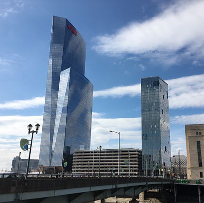
Cira Center South Address: Cira Center South, 2930 Chestnut St, Philadelphia, PA 19104, USA street in Philadelphia
Attractions near Cira Center South
Cira Green,Fmc Tower,FMC Tower,3000 Chestnut Street,James E. Hogwood Memorial Building,Megabus Stop,Chestnut St,World Cafe Live,Upenn Campus,Market St (30th market street),Amtrak-30th Street Station (30th St Station - Mfl),Amtrak / William H. Gray III - 30th Street Station,Lincoln University,The Philadelphia Amtrak Station,William H. Gray III 30th Street Station,Schuylkill River Trail,SEPTA MFL / TRL 30th Street Station,Delta Group,Taxi Stand - 30th Street Station,Penn Medicine Information ServicesHow to get to popular attractions in Philadelphia with public transit
Dalessandro’s Steaks and Hoagies, Philadelphia,Mantua, NJ,Iron Hill Brewery & Restaurant, West Chester,Fogo De Chão, Philadelphia,SEI Investments, Upper Providence,Drexel Dragon Route CC Shuttle Stop, Philadelphia,Lockheed Martin Rotary and Mission Systems,Mercer County Community College,Lansdowne, PA, Lansdowne,Williamstown, NJ, Williamstown,McCarter Theatre, Princeton,Geno's Steaks, Philadelphia,The Cheesecake Factory, Willow Grove,Hatfield, PA, Hatfield,SEPTA Elm Street Station (Norristown), Norristown,West Chester, PA, West Chester,Plainsboro, NJ, Plainsboro Center,Burlington, NJ, Burlington,NJT - Hamilton Station (NEC),McCormick & Schmick's Seafood and Steaks, PhiladelphiaGet around Philadelphia by public transit!
Traveling around Philadelphia has never been so easy. See step by step directions as you travel to any attraction, street or major public transit station. View bus and train schedules, arrival times, service alerts and detailed routes on a map, so you know exactly how to get to anywhere in Philadelphia.
When traveling to any destination around Philadelphia use Moovit's Live Directions with Get Off Notifications to know exactly where and how far to walk, how long to wait for your line, and how many stops are left. Moovit will alert you when it's time to get off — no need to constantly re-check whether yours is the next stop.
Wondering how to use public transit in Philadelphia or how to pay for public transit in Philadelphia? Moovit public transit app can help you navigate your way with public transit easily, and at minimum cost. It includes public transit fees, ticket prices, and costs. Looking for a map of Philadelphia public transit lines? Moovit public transit app shows all public transit maps in Philadelphia with all bus, train or subway routes and stops on an interactive map.
Philadelphia has 3 transit type(s), including: bus, train or subway, operated by several transit agencies, including SEPTA Subway, SEPTA Trolley, SEPTA Rail, SEPTA, SEPTA, NJ TRANSIT RAIL-Rail, NJ TRANSIT RAIL-Tram, NJ TRANSIT BUS, Port Authority Transit Corporation, Navy Yard, Penn Transit, Drexel University, Pottstown Area Rapid Transit (PART), Fullington Tours and Chescobus